

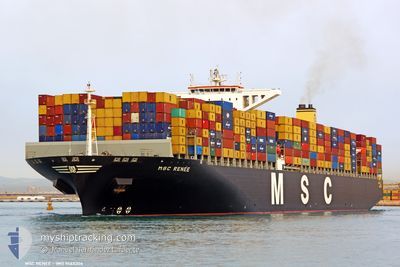
MSC RENEE
Container Ship

Current Trip
| Time Travelled | 2 days |
|---|---|
| Remaining Time | --- |
| Distance Travelled | 953.84 nm |
| Remaining Distance | 598.28 nm |
| AVG Speed | 16.3 Knopen |
| MAX Speed | 19.3 Knopen |
| AVG Wind | 6.1 knots |
| MAX Wind | 15 knots |
| MIN Temp | 21.2°C / 70.16°F |
| MAX Temp | 28.3°C / 82.94°F |
| Diepgang | 11.9 M |
| Positie ontvangen | 9 d geleden |
Current Position
| Lengtegraad | --- |
|---|---|
| Breedtegraat | --- |
| Status | Moored |
| Snelheid | |
| Koers | 254° |
| Gebied | Gulf of Thailand |
| Station | T-AIS |
| Positie ontvangen | 9 d geleden |
Information
The current position of MSC RENEE is in Gulf of Thailand with coordinates 13.05161° / 100.90320° as reported on 2025-03-17 07:09 by AIS to our vessel tracker app. The vessel's current speed is 0 Knopen and is heading at the port of LAEM CHABANG.
The vessel MSC RENEE (IMO: 9465306, MMSI: 477307300) is a Container Ship that was built in 2012 ( 13 Jaar oud ). It's sailing under the flag of [HK] Hong Kong.
In this page you can find informations about the vessels current position, last detected port calls, and current voyage information. If the vessels is not in coverage by AIS you will find the latest position.
The current position of MSC RENEE is detected by our AIS receivers and we are not responsible for the reliability of the data. The last position was recorded while the vessel was in Coverage by the Ais receivers of our vessel tracking app.
The current draught of MSC RENEE as reported by AIS is 11.9 meters
Weather
| Temperature | 23.9°C / 75.02°F |
|---|---|
| Wind Speed | 6 knots |
| Direction | 113° ESE |
| Pressure | 1007.7 hPa |
| Humidity | 86.8 % |
| Cloud Coverage | 44 % |


Featured Company
Last Port Calls
| Port | Arrival | Departure | Time In Port |
|---|---|---|---|
| 2025-03-23 01:17 | 2025-03-24 15:26 | 1 d | |
| 2025-03-15 22:50 | 2025-03-18 18:57 | 2 d | |
| 2025-03-02 23:16 | 2025-03-05 11:47 | 2 d | |
| 2025-03-01 15:49 | 2025-03-02 14:36 | 22 h | |
| 2025-02-25 18:07 | 2025-02-26 13:15 | 19 h | |
| 2025-01-30 15:52 | 2025-01-31 08:06 | 16 h | |
| 2025-01-28 09:48 | 2025-01-29 09:12 | 23 h | |
| 2025-01-25 06:03 | 2025-01-26 06:09 | 1 d | |
| 2025-01-22 08:49 | 2025-01-23 07:56 | 23 h | |
| 2025-01-18 02:50 | 2025-01-19 20:56 | 1 d |
Last Trips
| Origin | Departure | Destination | Arrival | Distance | |
|---|---|---|---|---|---|
| 2025-03-18 18:57 | 2025-03-23 01:17 | 1638.86 nm | |||
| 2025-03-05 11:47 | 2025-03-15 22:50 | 4469.70 nm | |||
| 2025-03-02 14:36 | 2025-03-02 23:16 | 54.94 nm | |||
| 2025-02-26 13:15 | 2025-03-01 15:49 | 1036.95 nm | |||
| 2025-01-31 08:06 | 2025-02-25 18:07 | 10072.55 nm | |||
| 2025-01-29 09:12 | 2025-01-30 15:52 | 474.49 nm | |||
| 2025-01-26 06:09 | 2025-01-28 09:48 | 289.36 nm | |||
| 2025-01-23 07:56 | 2025-01-25 06:03 | 770.75 nm | |||
| 2025-01-19 20:56 | 2025-01-22 08:49 | 797.54 nm | |||
| 2025-01-17 15:48 | 2025-01-18 02:50 | 112.67 nm |
Events
| Tijd | Evenement | Details | Positie / Bestemming | Info |
|---|---|---|---|---|
| 2025-03-26 17:08 | Stop beweging | 2.36 nm, South West of CAI MEP |
10.50682 / 107.00748
THLCH
|
Snelheid: 0.1 kn Koers: 49° |
| 2025-03-24 07:26 | Start beweging | 0.72 nm, South East of YANTIAN |
22.56075 / 114.27720
THLCH
|
Snelheid: 6 kn Koers: 112° |
| 2025-03-24 07:26 | Vertrekhaven |
|
22.56075 / 114.27720
THLCH
|
Snelheid: 2.9 kn Koers: 140° |
| 2025-03-22 17:17 | Stop beweging |
22.57093 / 114.26976
[CN] YANTIAN
|
Snelheid: 0.3 kn Koers: 320° |
|
| 2025-03-22 17:17 | Aankomsthaven |
|
22.57093 / 114.26976
[CN] YANTIAN
|
Snelheid: 0.8 kn Koers: 335° |
| 2025-03-18 11:57 | Vertrekhaven |
|
13.07658 / 100.86128
THLCH
|
Snelheid: 6.1 kn Koers: 301° |
| 2025-03-18 11:34 | Start beweging |
13.04998 / 100.89020
[TH] LAEM CHABANG
|
Snelheid: 3.9 kn Koers: 264° |
|
| 2025-03-17 07:12 | Status Changed | Default Moored |
13.05154 / 100.90282
[TH] LAEM CHABANG
|
Snelheid: Koers: 254° |
| 2025-03-17 07:09 | Status Changed | Moored Default |
13.05161 / 100.90320
[TH] LAEM CHABANG
|
Snelheid: Koers: 254° |
| 2025-03-17 07:09 | Buitenbereik |
13.05161 / 100.90320
Gulf of Thailand
[TH] LAEM CHABANG
|
Snelheid: Koers: 207.7° |