
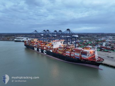
MSC MIRJA
Cargo A
Current Trip
| Time Travelled | 15 days |
|---|---|
| Remaining Time | --- |
| Distance Travelled | 6289.96 nm |
| Remaining Distance | --- |
| AVG Speed | 17.7 Knopen |
| MAX Speed | 17.7 Knopen |
| AVG Wind | 14.4 knots |
| MAX Wind | 31 knots |
| MIN Temp | 11.8°C / 53.24°F |
| MAX Temp | 28.8°C / 83.84°F |
| Diepgang | 14.4 M |
| Positie ontvangen | 5 d geleden |
Current Position
| Lengtegraad | -18.04060° |
|---|---|
| Breedtegraat | 19.82530° |
| Status | Under way using engine |
| Snelheid | 19.5 Knopen |
| Koers | 178.1° |
| Gebied | North Atlantic Ocean |
| Station | T-AIS |
| Positie ontvangen | 5 d geleden |
Info
Information
The current position of MSC MIRJA is in North Atlantic Ocean with coordinates 19.82530° / -18.04060° as reported on 2024-05-11 06:55 by AIS to our vessel tracker app. The vessel's current speed is 19.5 Knopen and is heading at the port of ABU DHABI. The estimated time of arrival as calculated by MyShipTracking vessel tracking app is 2024-05-31 06:00 LT
The vessel MSC MIRJA (IMO: 9762338, MMSI: 636017516) is a Cargo A It's sailing under the flag of [LR] Liberia.
In this page you can find informations about the vessels current position, last detected port calls, and current voyage information. If the vessels is not in coverage by AIS you will find the latest position.
The current position of MSC MIRJA is detected by our AIS receivers and we are not responsible for the reliability of the data. The last position was recorded while the vessel was in Coverage by the Ais receivers of our vessel tracking app.
The current draught of MSC MIRJA as reported by AIS is 14.4 meters
Weather
| Temperature | 23.8°C / 74.84°F |
|---|---|
| Wind Speed | 16 knots |
| Direction | 144° SE |
| Pressure | 1013.4 hPa |
| Humidity | 79.6 % |
| Cloud Coverage | 9 % |
Featured Company
Last Port Calls
| Port | Arrival | Departure | Time In Port |
|---|---|---|---|
| 2024-05-03 16:52 | 2024-05-04 06:28 | 13 h | |
| 2024-05-03 02:15 | 2024-05-03 16:36 | 14 h | |
| 2024-05-03 00:24 | 2024-05-03 02:12 | 1 h | |
| 2024-04-29 02:32 | 2024-04-30 20:52 | 1 d | |
| 2024-04-25 17:38 | 2024-04-28 00:03 | 2 d | |
| 2024-04-22 04:01 | 2024-04-24 21:23 | 2 d | |
| 2024-04-18 03:29 | 2024-04-19 14:23 | 1 d | |
| 2024-04-17 17:47 | |||
| 2024-04-15 20:11 | 2024-04-16 15:31 | 19 h | |
| 2024-03-15 04:49 | 2024-03-16 14:59 | 1 d |
Most Visited Ports (Last year)
| Port | Arrivals | |
|---|---|---|
| 9 | ||
| 4 | ||
| 3 | ||
| 3 | ||
| 2 | ||
| 2 |
Last Trips
| Origin | Departure | Destination | Arrival | Distance | |
|---|---|---|---|---|---|
| 2024-04-30 23:52 | 2024-05-03 18:52 | 794.88 nm | |||
| 2024-04-30 23:52 | 2024-05-03 04:15 | 774.92 nm | |||
| 2024-04-30 23:52 | 2024-05-03 02:24 | 770.26 nm | |||
| 2024-04-28 03:03 | 2024-04-29 05:32 | 79.23 nm | |||
| 2024-04-25 00:23 | 2024-04-25 20:38 | 68.46 nm | |||
| 2024-04-19 17:23 | 2024-04-22 07:01 | 898.48 nm | |||
| 2024-03-16 22:59 | 2024-04-17 20:47 | 12840.64 nm | |||
| 2024-03-16 22:59 | 2024-04-15 22:11 | 12669.63 nm | |||
| 2024-03-03 05:39 | 2024-03-15 12:49 | 2780.99 nm |
Events
| Tijd | Evenement | Details | Positie / Bestemming | Info |
|---|---|---|---|---|
| 2024-05-11 07:02 | Status Changed | Default Under way using engine |
19.78380 / -18.03974
AEAUH-ABU DHABI
|
Snelheid: 19.5 kn Koers: 178.1° |
| 2024-05-11 06:55 | Buitenbereik |
19.82530 / -18.04060
North Atlantic Ocean
AEAUH-ABU DHABI
|
Snelheid: 19.5 kn Koers: 178.1° |
|
| 2024-05-11 06:53 | Status Changed | Under way using engine Default |
19.83182 / -18.04078
AEAUH-ABU DHABI
|
Snelheid: 19.6 kn Koers: 181° |
| 2024-05-11 06:51 | Status Changed | Default Under way using engine |
19.84697 / -18.04072
AEAUH-ABU DHABI
|
Snelheid: 19.4 kn Koers: 177.7° |
| 2024-05-11 06:45 | Status Changed | Under way using engine Default |
19.87957 / -18.04212
AEAUH-ABU DHABI
|
Snelheid: 19.5 kn Koers: 180° |
| 2024-05-11 06:42 | Status Changed | Default Under way using engine |
19.89108 / -18.04220
AEAUH-ABU DHABI
|
Snelheid: 19.8 kn Koers: 176.6° |
| 2024-05-11 06:32 | Status Changed | Under way using engine Default |
19.94909 / -18.04581
AEAUH-ABU DHABI
|
Snelheid: 19.7 kn Koers: 176° |
| 2024-05-11 06:31 | Status Changed | Default Under way using engine |
19.95616 / -18.04638
AEAUH-ABU DHABI
|
Snelheid: 19.6 kn Koers: 175.5° |
| 2024-05-11 06:26 | Status Changed | Under way using engine Default |
19.98307 / -18.04833
AEAUH-ABU DHABI
|
Snelheid: 19.5 kn Koers: 175° |
| 2024-05-11 06:07 | Binnenbereik |
19.98307 / -18.04833
North Atlantic Ocean
AEAUH-ABU DHABI
|
Snelheid: 19.6 kn Koers: 175.5° |