

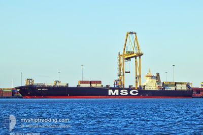
MSC EDITH II
Container Ship

Current Trip
| Time Travelled | 1 day |
|---|---|
| Remaining Time | 7 h, 43 mins |
| Distance Travelled | 365.70 nm |
| Remaining Distance | 227.09 nm |
| AVG Speed | 12.6 Knopen |
| MAX Speed | 13.5 Knopen |
| AVG Wind | 5.3 knots |
| MAX Wind | 11 knots |
| MIN Temp | 10.6°C / 51.08°F |
| MAX Temp | 17.7°C / 63.86°F |
| Diepgang | 9.1 M |
| Positie ontvangen | 23 h, 41 m geleden |
Current Position
| Lengtegraad | --- |
|---|---|
| Breedtegraat | --- |
| Status | Under way using engine |
| Snelheid | 11.8 Knopen |
| Koers | 211.3° |
| Gebied | Mediterranean Sea - Eastern Basin |
| Station | T-AIS |
| Positie ontvangen | 23 h, 41 m geleden |
Information
The current position of MSC EDITH II is in Mediterranean Sea - Eastern Basin with coordinates 35.77649° / 35.18297° as reported on 2025-02-17 21:40 by AIS to our vessel tracker app. The vessel's current speed is 11.8 Knopen and is heading at the port of MERSIN. The estimated time of arrival as calculated by MyShipTracking vessel tracking app is 2025-02-19 08:04 LT
The vessel MSC EDITH II (IMO: 9169029, MMSI: 636018324) is a Container Ship that was built in 1998 ( 27 Jaar oud ). It's sailing under the flag of [LR] Liberia.
In this page you can find informations about the vessels current position, last detected port calls, and current voyage information. If the vessels is not in coverage by AIS you will find the latest position.
The current position of MSC EDITH II is detected by our AIS receivers and we are not responsible for the reliability of the data. The last position was recorded while the vessel was in Coverage by the Ais receivers of our vessel tracking app.
The current draught of MSC EDITH II as reported by AIS is 9.1 meters
Weather
| Temperature | 16.4°C / 61.52°F |
|---|---|
| Wind Speed | 7 knots |
| Direction | 308° NW |
| Pressure | 1018 hPa |
| Humidity | 70.5 % |
| Cloud Coverage | 78 % |


Featured Company
Last Port Calls
| Port | Arrival | Departure | Time In Port |
|---|---|---|---|
| 2025-02-16 22:09 | 2025-02-17 18:33 | 20 h | |
| 2025-02-14 14:41 | 2025-02-15 05:17 | 14 h | |
| 2025-02-13 01:03 | 2025-02-13 20:37 | 19 h | |
| 2025-02-11 18:12 | 2025-02-12 17:41 | 23 h | |
| 2025-02-06 09:23 | 2025-02-08 01:42 | 1 d | |
| 2025-02-03 06:15 | 2025-02-03 16:07 | 9 h | |
| 2025-01-29 03:33 | 2025-01-30 04:29 | 1 d | |
| 2025-01-27 11:41 | 2025-01-28 07:51 | 20 h | |
| 2025-01-22 19:09 | 2025-01-23 07:09 | 11 h | |
| 2025-01-21 13:25 | 2025-01-22 06:07 | 16 h |
Last Trips
| Origin | Departure | Destination | Arrival | Distance | |
|---|---|---|---|---|---|
| 2025-02-15 05:17 | 2025-02-16 22:09 | 384.99 nm | |||
| 2025-02-13 20:37 | 2025-02-14 14:41 | 193.88 nm | |||
| 2025-02-12 17:41 | 2025-02-13 01:03 | 83.82 nm | |||
| 2025-02-08 01:42 | 2025-02-11 18:12 | 1053.42 nm | |||
| 2025-02-03 16:07 | 2025-02-06 09:23 | 215.34 nm | |||
| 2025-01-30 04:29 | 2025-02-03 06:15 | 1241.85 nm | |||
| 2025-01-28 07:51 | 2025-01-29 03:33 | 95.33 nm | |||
| 2025-01-23 07:09 | 2025-01-27 11:41 | 374.99 nm | |||
| 2025-01-22 06:07 | 2025-01-22 19:09 | 131.98 nm | |||
| 2025-01-19 23:59 | 2025-01-21 13:25 | 115.35 nm |
Events
| Tijd | Evenement | Details | Positie / Bestemming | Info |
|---|---|---|---|---|
| 2025-02-17 21:50 | Status Changed | Default Under way using engine |
35.74869 / 35.16142
TRMER
|
Snelheid: 11.8 kn Koers: 211.3° |
| 2025-02-17 21:40 | Buitenbereik |
35.77649 / 35.18297
Mediterranean Sea - Eastern Basin
TRMER
|
Snelheid: 11.8 kn Koers: 211.3° |
|
| 2025-02-17 21:34 | Wijzig zee gebeid | Syrian part of the Mediterranean Sea - Eastern Basin Turkish part of the Mediterranean Sea - Eastern Basin |
35.79257 / 35.19503
Mediterranean Sea - Eastern Basin
TRMER
|
Snelheid: 11.8 kn Koers: 212.3° |
| 2025-02-17 21:33 | Status Changed | Under way using engine Default |
35.79535 / 35.19716
TRMER
|
Snelheid: 11 kn Koers: 211° |
| 2025-02-17 21:29 | Binnenbereik |
35.79257 / 35.19503
Mediterranean Sea - Eastern Basin
TRMER
|
Snelheid: 11.8 kn Koers: 212.3° |
|
| 2025-02-17 18:42 | Status Changed | Default Under way using engine |
36.29757 / 35.55285
TRMER
|
Snelheid: 12.7 kn Koers: 207.4° |
| 2025-02-17 18:32 | Buitenbereik |
36.32894 / 35.57352
Mediterranean Sea - Eastern Basin
TRMER
|
Snelheid: 12.7 kn Koers: 207.4° |
|
| 2025-02-17 17:02 | Draught Changed | 9.1 8.3 |
36.54552 / 35.84744
TRMER
|
Snelheid: 12.1 kn Koers: 229.4° |
| 2025-02-17 17:02 | Destination Changed | TRMER TRISK |
36.54552 / 35.84744
TRMER
|
Snelheid: 12.1 kn Koers: 229.4° |
| 2025-02-17 17:02 | ETA Changed | 2025/02/17 23:00 2025/02/16 19:00 |
36.54552 / 35.84744
TRMER
|
Snelheid: 12.1 kn Koers: 229.4° |