
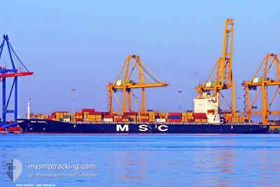
MSC DIEGO
Container Ship
Current Trip
| Time Travelled | 3 days |
|---|---|
| Remaining Time | 1 day |
| Distance Travelled | 806.83 nm |
| Remaining Distance | 1046.93 nm |
| AVG Speed | 10.1 Knopen |
| MAX Speed | 12 Knopen |
| AVG Wind | 17.4 knots |
| MAX Wind | 22 knots |
| MIN Temp | 26.2°C / 79.16°F |
| MAX Temp | 29.8°C / 85.64°F |
| Diepgang | 13.1 M |
| Positie ontvangen | 2 d geleden |
Current Position
| Lengtegraad | 76.86105° |
|---|---|
| Breedtegraat | 7.91578° |
| Status | Under way using engine |
| Snelheid | 10.8 Knopen |
| Koers | 312.6° |
| Gebied | Laccadive Sea |
| Station | T-AIS |
| Positie ontvangen | 2 d geleden |
Info
Information
The current position of MSC DIEGO is in Laccadive Sea with coordinates 7.91578° / 76.86105° as reported on 2024-05-27 16:03 by AIS to our vessel tracker app. The vessel's current speed is 10.8 Knopen and is heading at the port of MUNDRA. The estimated time of arrival as calculated by MyShipTracking vessel tracking app is 2024-05-31 19:21 LT
The vessel MSC DIEGO (IMO: 9202649, MMSI: 357106000) is a Container Ship that was built in 1999 ( 25 Jaar oud ). It's sailing under the flag of [PA] Panama.
In this page you can find informations about the vessels current position, last detected port calls, and current voyage information. If the vessels is not in coverage by AIS you will find the latest position.
The current position of MSC DIEGO is detected by our AIS receivers and we are not responsible for the reliability of the data. The last position was recorded while the vessel was in Coverage by the Ais receivers of our vessel tracking app.
The current draught of MSC DIEGO as reported by AIS is 13.1 meters
Weather
| Temperature | 29.2°C / 84.56°F |
|---|---|
| Wind Speed | 15 knots |
| Direction | 282° WNW |
| Pressure | 1007.6 hPa |
| Humidity | 82.9 % |
| Cloud Coverage | 75 % |
Featured Company
Last Port Calls
| Port | Arrival | Departure | Time In Port |
|---|---|---|---|
| 2024-05-22 20:06 | 2024-05-26 17:45 | 3 d | |
| 2024-05-19 15:06 | 2024-05-21 03:34 | 1 d | |
| 2024-05-07 19:58 | |||
| 2024-05-04 00:44 | 2024-05-04 14:14 | 13 h | |
| 2024-04-29 00:55 | 2024-04-30 05:49 | 1 d | |
| 2024-04-26 08:25 | 2024-04-26 14:22 | 5 h | |
| 2024-04-13 23:41 | 2024-04-17 15:07 | 3 d | |
| 2024-04-07 15:51 | 2024-04-09 15:37 | 1 d | |
| 2024-04-02 13:20 | 2024-04-05 10:44 | 2 d | |
| 2024-03-23 20:28 | 2024-03-29 23:31 | 6 d |
Last Trips
| Origin | Departure | Destination | Arrival | Distance | |
|---|---|---|---|---|---|
| 2024-05-21 03:34 | 2024-05-22 20:06 | 313.48 nm | |||
| 2024-05-04 14:14 | 2024-05-07 19:58 | 728.84 nm | |||
| 2024-04-30 05:49 | 2024-05-04 00:44 | 1030.60 nm | |||
| 2024-04-26 14:22 | 2024-04-29 00:55 | 293.63 nm | |||
| 2024-04-17 15:07 | 2024-04-26 08:25 | 2829.60 nm | |||
| 2024-04-09 15:37 | 2024-04-13 23:41 | 1186.33 nm | |||
| 2024-04-05 10:44 | 2024-04-07 15:51 | 530.47 nm | |||
| 2024-03-29 23:31 | 2024-04-02 13:20 | 343.11 nm | |||
| 2024-02-09 08:45 | 2024-03-13 02:09 | 1947.32 nm |
Events
| Tijd | Evenement | Details | Positie / Bestemming | Info |
|---|---|---|---|---|
| 2024-05-27 16:04 | Status Changed | Default Under way using engine |
7.91667 / 76.85667
MUNDRA
|
Snelheid: 10.8 kn Koers: 312.6° |
| 2024-05-27 16:03 | Buitenbereik |
7.91578 / 76.86105
Laccadive Sea
MUNDRA
|
Snelheid: 10.8 kn Koers: 312.6° |
|
| 2024-05-27 12:49 | Draught Changed | 13.1 7.8 |
7.59637 / 77.36673
MUNDRA
|
Snelheid: 10.6 kn Koers: 302.1° |
| 2024-05-27 12:49 | Destination Changed | MUNDRA SALALAH |
7.59637 / 77.36673
MUNDRA
|
Snelheid: 10.6 kn Koers: 302.1° |
| 2024-05-27 12:49 | ETA Changed | 2024/05/31 10:30 2024/05/03 08:00 |
7.59637 / 77.36673
MUNDRA
|
Snelheid: 10.6 kn Koers: 302.1° |
| 2024-05-27 12:09 | Status Changed | Under way using engine Default |
7.53366 / 77.46858
SALALAH
|
Snelheid: 10 kn Koers: 300° |
| 2024-05-27 12:04 | Status Changed | Default Under way using engine |
7.52500 / 77.48167
SALALAH
|
Snelheid: 11.1 kn Koers: 301.4° |
| 2024-05-27 11:42 | Status Changed | Under way using engine Default |
7.48978 / 77.54105
SALALAH
|
Snelheid: 11 kn Koers: 302° |
| 2024-05-27 11:34 | Binnenbereik |
7.49237 / 77.53698
Laccadive Sea
|
Snelheid: 11.3 kn Koers: 302.8° |
|
| 2024-05-27 09:51 | Buitenbereik |
7.30698 / 77.83954
Laccadive Sea
|
Snelheid: 11.3 kn Koers: 301.7° |