
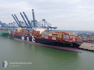
MSC DIANA
Cargo A
Current Trip
| Time Travelled | 18 days |
|---|---|
| Remaining Time | 11 days |
| Distance Travelled | 7929.77 nm |
| Remaining Distance | 4616.22 nm |
| AVG Speed | 17.8 Knopen |
| MAX Speed | 19.7 Knopen |
| AVG Wind | 12.4 knots |
| MAX Wind | 30.8 knots |
| MIN Temp | 14.6°C / 58.28°F |
| MAX Temp | 28.5°C / 83.3°F |
| Diepgang | 13.9 M |
| Positie ontvangen | 2 d geleden |
Current Position
| Lengtegraad | --- |
|---|---|
| Breedtegraat | --- |
| Status | Under way using engine |
| Snelheid | 17.9 Knopen |
| Koers | 113.7° |
| Gebied | South Atlantic Ocean |
| Station | T-AIS |
| Positie ontvangen | 2 d geleden |
Info
Information
The current position of MSC DIANA is in South Atlantic Ocean with coordinates -34.83030° / 19.42452° as reported on 2025-03-15 14:14 by AIS to our vessel tracker app. The vessel's current speed is 17.9 Knopen and is heading at the port of SINGAPORE. The estimated time of arrival as calculated by MyShipTracking vessel tracking app is 2025-03-30 03:40 LT
The vessel MSC DIANA (IMO: 9755933, MMSI: 636017433) is a Cargo A It's sailing under the flag of [LR] Liberia.
In this page you can find informations about the vessels current position, last detected port calls, and current voyage information. If the vessels is not in coverage by AIS you will find the latest position.
The current position of MSC DIANA is detected by our AIS receivers and we are not responsible for the reliability of the data. The last position was recorded while the vessel was in Coverage by the Ais receivers of our vessel tracking app.
The current draught of MSC DIANA as reported by AIS is 13.9 meters
Weather
| Temperature | 23.6°C / 74.48°F |
|---|---|
| Wind Speed | 18 knots |
| Direction | 66° ENE |
| Pressure | 1021.5 hPa |
| Humidity | 62 % |
| Cloud Coverage | 99 % |
Featured Company
Last Port Calls
| Port | Arrival | Departure | Time In Port |
|---|---|---|---|
| 2025-02-26 13:57 | 2025-02-27 14:30 | 1 d | |
| 2025-02-25 04:37 | 2025-02-26 02:40 | 22 h | |
| 2025-02-20 17:43 | 2025-02-23 00:47 | 2 d | |
| 2025-02-18 10:32 | 2025-02-20 11:46 | 2 d | |
| 2025-02-16 06:09 | 2025-02-18 04:47 | 1 d | |
| 2025-02-12 16:33 | 2025-02-13 14:53 | 22 h | |
| 2025-02-09 06:46 | 2025-02-11 03:28 | 1 d | |
| 2025-01-09 04:32 | 2025-01-10 19:09 | 1 d |
Last Trips
| Origin | Departure | Destination | Arrival | Distance | |
|---|---|---|---|---|---|
| 2025-02-23 00:47 | 2025-02-26 13:57 | 912.80 nm | |||
| 2025-02-23 00:47 | 2025-02-25 04:37 | 757.25 nm | |||
| 2025-02-20 11:46 | 2025-02-20 17:43 | 59.72 nm | |||
| 2025-02-18 04:47 | 2025-02-18 10:32 | 57.03 nm | |||
| 2025-02-11 03:28 | 2025-02-16 06:09 | 998.94 nm | |||
| 2025-02-11 03:28 | 2025-02-12 16:33 | 150.70 nm | |||
| 2025-01-10 19:09 | 2025-02-09 06:46 | 12746.31 nm | |||
| 2024-12-17 14:53 | 2025-01-09 04:32 | 4920.75 nm |
Events
| Tijd | Evenement | Details | Positie / Bestemming | Info |
|---|---|---|---|---|
| 2025-03-15 14:20 | Status Changed | Default Under way using engine |
-34.83960 / 19.45340
SGSIN
|
Snelheid: 17.9 kn Koers: 113.7° |
| 2025-03-15 14:14 | Status Changed | Under way using engine Default |
-34.83030 / 19.42452
SGSIN
|
Snelheid: 18 kn Koers: 114° |
| 2025-03-15 14:14 | Buitenbereik |
-34.83030 / 19.42452
South Atlantic Ocean
SGSIN
|
Snelheid: 17.9 kn Koers: 113.7° |
|
| 2025-03-15 14:03 | Binnenbereik |
-34.83030 / 19.42452
South Atlantic Ocean
SGSIN
|
Snelheid: 17.9 kn Koers: 113.7° |
|
| 2025-03-15 11:48 | Status Changed | Default Under way using engine |
-34.53606 / 18.60948
SGSIN
|
Snelheid: 18.7 kn Koers: 113.4° |
| 2025-03-15 11:43 | Buitenbereik |
-34.52555 / 18.58061
South Atlantic Ocean
SGSIN
|
Snelheid: 18.7 kn Koers: 113.4° |
|
| 2025-03-15 11:39 | Status Changed | Under way using engine Default |
-34.51680 / 18.55654
SGSIN
|
Snelheid: 18.7 kn Koers: 114° |
| 2025-03-15 11:28 | Binnenbereik |
-34.52008 / 18.56572
South Atlantic Ocean
SGSIN
|
Snelheid: 18.6 kn Koers: 113.6° |
|
| 2025-03-15 10:31 | Status Changed | Default Under way using engine |
-34.31465 / 18.22315
SGSIN
|
Snelheid: 18.6 kn Koers: 142.3° |
| 2025-03-15 10:26 | Buitenbereik |
-34.29606 / 18.20639
South Atlantic Ocean
SGSIN
|
Snelheid: 18.6 kn Koers: 142.3° |