
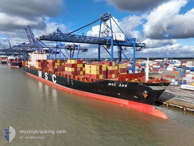
MSC ANS
Container Ship
Current Trip
| Time Travelled | 4 days |
|---|---|
| Remaining Time | 10 h, 24 mins |
| Distance Travelled | 1817.81 nm |
| Remaining Distance | 104.41 nm |
| AVG Speed | 17.1 Knopen |
| MAX Speed | 19.3 Knopen |
| AVG Wind | 10 knots |
| MAX Wind | 24.6 knots |
| MIN Temp | 15.7°C / 60.26°F |
| MAX Temp | 24.8°C / 76.64°F |
| Diepgang | 12.8 M |
| Positie ontvangen | 1 m geleden |
Current Position
| Lengtegraad | -8.68936° |
|---|---|
| Breedtegraat | 36.60810° |
| Status | Under way using engine |
| Snelheid | 9.5 Knopen |
| Koers | 289.6° |
| Gebied | North Atlantic Ocean |
| Station | T-AIS |
| Positie ontvangen | 1 m geleden |
Info
Information
The current position of MSC ANS is in North Atlantic Ocean with coordinates 36.60810° / -8.68936° as reported on 2024-05-12 23:23 by AIS to our vessel tracker app. The vessel's current speed is 9.5 Knopen and is heading at the port of SINES. The estimated time of arrival as calculated by MyShipTracking vessel tracking app is 2024-05-13 09:48 LT
The vessel MSC ANS (IMO: 9282261, MMSI: 353873000) is a Container Ship that was built in 2004 ( 20 Jaar oud ). It's sailing under the flag of [PA] Panama.
In this page you can find informations about the vessels current position, last detected port calls, and current voyage information. If the vessels is not in coverage by AIS you will find the latest position.
The current position of MSC ANS is detected by our AIS receivers and we are not responsible for the reliability of the data. The last position was recorded while the vessel was in Coverage by the Ais receivers of our vessel tracking app.
The current draught of MSC ANS as reported by AIS is 12.8 meters
Weather
| Temperature | 17.2°C / 62.96°F |
|---|---|
| Wind Speed | 23 knots |
| Direction | 339° NNW |
| Pressure | 1016.8 hPa |
| Humidity | 84.7 % |
| Cloud Coverage | 48 % |
Featured Company
Last Port Calls
| Port | Arrival | Departure | Time In Port |
|---|---|---|---|
| 2024-05-07 03:20 | 2024-05-08 13:18 | 1 d | |
| 2024-05-05 15:59 | 2024-05-06 06:33 | 14 h | |
| 2024-05-04 17:48 | 2024-05-05 06:16 | 12 h | |
| 2024-05-03 22:00 | 2024-05-04 10:19 | 12 h | |
| 2024-05-02 04:18 | 2024-05-02 18:32 | 14 h | |
| 2024-04-29 09:08 | 2024-04-30 04:40 | 19 h | |
| 2024-04-25 12:26 | 2024-04-26 03:34 | 15 h | |
| 2024-04-19 07:57 | 2024-04-21 07:25 | 1 d | |
| 2024-04-17 08:22 | 2024-04-17 20:35 | 12 h | |
| 2024-04-15 20:56 | 2024-04-16 22:28 | 1 d |
Last Trips
| Origin | Departure | Destination | Arrival | Distance | |
|---|---|---|---|---|---|
| 2024-05-06 09:33 | 2024-05-07 06:20 | 213.58 nm | |||
| 2024-05-05 09:16 | 2024-05-05 18:59 | 87.95 nm | |||
| 2024-05-04 13:19 | 2024-05-04 20:48 | 46.41 nm | |||
| 2024-05-02 21:32 | 2024-05-04 01:00 | 355.03 nm | |||
| 2024-04-30 06:40 | 2024-05-02 07:18 | 525.87 nm | |||
| 2024-04-26 04:34 | 2024-04-29 11:08 | 1326.25 nm | |||
| 2024-04-21 09:25 | 2024-04-25 13:26 | 1193.44 nm | |||
| 2024-04-17 22:35 | 2024-04-19 09:57 | 375.00 nm | |||
| 2024-04-17 00:28 | 2024-04-17 10:22 | 134.17 nm | |||
| 2024-04-13 21:13 | 2024-04-15 22:56 | 460.40 nm |
Events
| Tijd | Evenement | Details | Positie / Bestemming | Info |
|---|---|---|---|---|
| 2024-05-12 18:06 | ETA Changed | 2024/05/13 09:00 2024/05/13 12:00 |
36.32964 / -7.66879
PTSIE-SINES
|
Snelheid: 9.3 kn Koers: 287.4° |
| 2024-05-12 16:56 | Gevonden in zee | Portuguese part of the North Atlantic Ocean |
36.27568 / -7.45375
North Atlantic Ocean
PTSIE-SINES
|
Snelheid: 9 kn Koers: 288.5° |
| 2024-05-12 16:17 | ETA Changed | 2024/05/13 12:00 2024/05/13 01:00 |
36.24592 / -7.34221
PTSIE-SINES
|
Snelheid: 7.8 kn Koers: 287.6° |
| 2024-05-12 15:37 | Status Changed | Under way using engine Default |
36.21674 / -7.24227
PTSIE-SINES
|
Snelheid: 7 kn Koers: 289° |
| 2024-05-12 15:28 | Status Changed | Default Under way using engine |
36.21067 / -7.22059
PTSIE-SINES
|
Snelheid: 7.8 kn Koers: 289.3° |
| 2024-05-12 13:41 | Status Changed | Under way using engine Default |
36.07874 / -6.73266
PTSIE-SINES
|
Snelheid: 17.3 kn Koers: 289° |
| 2024-05-12 13:30 | Status Changed | Default Under way using engine |
36.06495 / -6.68385
PTSIE-SINES
|
Snelheid: 17.1 kn Koers: 288.6° |
| 2024-05-12 13:16 | Status Changed | Under way using engine Default |
36.04253 / -6.60220
PTSIE-SINES
|
Snelheid: 17 kn Koers: 288° |
| 2024-05-12 12:22 | Status Changed | Default Under way using engine |
35.96630 / -6.30199
PTSIE-SINES
|
Snelheid: 17.1 kn Koers: 281.1° |
| 2024-05-12 11:37 | Status Changed | Under way using engine Default |
35.96408 / -6.04355
PTSIE-SINES
|
Snelheid: 17.2 kn Koers: 270° |