
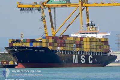
MSC AMERICA III
Container Ship
Current Trip
ABIDJAN
| Time Travelled | 19 h, 54 mins |
|---|---|
| Remaining Time | --- |
| Distance Travelled | 283.48 nm |
| Remaining Distance | --- |
| AVG Speed | 14.8 Knopen |
| MAX Speed | 16.2 Knopen |
| AVG Wind | 10.3 knots |
| MAX Wind | 14.9 knots |
| MIN Temp | 27.3°C / 81.14°F |
| MAX Temp | 28°C / 82.4°F |
| Diepgang | 10.5 M |
| Positie ontvangen | 22 d geleden |
Current Position
| Lengtegraad | --- |
|---|---|
| Breedtegraat | --- |
| Status | Moored |
| Snelheid | |
| Koers | 292° |
| Gebied | Gulf of Guinea |
| Station | T-AIS |
| Positie ontvangen | 22 d geleden |
Info
Information
The current position of MSC AMERICA III is in Gulf of Guinea with coordinates 6.43637° / 3.38668° as reported on 2025-01-25 16:54 by AIS to our vessel tracker app. The vessel's current speed is 0 Knopen
The vessel MSC AMERICA III (IMO: 9008603, MMSI: 355028000) is a Container Ship that was built in 1993 ( 32 Jaar oud ). It's sailing under the flag of [PA] Panama.
In this page you can find informations about the vessels current position, last detected port calls, and current voyage information. If the vessels is not in coverage by AIS you will find the latest position.
The current position of MSC AMERICA III is detected by our AIS receivers and we are not responsible for the reliability of the data. The last position was recorded while the vessel was in Coverage by the Ais receivers of our vessel tracking app.
The current draught of MSC AMERICA III as reported by AIS is 10.5 meters
Weather
| Temperature | 27.8°C / 82.04°F |
|---|---|
| Wind Speed | 10 knots |
| Direction | 246° WSW |
| Pressure | 1008.5 hPa |
| Humidity | 83.9 % |
| Cloud Coverage | 100 % |
Featured Company
Last Port Calls
| Port | Arrival | Departure | Time In Port |
|---|---|---|---|
| 2025-02-15 17:31 | 2025-02-16 17:26 | 23 h | |
| 2025-02-08 10:31 | 2025-02-13 16:01 | 5 d | |
| 2025-02-03 20:41 | 2025-02-05 19:45 | 1 d | |
| 2025-01-24 22:15 | 2025-01-31 14:05 | 6 d | |
| 2025-01-22 11:36 | 2025-01-24 07:25 | 1 d | |
| 2025-01-16 20:13 | 2025-01-19 21:01 | 3 d | |
| 2025-01-10 12:53 | 2025-01-13 14:04 | 3 d | |
| 2025-01-05 11:25 | 2025-01-07 12:33 | 2 d | |
| 2024-12-27 16:53 | 2024-12-31 12:37 | 3 d | |
| 2024-12-23 20:05 | 2024-12-25 03:41 | 1 d |
Last Trips
| Origin | Departure | Destination | Arrival | Distance | |
|---|---|---|---|---|---|
| 2025-02-13 16:01 | 2025-02-15 17:31 | 633.92 nm | |||
| 2025-02-05 19:45 | 2025-02-08 10:31 | 190.73 nm | |||
| 2025-01-31 14:05 | 2025-02-03 20:41 | 178.81 nm | |||
| 2025-01-24 07:25 | 2025-01-24 22:15 | 142.99 nm | |||
| 2025-01-19 21:01 | 2025-01-22 11:36 | 641.36 nm | |||
| 2025-01-13 14:04 | 2025-01-16 20:13 | 387.71 nm | |||
| 2025-01-07 12:33 | 2025-01-10 12:53 | 471.36 nm | |||
| 2024-12-31 12:37 | 2025-01-05 11:25 | 628.93 nm | |||
| 2024-12-25 03:41 | 2024-12-27 16:53 | 639.28 nm | |||
| 2024-12-20 14:56 | 2024-12-23 20:05 | 653.48 nm |
Events
| Tijd | Evenement | Details | Positie / Bestemming | Info |
|---|---|---|---|---|
| 2025-02-16 17:26 | Vertrekhaven |
|
4.73696 / -6.61008
ABIDJAN
|
Snelheid: 4.3 kn Koers: 111° |
| 2025-02-16 17:23 | Start beweging |
4.73854 / -6.61427
[CI] SAN PEDRO
|
Snelheid: 4.3 kn Koers: 111° |
|
| 2025-02-15 18:29 | Stop beweging |
4.73975 / -6.61850
[CI] SAN PEDRO
|
Snelheid: Koers: 350° |
|
| 2025-02-15 17:31 | Aankomsthaven |
|
4.73892 / -6.61465
[CI] SAN PEDRO
|
Snelheid: 3.8 kn Koers: 286° |
| 2025-02-13 15:01 | Vertrekhaven |
|
6.38336 / 3.40610
ABIDJAN
|
Snelheid: 9.7 kn Koers: 162° |
| 2025-02-13 13:41 | Start beweging |
6.42860 / 3.33961
[NG] LAGOS
|
Snelheid: 3.1 kn Koers: 276° |
|
| 2025-02-08 09:31 | Stop beweging |
6.43638 / 3.38668
[NG] LAGOS
|
Snelheid: Koers: 291° |
|
| 2025-02-08 09:31 | Aankomsthaven |
|
6.43638 / 3.38668
[NG] LAGOS
|
Snelheid: 2 kn Koers: 288° |
| 2025-02-07 15:21 | Start beweging | 5.36 nm, South East of LOME |
6.05526 / 1.32286
ABIDJAN
|
Snelheid: 4.8 kn Koers: 325° |