
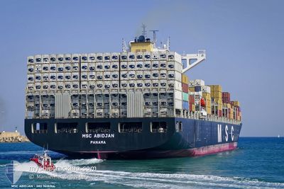
MSC ABIDJAN
Container Ship
Current Trip
| Time Travelled | 3 days |
|---|---|
| Remaining Time | 1 day |
| Distance Travelled | 1176.70 nm |
| Remaining Distance | 612.90 nm |
| AVG Speed | 17 Knopen |
| MAX Speed | 18.6 Knopen |
| AVG Wind | 14.1 knots |
| MAX Wind | 31.3 knots |
| MIN Temp | 12.6°C / 54.68°F |
| MAX Temp | 19.3°C / 66.74°F |
| Diepgang | 13 M |
| Positie ontvangen | 2 d geleden |
Current Position
| Lengtegraad | -15.06774° |
|---|---|
| Breedtegraat | 28.92075° |
| Status | Under way using engine |
| Snelheid | 18.3 Knopen |
| Koers | 15.2° |
| Gebied | North Atlantic Ocean |
| Station | T-AIS |
| Positie ontvangen | 2 d geleden |
Info
Information
The current position of MSC ABIDJAN is in North Atlantic Ocean with coordinates 28.92075° / -15.06774° as reported on 2024-05-01 16:21 by AIS to our vessel tracker app. The vessel's current speed is 18.3 Knopen and is heading at the port of ROTTERDAM. The estimated time of arrival as calculated by MyShipTracking vessel tracking app is 2024-05-05 17:10 LT
The vessel MSC ABIDJAN (IMO: 9618264, MMSI: 255806434) is a Container Ship that was built in 2013 ( 11 Jaar oud ). It's sailing under the flag of [PT] Portugal.
In this page you can find informations about the vessels current position, last detected port calls, and current voyage information. If the vessels is not in coverage by AIS you will find the latest position.
The current position of MSC ABIDJAN is detected by our AIS receivers and we are not responsible for the reliability of the data. The last position was recorded while the vessel was in Coverage by the Ais receivers of our vessel tracking app.
The current draught of MSC ABIDJAN as reported by AIS is 13 meters
Weather
| Temperature | 12.7°C / 54.86°F |
|---|---|
| Wind Speed | 18 knots |
| Direction | 35° NE |
| Pressure | 1002.6 hPa |
| Humidity | 94.5 % |
| Cloud Coverage | 100 % |
Featured Company
Last Port Calls
| Port | Arrival | Departure | Time In Port |
|---|---|---|---|
| 2024-04-29 23:49 | 2024-05-01 01:27 | 1 d | |
| 2024-04-04 18:17 | 2024-04-19 10:44 | 14 d | |
| 2024-03-15 18:01 | 2024-03-23 12:22 | 7 d | |
| 2024-03-03 18:19 |
Most Visited Ports (Last year)
| Port | Arrivals | |
|---|---|---|
| 3 | ||
| 3 | ||
| 2 | ||
| 2 | ||
| 2 | ||
| 2 |
Events
| Tijd | Evenement | Details | Positie / Bestemming | Info |
|---|---|---|---|---|
| 2024-05-01 16:25 | Status Changed | Default Under way using engine |
28.93667 / -15.06167
NLRTM
|
Snelheid: 18.3 kn Koers: 15.2° |
| 2024-05-01 16:21 | Buitenbereik |
28.92075 / -15.06774
North Atlantic Ocean
NLRTM
|
Snelheid: 18.3 kn Koers: 15.2° |
|
| 2024-05-01 14:58 | Draught Changed | 13 12.7 |
28.51040 / -15.18539
NLRTM
|
Snelheid: 18.1 kn Koers: 14.5° |
| 2024-05-01 14:58 | ETA Changed | 2024/05/05 17:30 2024/05/05 17:00 |
28.51040 / -15.18539
NLRTM
|
Snelheid: 18.1 kn Koers: 14.5° |
| 2024-05-01 13:15 | Start beweging | 1.13 nm, East of LAS PALMAS |
28.12751 / -15.39412
NLRTM
|
Snelheid: 3.8 kn Koers: 66° |
| 2024-05-01 12:56 | Status Changed | Under way using engine At anchor |
28.12918 / -15.39710
NLRTM
|
Snelheid: 0.1 kn Koers: 33° |
| 2024-05-01 12:55 | ETA Changed | 2024/05/05 17:00 2024/05/05 18:00 |
28.12921 / -15.39710
NLRTM
|
Snelheid: 0.1 kn Koers: 33° |
| 2024-05-01 12:52 | Status Changed | At anchor Default |
28.12927 / -15.39712
NLRTM
|
Snelheid: 0.1 kn Koers: 32° |
| 2024-05-01 12:46 | Status Changed | Default At anchor |
28.12904 / -15.39707
NLRTM
|
Snelheid: 0.5 kn Koers: 25° |
| 2024-05-01 12:34 | Status Changed | At anchor Default |
28.12739 / -15.39742
NLRTM
|
Snelheid: 0.1 kn Koers: 19° |