
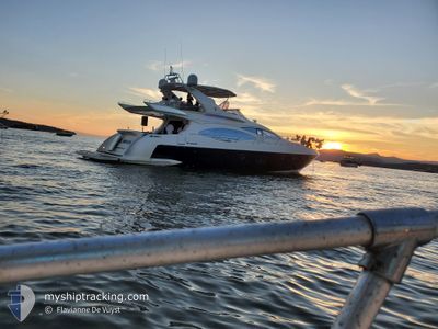
MR POPEYE
Pleasure Craft
Current Trip
Unknown
| Time Travelled | 3 days |
|---|---|
| Remaining Time | --- |
| Distance Travelled | 15.18 nm |
| Remaining Distance | --- |
| AVG Speed | 9.3 Knopen |
| MAX Speed | 10.6 Knopen |
| AVG Wind | 2.7 knots |
| MAX Wind | 4.9 knots |
| MIN Temp | 11.6°C / 52.88°F |
| MAX Temp | 13.4°C / 56.12°F |
| Diepgang | --- |
| Positie ontvangen | 3 d geleden |
Current Position
| Lengtegraad | -123.13923° |
|---|---|
| Breedtegraat | 49.18567° |
| Status | Default |
| Snelheid | |
| Koers | --- |
| Gebied | The Coastal Waters of Southeast Alaska and British Columbia |
| Station | T-AIS |
| Positie ontvangen | 3 d geleden |
Info
Information
The current position of MR POPEYE is in The Coastal Waters of Southeast Alaska and British Columbia with coordinates 49.18567° / -123.13923° as reported on 2024-06-01 01:40 by AIS to our vessel tracker app. The vessel's current speed is 0 Knopen
The vessel MR POPEYE (MMSI: 338129595) is a Pleasure Craft It's sailing under the flag of [US] USA.
In this page you can find informations about the vessels current position, last detected port calls, and current voyage information. If the vessels is not in coverage by AIS you will find the latest position.
The current position of MR POPEYE is detected by our AIS receivers and we are not responsible for the reliability of the data. The last position was recorded while the vessel was in Coverage by the Ais receivers of our vessel tracking app.
Weather
| Temperature | 13.4°C / 56.12°F |
|---|---|
| Wind Speed | 5 knots |
| Direction | 281° W |
| Pressure | 1017.1 hPa |
| Humidity | 60.4 % |
| Cloud Coverage | 100 % |
Featured Company
Most Visited Ports (Last year)
| Port | Arrivals | |
|---|---|---|
| 22 | ||
| 1 |
Last Trips
Events
| Tijd | Evenement | Details | Positie / Bestemming | Info |
|---|---|---|---|---|
| 2024-06-01 01:40 | Buitenbereik |
49.18567 / -123.13923
The Coastal Waters of Southeast Alaska and British Columbia
|
Snelheid: Koers: 84.4° |
|
| 2024-06-01 01:31 | Stop beweging | 4.13 nm, North of STEVESTON |
49.18568 / -123.13924
|
Snelheid: 0.2 kn Koers: 511° |
| 2024-06-01 01:08 | Start beweging | 4.88 nm, North of STEVESTON |
49.19742 / -123.13334
|
Snelheid: 6.6 kn Koers: 217° |
| 2024-05-31 23:54 | Stop beweging | 4.97 nm, North of STEVESTON |
49.19826 / -123.12994
|
Snelheid: 0.2 kn Koers: 511° |
| 2024-05-31 23:51 | Start beweging | 4.76 nm, North of STEVESTON |
49.19577 / -123.13523
|
Snelheid: 7.4 kn Koers: 22.1° |
| 2024-05-31 23:08 | Stop beweging | 4.9 nm, North of STEVESTON |
49.19851 / -123.13671
|
Snelheid: 0.1 kn Koers: 511° |
| 2024-05-31 21:41 | Vertrekhaven |
|
49.31529 / -123.14866
|
Snelheid: 11.2 kn Koers: 270.2° |
| 2024-05-31 21:28 | Start beweging |
49.30924 / -123.09238
[CA] VANCOUVER
|
Snelheid: 8.5 kn Koers: 257.5° |
|
| 2024-05-31 21:14 | Binnenbereik |
49.31031 / -123.08966
The Coastal Waters of Southeast Alaska and British Columbia
[CA] VANCOUVER
|
Snelheid: Koers: 192.4° |