

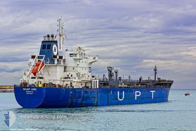
MOUNT KIBO
Oil/Chemical Tanker

Current Trip
TRTUZ
| Time Travelled | 2 days |
|---|---|
| Remaining Time | --- |
| Distance Travelled | 38.34 nm |
| Remaining Distance | --- |
| AVG Speed | 8.4 Knopen |
| MAX Speed | 11.9 Knopen |
| AVG Wind | 4.7 knots |
| MAX Wind | 13 knots |
| MIN Temp | 11.2°C / 52.16°F |
| MAX Temp | 20.7°C / 69.26°F |
| Diepgang | 4 M |
| Positie ontvangen | 2 m geleden |
Current Position
| Lengtegraad | --- |
|---|---|
| Breedtegraat | --- |
| Status | At anchor |
| Snelheid | |
| Koers | 267° |
| Gebied | Sea of Marmara |
| Station | T-AIS |
| Positie ontvangen | 2 m geleden |
Information
The current position of MOUNT KIBO is in Sea of Marmara with coordinates 40.95881° / 28.77375° as reported on 2025-03-28 18:25 by AIS to our vessel tracker app. The vessel's current speed is 0 Knopen
The vessel MOUNT KIBO (IMO: 9470997, MMSI: 636019845) is a Oil/Chemical Tanker that was built in 2010 ( 15 Jaar oud ). It's sailing under the flag of [LR] Liberia.
In this page you can find informations about the vessels current position, last detected port calls, and current voyage information. If the vessels is not in coverage by AIS you will find the latest position.
The current position of MOUNT KIBO is detected by our AIS receivers and we are not responsible for the reliability of the data. The last position was recorded while the vessel was in Coverage by the Ais receivers of our vessel tracking app.
The current draught of MOUNT KIBO as reported by AIS is 4 meters
Weather
| Temperature | 12.3°C / 54.14°F |
|---|---|
| Wind Speed | 2 knots |
| Direction | 4° N |
| Pressure | 1004.8 hPa |
| Humidity | 84.6 % |
| Cloud Coverage | 89 % |


Featured Company
Last Port Calls
| Port | Arrival | Departure | Time In Port |
|---|---|---|---|
| 2025-03-09 21:43 | 2025-03-25 21:59 | 16 d | |
| 2025-02-26 09:23 | 2025-02-27 21:48 | 1 d | |
| 2025-02-16 15:43 | 2025-02-18 07:19 | 1 d | |
| 2025-02-07 17:33 | 2025-02-09 00:56 | 1 d | |
| 2025-02-05 01:56 | 2025-02-07 15:12 | 2 d | |
| 2025-01-20 12:55 |
Last Trips
| Origin | Departure | Destination | Arrival | Distance | |
|---|---|---|---|---|---|
| 2025-02-27 21:48 | 2025-03-09 21:43 | 1955.21 nm | |||
| 2025-02-18 07:19 | 2025-02-26 09:23 | 17.34 nm | |||
| 2025-02-09 00:56 | 2025-02-16 15:43 | 1378.77 nm | |||
| 2025-02-07 15:12 | 2025-02-07 17:33 | 19.04 nm | |||
| 2025-01-20 12:55 | 2025-02-05 01:56 | 1784.38 nm |
Events
| Tijd | Evenement | Details | Positie / Bestemming | Info |
|---|---|---|---|---|
| 2025-03-27 09:13 | Status Changed | At anchor Default |
40.95811 / 28.77331
TRTUZ
|
Snelheid: Koers: 305° |
| 2025-03-27 09:07 | Status Changed | Default At anchor |
40.95808 / 28.77337
TRTUZ
|
Snelheid: 0.1 kn Koers: 305° |
| 2025-03-26 17:48 | Status Changed | At anchor Under way using engine |
40.95854 / 28.77236
TRTUZ
|
Snelheid: 0.4 kn Koers: 308° |
| 2025-03-26 17:43 | Stop beweging | 2.47 nm, West of YESILKOY |
40.95848 / 28.77164
TRTUZ
|
Snelheid: 0.2 kn Koers: 317° |
| 2025-03-26 15:06 | Start beweging | 3.21 nm, West of TUZLA |
40.82605 / 29.19671
TRTUZ
|
Snelheid: 3.4 kn Koers: 235° |
| 2025-03-26 14:59 | Status Changed | Under way using engine At anchor |
40.82563 / 29.20004
TRTUZ
|
Snelheid: 0.2 kn Koers: 312° |
| 2025-03-26 13:39 | Status Changed | At anchor Default |
40.82590 / 29.20094
TRTUZ
|
Snelheid: Koers: 287° |
| 2025-03-26 13:36 | Status Changed | Default At anchor |
40.82588 / 29.20088
TRTUZ
|
Snelheid: Koers: 287° |
| 2025-03-26 11:51 | Status Changed | At anchor Default |
40.82556 / 29.20105
TRTUZ
|
Snelheid: Koers: 304° |
| 2025-03-26 11:48 | Status Changed | Default At anchor |
40.82557 / 29.20111
TRTUZ
|
Snelheid: 0.1 kn Koers: 306° |