
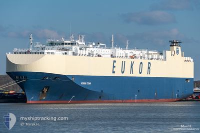
MORNING CROWN
Vehicles Carrier
Current Trip
| Time Travelled | 19 h, 31 mins |
|---|---|
| Remaining Time | --- |
| Distance Travelled | 297.80 nm |
| Remaining Distance | --- |
| AVG Speed | 14.1 Knopen |
| MAX Speed | 16.1 Knopen |
| AVG Wind | 10.5 knots |
| MAX Wind | 13.9 knots |
| MIN Temp | 22.5°C / 72.5°F |
| MAX Temp | 25.2°C / 77.36°F |
| Diepgang | 8.3 M |
| Positie ontvangen | 3 h, 2 m geleden |
Current Position
| Lengtegraad | -93.19881° |
|---|---|
| Breedtegraat | 25.67398° |
| Status | Under way using engine |
| Snelheid | 15.8 Knopen |
| Koers | 124° |
| Gebied | Gulf of Mexico |
| Station | T-AIS |
| Positie ontvangen | 3 h, 2 m geleden |
Info
Information
The current position of MORNING CROWN is in Gulf of Mexico with coordinates 25.67398° / -93.19881° as reported on 2024-05-01 00:24 by AIS to our vessel tracker app. The vessel's current speed is 15.8 Knopen and is heading at the port of MANZANILLO. The estimated time of arrival as calculated by MyShipTracking vessel tracking app is 2024-05-05 05:00 LT
The vessel MORNING CROWN (IMO: 9285641, MMSI: 311698000) is a Vehicles Carrier that was built in 2005 ( 19 Jaar oud ). It's sailing under the flag of [BS] Bahamas.
In this page you can find informations about the vessels current position, last detected port calls, and current voyage information. If the vessels is not in coverage by AIS you will find the latest position.
The current position of MORNING CROWN is detected by our AIS receivers and we are not responsible for the reliability of the data. The last position was recorded while the vessel was in Coverage by the Ais receivers of our vessel tracking app.
The current draught of MORNING CROWN as reported by AIS is 8.3 meters
Weather
| Temperature | 24.8°C / 76.64°F |
|---|---|
| Wind Speed | 12 knots |
| Direction | 109° ESE |
| Pressure | 1012.2 hPa |
| Humidity | 93.8 % |
| Cloud Coverage | 4 % |
Featured Company
Last Port Calls
| Port | Arrival | Departure | Time In Port |
|---|---|---|---|
| 2024-04-28 23:46 | 2024-04-30 07:56 | 1 d | |
| 2024-04-25 12:27 | 2024-04-25 23:43 | 11 h | |
| 2024-04-23 22:04 | 2024-04-24 20:20 | 22 h | |
| 2024-04-15 15:56 | 2024-04-16 20:46 | 1 d | |
| 2024-04-15 15:52 | |||
| 2024-04-15 03:25 | |||
| 2024-04-15 03:22 | |||
| 2024-04-14 11:47 | |||
| 2024-04-14 11:43 | |||
| 2024-04-13 11:06 |
Most Visited Ports (Last year)
| Port | Arrivals | |
|---|---|---|
| 4 | ||
| 4 | ||
| 3 | ||
| 3 | ||
| 3 | ||
| 2 |
Last Trips
| Origin | Departure | Destination | Arrival | Distance | |
|---|---|---|---|---|---|
| 2024-04-25 18:43 | 2024-04-28 18:46 | 528.24 nm | |||
| 2024-04-24 15:20 | 2024-04-25 07:27 | 240.14 nm | |||
| 2024-04-16 15:46 | 2024-04-23 17:04 | 1713.22 nm | |||
| 2024-03-29 18:53 | 2024-04-15 10:56 | 4525.21 nm | |||
| 2024-03-29 18:53 | 2024-04-15 10:52 | 4525.01 nm | |||
| 2024-03-29 18:53 | 2024-04-14 22:25 | 4524.91 nm | |||
| 2024-03-29 18:53 | 2024-04-14 22:22 | 4524.91 nm | |||
| 2024-03-29 18:53 | 2024-04-14 06:47 | 4524.80 nm | |||
| 2024-03-29 18:53 | 2024-04-14 06:43 | 4524.70 nm | |||
| 2024-03-29 18:53 | 2024-04-13 06:06 | 4524.49 nm |
Events
| Tijd | Evenement | Details | Positie / Bestemming | Info |
|---|---|---|---|---|
| 2024-05-01 00:27 | Status Changed | Default Under way using engine |
25.66566 / -93.18514
PAMIT
|
Snelheid: 15.8 kn Koers: 124° |
| 2024-05-01 00:24 | Wijzig zee gebeid | High seas of the Gulf of Mexico United States part of the Gulf of Mexico |
25.67398 / -93.19881
Gulf of Mexico
PAMIT
|
Snelheid: 15.8 kn Koers: 124° |
| 2024-05-01 00:24 | Status Changed | Under way using engine Default |
25.67398 / -93.19881
PAMIT
|
Snelheid: 15.8 kn Koers: 124° |
| 2024-05-01 00:24 | Buitenbereik |
25.67398 / -93.19881
Gulf of Mexico
PAMIT
|
Snelheid: 15.8 kn Koers: 124° |
|
| 2024-05-01 00:04 | Binnenbereik |
25.67398 / -93.19881
Gulf of Mexico
PAMIT
|
Snelheid: 15.8 kn Koers: 124° |
|
| 2024-04-30 14:14 | Status Changed | Default Under way using engine |
28.00260 / -94.42120
PAMIT
|
Snelheid: 15.4 kn Koers: 178.5° |
| 2024-04-30 14:07 | Buitenbereik |
28.03251 / -94.42157
Gulf of Mexico
PAMIT
|
Snelheid: 15.4 kn Koers: 178.5° |
|
| 2024-04-30 13:34 | Status Changed | Under way using engine Default |
28.17631 / -94.42883
PAMIT
|
Snelheid: 15.2 kn Koers: 173° |
| 2024-04-30 13:31 | Status Changed | Default Under way using engine |
28.19069 / -94.43069
PAMIT
|
Snelheid: 15.1 kn Koers: 174.3° |
| 2024-04-30 13:09 | Status Changed | Under way using engine Default |
28.28112 / -94.43622
PAMIT
|
Snelheid: 15.2 kn Koers: 180° |