

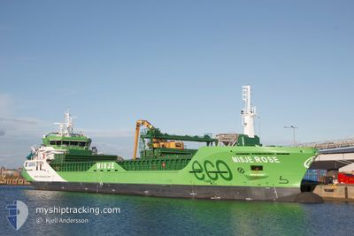
MISJE ROSE
Cargo

Current Trip
| Trip Time | 11 days |
|---|---|
| Trip Distance | 1225.87 nm |
| AVG Speed | 9.9 Knopen |
| MAX Speed | 16.2 Knopen |
| Diepgang | 6.4 M |
| AVG Wind | 15.9 knots |
| MAX Wind | 39 knots |
| MIN Temp | 2.4°C / 36.32°F |
| MAX Temp | 11.7°C / 53.06°F |
| Positie ontvangen | 5 h, 51 m geleden |
Current Position
| Lengtegraad | --- |
|---|---|
| Breedtegraat | --- |
| Status | Moored |
| Snelheid | |
| Koers | 87° |
| Gebied | Irish Sea and St. George's Channel |
| Station | T-AIS |
| Positie ontvangen | 5 h, 51 m geleden |
Information
The current position of MISJE ROSE is in Irish Sea and St. George's Channel with coordinates 53.72079° / -6.30495° as reported on 2025-03-07 06:10 by AIS to our vessel tracker app. The vessel's current speed is 0 Knopen and is currently inside the port of DROGHEDA.
The vessel MISJE ROSE (IMO: 9967548, MMSI: 257756000) is a Cargo It's sailing under the flag of [NO] Norway.
In this page you can find informations about the vessels current position, last detected port calls, and current voyage information. If the vessels is not in coverage by AIS you will find the latest position.
The current position of MISJE ROSE is detected by our AIS receivers and we are not responsible for the reliability of the data. The last position was recorded while the vessel was in Coverage by the Ais receivers of our vessel tracking app.
The current draught of MISJE ROSE as reported by AIS is 3.5 meters
Weather
| Temperature | 8.4°C / 47.12°F |
|---|---|
| Wind Speed | 2 knots |
| Direction | 229° SW |
| Pressure | 1005.1 hPa |
| Humidity | 95.7 % |
| Cloud Coverage | 100 % |


Featured Company
Last Port Calls
| Port | Arrival | Departure | Time In Port |
|---|---|---|---|
| 2025-03-01 12:05 | |||
| 2025-02-15 10:21 | 2025-02-17 18:59 | 2 d | |
| 2025-02-08 00:54 | 2025-02-08 21:13 | 20 h | |
| 2025-02-07 23:30 | 2025-02-08 00:19 | 48 m | |
| 2025-02-04 04:17 | 2025-02-06 01:39 | 1 d | |
| 2025-01-30 16:29 | 2025-02-01 14:28 | 1 d | |
| 2025-01-28 07:23 | 2025-01-29 18:38 | 1 d | |
| 2025-01-23 07:01 | 2025-01-23 17:18 | 10 h | |
| 2025-01-16 22:28 | 2025-01-20 16:22 | 3 d | |
| 2025-01-10 17:07 | 2025-01-11 17:39 | 1 d |
Last Trips
| Origin | Departure | Destination | Arrival | Distance | |
|---|---|---|---|---|---|
| 2025-02-17 18:59 | 2025-03-01 12:05 | 1225.87 nm | |||
| 2025-02-08 22:13 | 2025-02-15 10:21 | 665.76 nm | |||
| 2025-02-08 01:19 | 2025-02-08 01:54 | 5.53 nm | |||
| 2025-02-06 01:39 | 2025-02-08 00:30 | 196.31 nm | |||
| 2025-02-01 15:28 | 2025-02-04 04:17 | 576.42 nm | |||
| 2025-01-29 19:38 | 2025-01-30 17:29 | 228.58 nm | |||
| 2025-01-23 18:18 | 2025-01-28 08:23 | 904.11 nm | |||
| 2025-01-20 17:22 | 2025-01-23 08:01 | 670.40 nm | |||
| 2025-01-11 18:39 | 2025-01-16 23:28 | 1173.88 nm | |||
| 2025-01-09 01:52 | 2025-01-10 18:07 | 317.33 nm |
Events
| Tijd | Evenement | Details | Positie / Bestemming | Info |
|---|---|---|---|---|
| 2025-03-07 06:10 | Buitenbereik |
53.72079 / -6.30495
Irish Sea and St. George's Channel
[IE] DROGHEDA
|
Snelheid: Koers: 284.9° |
|
| 2025-03-07 00:28 | Status Changed | Moored Default |
53.72081 / -6.30492
[IE] DROGHEDA
|
Snelheid: Koers: 87° |
| 2025-03-07 00:10 | Binnenbereik |
53.72081 / -6.30492
Irish Sea and St. George's Channel
[IE] DROGHEDA
|
Snelheid: Koers: 91.8° |
|
| 2025-03-05 21:40 | Status Changed | Default Moored |
53.72080 / -6.30488
[IE] DROGHEDA
|
Snelheid: Koers: 86° |
| 2025-03-05 21:34 | Buitenbereik |
53.72081 / -6.30495
Irish Sea and St. George's Channel
[IE] DROGHEDA
|
Snelheid: Koers: 6.6° |
|
| 2025-03-05 21:28 | Status Changed | Moored Default |
53.72079 / -6.30489
[IE] DROGHEDA
|
Snelheid: Koers: 86° |
| 2025-03-05 21:16 | Binnenbereik |
53.72079 / -6.30489
Irish Sea and St. George's Channel
[IE] DROGHEDA
|
Snelheid: Koers: 203.7° |
|
| 2025-03-05 07:40 | Buitenbereik |
53.72082 / -6.30490
Irish Sea and St. George's Channel
[IE] DROGHEDA
|
Snelheid: Koers: 176.6° |
|
| 2025-03-05 05:46 | Binnenbereik |
53.72079 / -6.30490
Irish Sea and St. George's Channel
[IE] DROGHEDA
|
Snelheid: Koers: 81.7° |
|
| 2025-03-04 12:28 | Buitenbereik |
53.72068 / -6.30378
Irish Sea and St. George's Channel
[IE] DROGHEDA
|
Snelheid: 0.6 kn Koers: 233.7° |