

MIMMI SCHULTE
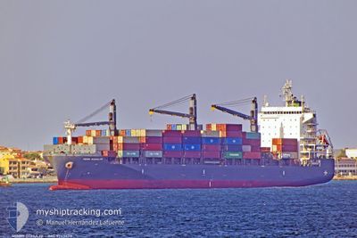
Cargo A

Current Trip
| Time Travelled | 4 days |
|---|---|
| Remaining Time | 30 mins |
| Distance Travelled | 595.29 nm |
| Remaining Distance | 3.20 nm |
| AVG Speed | 13.2 Knopen |
| MAX Speed | 16 Knopen |
| AVG Wind | 10.8 knots |
| MAX Wind | 22 knots |
| MIN Temp | 13.7°C / 56.66°F |
| MAX Temp | 18.3°C / 64.94°F |
| Diepgang | 10.3 M |
| Positie ontvangen | 1 m geleden |
Current Position
| Lengtegraad | --- |
|---|---|
| Breedtegraat | --- |
| Status | Under way using engine |
| Snelheid | 6 Knopen |
| Koers | 158.9° |
| Gebied | North Atlantic Ocean |
| Station | T-AIS |
| Positie ontvangen | 1 m geleden |
Information
The current position of MIMMI SCHULTE is in North Atlantic Ocean with coordinates 33.65310° / -7.57080° as reported on 2025-03-29 06:24 by AIS to our vessel tracker app. The vessel's current speed is 6 Knopen and is heading at the port of CASABLANCA. The estimated time of arrival as calculated by MyShipTracking vessel tracking app is 2025-03-29 06:55 LT
The vessel MIMMI SCHULTE (IMO: 9743473, MMSI: 563024600) is a Cargo A It's sailing under the flag of [SG] Singapore.
In this page you can find informations about the vessels current position, last detected port calls, and current voyage information. If the vessels is not in coverage by AIS you will find the latest position.
The current position of MIMMI SCHULTE is detected by our AIS receivers and we are not responsible for the reliability of the data. The last position was recorded while the vessel was in Coverage by the Ais receivers of our vessel tracking app.
The current draught of MIMMI SCHULTE as reported by AIS is 10.3 meters
Weather
| Temperature | 15.2°C / 59.36°F |
|---|---|
| Wind Speed | 12 knots |
| Direction | 65° ENE |
| Pressure | 1017.9 hPa |
| Humidity | 77.4 % |
| Cloud Coverage | 38 % |


Featured Company
Last Port Calls
| Port | Arrival | Departure | Time In Port |
|---|---|---|---|
| 2025-03-23 23:16 | 2025-03-24 14:29 | 15 h | |
| 2025-03-17 01:40 | 2025-03-20 07:10 | 3 d | |
| 2025-03-08 08:45 | 2025-03-08 22:22 | 13 h | |
| 2025-03-05 21:44 | 2025-03-06 18:27 | 20 h | |
| 2025-03-01 23:31 | 2025-03-05 07:43 | 3 d | |
| 2025-02-25 09:53 | 2025-02-27 10:22 | 2 d | |
| 2025-02-19 17:50 | 2025-02-22 00:34 | 2 d | |
| 2025-02-12 20:51 | 2025-02-13 16:29 | 19 h | |
| 2025-02-09 11:11 | 2025-02-11 16:02 | 2 d | |
| 2025-02-07 06:50 | 2025-02-08 07:24 | 1 d |
Last Trips
| Origin | Departure | Destination | Arrival | Distance | |
|---|---|---|---|---|---|
| 2025-03-20 07:10 | 2025-03-23 23:16 | 1253.79 nm | |||
| 2025-03-08 22:22 | 2025-03-17 01:40 | 1316.46 nm | |||
| 2025-03-06 18:27 | 2025-03-08 08:45 | 533.71 nm | |||
| 2025-03-05 07:43 | 2025-03-05 21:44 | 199.23 nm | |||
| 2025-02-27 10:22 | 2025-03-01 23:31 | 595.44 nm | |||
| 2025-02-22 00:34 | 2025-02-25 09:53 | 1247.38 nm | |||
| 2025-02-13 16:29 | 2025-02-19 17:50 | 349.52 nm | |||
| 2025-02-11 16:02 | 2025-02-12 20:51 | 233.02 nm | |||
| 2025-02-08 07:24 | 2025-02-09 11:11 | 250.21 nm | |||
| 2025-02-06 15:02 | 2025-02-07 06:50 | 211.68 nm |
Events
| Tijd | Evenement | Details | Positie / Bestemming | Info |
|---|---|---|---|---|
| 2025-03-29 06:06 | Start beweging | 3.74 nm, North of CASABLANCA |
33.67694 / -7.58845
MACAS
|
Snelheid: 3.1 kn Koers: 115° |
| 2025-03-29 05:56 | Stop beweging | 3.79 nm, North of CASABLANCA |
33.67806 / -7.59238
MACAS
|
Snelheid: 0.3 kn Koers: 62° |
| 2025-03-29 04:54 | Start beweging | 5.39 nm, North of CASABLANCA |
33.70161 / -7.62367
MACAS
|
Snelheid: 5 kn Koers: 126.6° |
| 2025-03-29 04:41 | Status Changed | Under way using engine At anchor |
33.70174 / -7.62833
MACAS
|
Snelheid: 0.2 kn Koers: 54° |
| 2025-03-29 04:26 | Status Changed | At anchor Default |
33.70178 / -7.62779
MACAS
|
Snelheid: 0.1 kn Koers: 60° |
| 2025-03-29 04:23 | Status Changed | Default At anchor |
33.70176 / -7.62789
MACAS
|
Snelheid: 0.1 kn Koers: 60° |
| 2025-03-29 03:53 | Status Changed | At anchor Default |
33.70162 / -7.62788
MACAS
|
Snelheid: 0.1 kn Koers: 60° |
| 2025-03-29 03:50 | Status Changed | Default At anchor |
33.70168 / -7.62788
MACAS
|
Snelheid: 0.2 kn Koers: 57° |
| 2025-03-29 03:41 | Status Changed | At anchor Default |
33.70159 / -7.62781
MACAS
|
Snelheid: 0.1 kn Koers: 54° |
| 2025-03-29 03:38 | Status Changed | Default At anchor |
33.70157 / -7.62778
MACAS
|
Snelheid: Koers: 59° |