
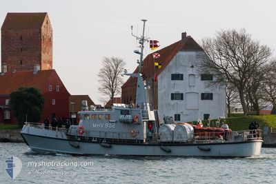
MHV 902 MANOE
Military ops
Current Trip
| Trip Time | 6 h, 24 mins |
|---|---|
| Trip Distance | 66.37 nm |
| AVG Speed | 10.8 Knopen |
| MAX Speed | 12 Knopen |
| Diepgang | 2.5 M |
| AVG Wind | 9.5 knots |
| MAX Wind | 13.2 knots |
| MIN Temp | 5.6°C / 42.08°F |
| MAX Temp | 8.5°C / 47.3°F |
| Positie ontvangen | 4 d geleden |
Current Position
| Lengtegraad | --- |
|---|---|
| Breedtegraat | --- |
| Status | Under way using engine |
| Snelheid | 11.1 Knopen |
| Koers | 239.1° |
| Gebied | Kattegat |
| Station | T-AIS |
| Positie ontvangen | 4 d geleden |
Info
Information
The current position of MHV 902 MANOE is in Kattegat with coordinates 57.03325° / 9.61713° as reported on 2025-12-07 08:05 by AIS to our vessel tracker app. The vessel's current speed is 11.1 Knopen and is currently inside the port of LEMVIG.
The vessel MHV 902 MANOE (MMSI: 219000166) is a Military ops It's sailing under the flag of [DK] Denmark.
In this page you can find informations about the vessels current position, last detected port calls, and current voyage information. If the vessels is not in coverage by AIS you will find the latest position.
The current position of MHV 902 MANOE is detected by our AIS receivers and we are not responsible for the reliability of the data. The last position was recorded while the vessel was in Coverage by the Ais receivers of our vessel tracking app.
The current draught of MHV 902 MANOE as reported by AIS is 2.5 meters
Weather
| Temperature | 7.6°C / 45.68°F |
|---|---|
| Wind Speed | 10 knots |
| Direction | 238° WSW |
| Pressure | 1017.3 hPa |
| Humidity | 94.3 % |
| Cloud Coverage | 99 % |
Featured Company
Last Port Calls
| Port | Arrival | Departure | Time In Port |
|---|---|---|---|
| 2025-12-07 14:33 | |||
| 2025-12-06 17:19 | 2025-12-07 08:09 | 14 h | |
| 2025-11-01 08:32 | |||
| 2025-10-10 22:28 | 2025-10-19 14:02 | 8 d |
Last Trips
| Origin | Departure | Destination | Arrival | Distance | |
|---|---|---|---|---|---|
| 2025-12-07 08:09 | 2025-12-07 14:33 | 66.37 nm | |||
| 2025-12-07 08:09 | 2025-12-06 17:19 | 66.37 nm | |||
| 2025-10-19 14:02 | 2025-11-01 08:32 | 258.68 nm | |||
| 2025-09-14 05:44 | 2025-10-10 22:28 | 190.20 nm |
Events
| Tijd | Evenement | Details | Positie / Bestemming | Info |
|---|---|---|---|---|
| 2025-12-07 13:43 | Stop beweging |
56.55049 / 8.30598
[DK] LEMVIG
|
Snelheid: 0.1 kn Koers: 79° |
|
| 2025-12-07 13:33 | Aankomsthaven |
|
56.56406 / 8.30176
[DK] LEMVIG
|
Snelheid: 10.4 kn Koers: 193° |
| 2025-12-07 08:13 | Status Changed | Default Under way using engine |
57.02772 / 9.57709
UNKNOWN
|
Snelheid: 11.1 kn Koers: 239.1° |
| 2025-12-07 08:05 | Status Changed | Under way using engine Default |
57.03325 / 9.61713
UNKNOWN
|
Snelheid: 10.5 kn Koers: 303° |
| 2025-12-07 08:05 | Buitenbereik |
57.03325 / 9.61713
Kattegat
|
Snelheid: 11.1 kn Koers: 239.1° |
|
| 2025-12-07 08:01 | Status Changed | Default Under way using engine |
57.02892 / 9.63885
UNKNOWN
|
Snelheid: 11 kn Koers: 220.6° |
| 2025-12-07 07:53 | Status Changed | Under way using engine Default |
57.04042 / 9.67434
UNKNOWN
|
Snelheid: 10.8 kn Koers: 250° |
| 2025-12-07 07:49 | Status Changed | Default Under way using engine |
57.04486 / 9.69282
UNKNOWN
|
Snelheid: 10.9 kn Koers: 250.9° |
| 2025-12-07 07:09 | Vertrekhaven |
|
57.06004 / 9.88270
UNKNOWN
|
Snelheid: 10.9 kn Koers: 249° |
| 2025-12-07 07:06 | Status Changed | Under way using engine Moored |
57.06086 / 9.89915
[DK] AALBORG
|
Snelheid: 8.5 kn Koers: 298° |