
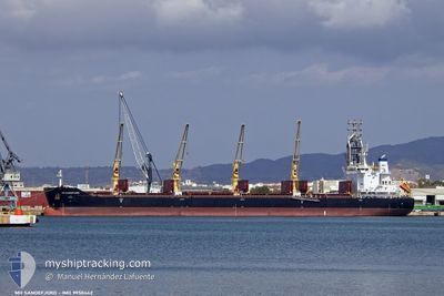
MH SANDEFJORD
Cargo
Current Trip
| Trip Time | 4 days |
|---|---|
| Trip Distance | 504.46 nm |
| AVG Speed | 8.8 Knopen |
| MAX Speed | 14.2 Knopen |
| Diepgang | 13.3 M |
| AVG Wind | 13.5 knots |
| MAX Wind | 19 knots |
| MIN Temp | 26.8°C / 80.24°F |
| MAX Temp | 36°C / 96.8°F |
| Positie ontvangen | 16 d geleden |
Current Position
| Lengtegraad | 75.62799° |
|---|---|
| Breedtegraat | 8.80114° |
| Status | Under way using engine |
| Snelheid | 11.1 Knopen |
| Koers | 331.3° |
| Gebied | Laccadive Sea |
| Station | T-AIS |
| Positie ontvangen | 16 d geleden |
Info
Information
The current position of MH SANDEFJORD is in Laccadive Sea with coordinates 8.80114° / 75.62799° as reported on 2024-04-24 07:03 by AIS to our vessel tracker app. The vessel's current speed is 11.1 Knopen and is currently inside the port of PORT QASIM.
The vessel MH SANDEFJORD (IMO: 9950442, MMSI: 636021584) is a Cargo It's sailing under the flag of [LR] Liberia.
In this page you can find informations about the vessels current position, last detected port calls, and current voyage information. If the vessels is not in coverage by AIS you will find the latest position.
The current position of MH SANDEFJORD is detected by our AIS receivers and we are not responsible for the reliability of the data. The last position was recorded while the vessel was in Coverage by the Ais receivers of our vessel tracking app.
The current draught of MH SANDEFJORD as reported by AIS is 13.3 meters
Weather
| Temperature | 31.9°C / 89.42°F |
|---|---|
| Wind Speed | 13 knots |
| Direction | 213° SSW |
| Pressure | 1005.6 hPa |
| Humidity | 58.5 % |
| Cloud Coverage | --- |
Featured Company
Last Port Calls
| Port | Arrival | Departure | Time In Port |
|---|---|---|---|
| 2024-05-07 03:37 | |||
| 2024-04-28 11:56 | 2024-05-02 10:31 | 3 d |
Most Visited Ports (Last year)
| Port | Arrivals | |
|---|---|---|
| 4 | ||
| 1 | ||
| 1 | ||
| 1 | ||
| 1 | ||
| 1 |
Last Trips
| Origin | Departure | Destination | Arrival | Distance | |
|---|---|---|---|---|---|
| 2024-05-02 16:01 | 2024-05-07 08:37 | 504.46 nm |
Events
| Tijd | Evenement | Details | Positie / Bestemming | Info |
|---|---|---|---|---|
| 2024-05-07 03:41 | Stop beweging |
24.77236 / 67.33942
[PK] PORT QASIM
|
Snelheid: 0.2 kn Koers: 231° |
|
| 2024-05-07 03:37 | Aankomsthaven |
|
24.77195 / 67.33952
[PK] PORT QASIM
|
Snelheid: 1.7 kn Koers: 268° |
| 2024-05-06 23:29 | Start beweging | 15.1 nm, South of SALEHAABAD ISLAND |
24.55258 / 66.97675
KANDLA
|
Snelheid: 4 kn Koers: 168° |
| 2024-05-06 06:56 | Stop beweging | 14.88 nm, South of SALEHAABAD ISLAND |
24.55632 / 66.97630
KANDLA
|
Snelheid: 0.3 kn Koers: 116° |
| 2024-05-05 01:12 | Start beweging |
24.10665 / 66.42362
KANDLA
|
Snelheid: 3.2 kn Koers: 311° |
|
| 2024-05-04 17:03 | Stop beweging |
24.06333 / 66.28833
KANDLA
|
Snelheid: Koers: -1° |
|
| 2024-05-03 18:03 | Start beweging |
24.23500 / 66.18500
KANDLA
|
Snelheid: 4 kn Koers: -1° |
|
| 2024-05-03 15:33 | Stop beweging |
24.21333 / 66.15334
KANDLA
|
Snelheid: Koers: -1° |
|
| 2024-05-02 10:31 | Vertrekhaven |
|
22.95643 / 70.24079
KANDLA
|
Snelheid: 11 kn Koers: -1° |
| 2024-05-02 10:18 | Start beweging |
22.98854 / 70.22735
[IN] KANDLA
|
Snelheid: 5.2 kn Koers: 155° |