
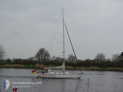
MAY BRITT
Pleasure Craft
Current Trip
| Trip Time | 2 days |
|---|---|
| Trip Distance | 55.54 nm |
| AVG Speed | 5.3 Knopen |
| MAX Speed | 8.2 Knopen |
| Diepgang | --- |
| AVG Wind | 10.1 knots |
| MAX Wind | 13.9 knots |
| MIN Temp | 13.1°C / 55.58°F |
| MAX Temp | 16.3°C / 61.34°F |
| Positie ontvangen | 6 d geleden |
Current Position
| Lengtegraad | 9.99287° |
|---|---|
| Breedtegraat | 54.68129° |
| Status | Default |
| Snelheid | |
| Koers | --- |
| Gebied | Baltic Sea |
| Station | T-AIS |
| Positie ontvangen | 6 d geleden |
Info
Information
The current position of MAY BRITT is in Baltic Sea with coordinates 54.68129° / 9.99287° as reported on 2024-05-20 12:30 by AIS to our vessel tracker app. The vessel's current speed is 0 Knopen and is currently inside the port of MAASHOLM.
The vessel MAY BRITT (MMSI: 211161510) is a Pleasure Craft It's sailing under the flag of [DE] Germany.
In this page you can find informations about the vessels current position, last detected port calls, and current voyage information. If the vessels is not in coverage by AIS you will find the latest position.
The current position of MAY BRITT is detected by our AIS receivers and we are not responsible for the reliability of the data. The last position was recorded while the vessel was in Coverage by the Ais receivers of our vessel tracking app.
Weather
| Temperature | 15.3°C / 59.54°F |
|---|---|
| Wind Speed | 11 knots |
| Direction | 72° ENE |
| Pressure | 1013 hPa |
| Humidity | 79.8 % |
| Cloud Coverage | 2 % |
Featured Company
Most Visited Ports (Last year)
| Port | Arrivals | |
|---|---|---|
| 9 | ||
| 2 | ||
| 1 | ||
| 1 | ||
| 1 | ||
| 1 |
Last Trips
| Origin | Departure | Destination | Arrival | Distance | |
|---|---|---|---|---|---|
| 2024-05-18 09:44 | 2024-05-20 14:06 | 55.54 nm | |||
| 2024-05-12 10:07 | 2024-05-12 13:50 | 23.39 nm | |||
| 2024-05-11 10:13 | 2024-05-11 14:03 | 23.43 nm | |||
| 2024-05-04 07:48 | 2024-05-04 15:15 | 40.24 nm | |||
| 2024-04-27 08:42 | 2024-04-27 17:49 | 63.80 nm |
Events
| Tijd | Evenement | Details | Positie / Bestemming | Info |
|---|---|---|---|---|
| 2024-05-20 12:30 | Buitenbereik |
54.68129 / 9.99287
Baltic Sea
[DE] MAASHOLM
|
Snelheid: Koers: 511° |
|
| 2024-05-20 12:08 | Stop beweging |
54.68130 / 9.99290
[DE] MAASHOLM
|
Snelheid: 0.2 kn Koers: 511° |
|
| 2024-05-20 12:06 | Aankomsthaven |
|
54.68041 / 9.99272
[DE] MAASHOLM
|
Snelheid: 0.8 kn Koers: 511° |
| 2024-05-20 10:37 | Wijzig zee gebeid | German part of the Baltic Sea Danish part of the Baltic Sea |
54.77697 / 10.10036
Baltic Sea
|
Snelheid: 5.5 kn Koers: 201.5° |
| 2024-05-20 10:25 | Wijzig zee gebeid | Danish part of the Baltic Sea Danish part of the Kattegat |
54.79411 / 10.11196
Baltic Sea
|
Snelheid: 5.6 kn Koers: 201.2° |
| 2024-05-20 06:52 | Start beweging | 3.59 nm, South West of FAABORG |
55.05345 / 10.15784
|
Snelheid: 4.7 kn Koers: 0.7° |
| 2024-05-20 06:41 | Binnenbereik |
55.05166 / 10.15685
Kattegat
|
Snelheid: Koers: 511° |
|
| 2024-05-18 17:54 | Buitenbereik |
55.05167 / 10.15682
Kattegat
|
Snelheid: Koers: 511° |
|
| 2024-05-18 12:33 | Stop beweging | 3.68 nm, South West of FAABORG |
55.05165 / 10.15689
|
Snelheid: 0.2 kn Koers: 511° |
| 2024-05-18 09:40 | Wijzig zee gebeid | Danish part of the Kattegat Danish part of the Baltic Sea |
54.79595 / 10.09480
Kattegat
|
Snelheid: 5.6 kn Koers: 16.6° |