
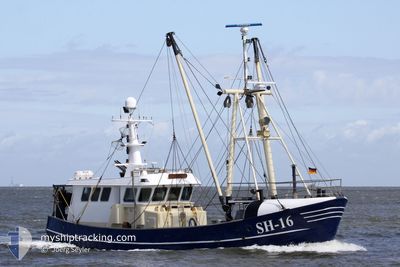
MARIE LOUISE SH-16
Fishing
Current Trip
REQUEST 0;5M CLEAR
| Time Travelled | 1 day |
|---|---|
| Remaining Time | --- |
| Distance Travelled | 112.04 nm |
| Remaining Distance | --- |
| AVG Speed | 5.8 Knopen |
| MAX Speed | 10.4 Knopen |
| AVG Wind | 16.1 knots |
| MAX Wind | 21.9 knots |
| MIN Temp | 1.4°C / 34.52°F |
| MAX Temp | 5.2°C / 41.36°F |
| Diepgang | 2.6 M |
| Positie ontvangen | 13 m geleden |
Current Position
| Lengtegraad | --- |
|---|---|
| Breedtegraat | --- |
| Status | Engaged in Fishing |
| Snelheid | 4.1 Knopen |
| Koers | 275° |
| Gebied | North Sea |
| Station | T-AIS |
| Positie ontvangen | 13 m geleden |
Info
Information
The current position of MARIE LOUISE SH-16 is in North Sea with coordinates 51.65649° / 2.39934° as reported on 2025-02-18 21:40 by AIS to our vessel tracker app. The vessel's current speed is 4.1 Knopen
The vessel MARIE LOUISE SH-16 (MMSI: 211588480) is a Fishing It's sailing under the flag of [DE] Germany.
In this page you can find informations about the vessels current position, last detected port calls, and current voyage information. If the vessels is not in coverage by AIS you will find the latest position.
The current position of MARIE LOUISE SH-16 is detected by our AIS receivers and we are not responsible for the reliability of the data. The last position was recorded while the vessel was in Coverage by the Ais receivers of our vessel tracking app.
The current draught of MARIE LOUISE SH-16 as reported by AIS is 2.6 meters
Weather
| Temperature | 4.2°C / 39.56°F |
|---|---|
| Wind Speed | 20 knots |
| Direction | 121° ESE |
| Pressure | 1021.5 hPa |
| Humidity | 58.5 % |
| Cloud Coverage | 72 % |
Featured Company
Last Port Calls
| Port | Arrival | Departure | Time In Port |
|---|---|---|---|
| 2025-02-16 18:36 | 2025-02-17 20:22 | 1 d | |
| 2025-02-07 01:50 | 2025-02-12 20:37 | 5 d | |
| 2025-02-01 15:22 | 2025-02-01 22:46 | 7 h | |
| 2025-01-22 23:53 | 2025-01-30 17:15 | 7 d | |
| 2025-01-19 21:08 | 2025-01-19 23:38 | 2 h | |
| 2025-01-14 13:49 | 2025-01-14 19:10 | 5 h | |
| 2025-01-12 21:18 | 2025-01-13 04:09 | 6 h | |
| 2024-12-30 22:20 | 2025-01-08 08:02 | 8 d | |
| 2024-12-27 16:58 | 2024-12-29 02:05 | 1 d | |
| 2024-12-13 00:19 | 2024-12-26 22:38 | 13 d |
Most Visited Ports (Last year)
| Port | Arrivals | |
|---|---|---|
| 14 | ||
| 12 | ||
| 8 | ||
| 5 | ||
| 4 | ||
| 4 |
Last Trips
| Origin | Departure | Destination | Arrival | Distance | |
|---|---|---|---|---|---|
| 2025-02-12 21:37 | 2025-02-16 19:36 | 155.87 nm | |||
| 2025-02-01 23:46 | 2025-02-07 02:50 | 140.28 nm | |||
| 2025-01-30 18:15 | 2025-02-01 16:22 | 50.14 nm | |||
| 2025-01-20 00:38 | 2025-01-23 00:53 | 192.95 nm | |||
| 2025-01-14 20:10 | 2025-01-19 22:08 | 163.44 nm | |||
| 2025-01-13 05:09 | 2025-01-14 14:49 | 174.10 nm | |||
| 2025-01-08 09:02 | 2025-01-12 22:18 | 348.01 nm | |||
| 2024-12-29 03:05 | 2024-12-30 23:20 | 204.37 nm | |||
| 2024-12-26 23:38 | 2024-12-27 17:58 | 117.77 nm | |||
| 2024-12-10 16:23 | 2024-12-13 01:19 | 268.95 nm |
Events
| Tijd | Evenement | Details | Positie / Bestemming | Info |
|---|---|---|---|---|
| 2025-02-18 21:40 | Binnenbereik |
51.65649 / 2.39934
North Sea
|
Snelheid: 4.1 kn Koers: 266.5° |
|
| 2025-02-18 19:28 | Buitenbereik |
51.66038 / 2.34994
North Sea
|
Snelheid: 3.6 kn Koers: 31.7° |
|
| 2025-02-18 18:15 | Gevonden in zee | Belgian part of the North Sea |
51.61340 / 2.27398
North Sea
|
Snelheid: 5.8 kn Koers: 49.5° |
| 2025-02-18 18:15 | Binnenbereik |
51.61340 / 2.27398
North Sea
|
Snelheid: 5.8 kn Koers: 49.5° |
|
| 2025-02-18 17:05 | Buitenbereik |
51.56625 / 2.22858
North Sea
|
Snelheid: 4 kn Koers: 49.1° |
|
| 2025-02-18 11:14 | Gevonden in zee | United Kingdom part of the North Sea |
51.52112 / 2.14967
North Sea
|
Snelheid: 4.5 kn Koers: 234.7° |
| 2025-02-18 11:14 | Binnenbereik |
51.52112 / 2.14967
North Sea
|
Snelheid: 4.5 kn Koers: 234.7° |
|
| 2025-02-18 09:05 | Buitenbereik |
51.57620 / 2.24508
North Sea
|
Snelheid: 2.8 kn Koers: 49.1° |
|
| 2025-02-18 09:05 | Wijzig zee gebeid | Belgian part of the North Sea United Kingdom part of the North Sea |
51.57620 / 2.24508
North Sea
|
Snelheid: 2.8 kn Koers: 49.1° |
| 2025-02-18 03:40 | Gevonden in zee | United Kingdom part of the North Sea |
51.46726 / 2.10101
North Sea
|
Snelheid: 3.1 kn Koers: 266.5° |