
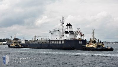
MARIE C
Reserved for future use
Current Trip
| Trip Time | 10 days |
|---|---|
| Trip Distance | 2834.53 nm |
| AVG Speed | 10.3 Knopen |
| MAX Speed | 15.2 Knopen |
| Diepgang | 9.7 M |
| AVG Wind | 15.6 knots |
| MAX Wind | 36 knots |
| MIN Temp | 3.2°C / 37.76°F |
| MAX Temp | 29°C / 84.2°F |
| Positie ontvangen | 1 d geleden |
Current Position
| Lengtegraad | -54.05731° |
|---|---|
| Breedtegraat | 47.42585° |
| Status | Under way using engine |
| Snelheid | 10 Knopen |
| Koers | 20.4° |
| Gebied | North Atlantic Ocean |
| Station | T-AIS |
| Positie ontvangen | 1 d geleden |
Info
Information
The current position of MARIE C is in North Atlantic Ocean with coordinates 47.42585° / -54.05731° as reported on 2024-04-30 14:59 by AIS to our vessel tracker app. The vessel's current speed is 10 Knopen and is currently inside the port of COME BY CHANCE.
The vessel MARIE C (IMO: 9749348, MMSI: 538006807) is a Reserved for future use It's sailing under the flag of [MH] Marshall Is.
In this page you can find informations about the vessels current position, last detected port calls, and current voyage information. If the vessels is not in coverage by AIS you will find the latest position.
The current position of MARIE C is detected by our AIS receivers and we are not responsible for the reliability of the data. The last position was recorded while the vessel was in Coverage by the Ais receivers of our vessel tracking app.
The current draught of MARIE C as reported by AIS is 9.7 meters
Weather
| Temperature | 8°C / 46.4°F |
|---|---|
| Wind Speed | 9 knots |
| Direction | 28° NNE |
| Pressure | 1010.2 hPa |
| Humidity | 91.5 % |
| Cloud Coverage | 99 % |
Featured Company
Last Port Calls
| Port | Arrival | Departure | Time In Port |
|---|---|---|---|
| 2024-04-30 17:46 | |||
| 2024-04-19 17:42 | 2024-04-19 21:14 | 3 h | |
| 2024-04-17 07:09 | 2024-04-17 14:31 | 7 h | |
| 2024-04-15 09:32 | 2024-04-17 04:17 | 1 d | |
| 2024-04-11 08:04 | 2024-04-13 02:40 | 1 d | |
| 2024-04-05 22:00 | 2024-04-08 20:14 | 2 d | |
| 2024-04-02 22:56 | 2024-04-04 19:00 | 1 d | |
| 2024-03-11 14:04 | 2024-03-13 19:07 | 2 d | |
| 2024-03-06 11:54 | 2024-03-10 15:26 | 4 d | |
| 2024-03-02 09:23 | 2024-03-04 20:02 | 2 d |
Most Visited Ports (Last year)
| Port | Arrivals | |
|---|---|---|
| 4 | ||
| 4 | ||
| 3 | ||
| 3 | ||
| 3 | ||
| 2 |
Last Trips
| Origin | Departure | Destination | Arrival | Distance | |
|---|---|---|---|---|---|
| 2024-04-19 16:14 | 2024-04-30 15:16 | 2834.53 nm | |||
| 2024-04-17 09:31 | 2024-04-19 12:42 | 77.08 nm | |||
| 2024-04-16 23:17 | 2024-04-17 02:09 | 20.71 nm | |||
| 2024-04-12 21:40 | 2024-04-15 04:32 | 486.99 nm | |||
| 2024-04-08 15:14 | 2024-04-11 03:04 | 271.22 nm | |||
| 2024-04-04 14:00 | 2024-04-05 17:00 | 49.82 nm | |||
| 2024-03-13 20:07 | 2024-04-02 17:56 | 5641.59 nm | |||
| 2024-03-10 16:26 | 2024-03-11 15:04 | 215.07 nm | |||
| 2024-03-04 21:02 | 2024-03-06 12:54 | 339.54 nm | |||
| 2024-02-29 10:36 | 2024-03-02 10:23 | 450.96 nm |
Events
| Tijd | Evenement | Details | Positie / Bestemming | Info |
|---|---|---|---|---|
| 2024-04-30 17:46 | Stop beweging |
47.79953 / -54.01801
[CA] COME BY CHANCE
|
Snelheid: 0.1 kn Koers: 195° |
|
| 2024-04-30 17:46 | Aankomsthaven |
|
47.79953 / -54.01801
[CA] COME BY CHANCE
|
Snelheid: 0.9 kn Koers: 186° |
| 2024-04-30 15:07 | Status Changed | Default Under way using engine |
47.44500 / -54.04500
CANADA,COME BY CHA
|
Snelheid: 10 kn Koers: 20.4° |
| 2024-04-30 14:59 | Status Changed | Under way using engine Default |
47.42585 / -54.05731
CANADA,COME BY CHA
|
Snelheid: 9 kn Koers: 20° |
| 2024-04-30 14:59 | Buitenbereik |
47.42585 / -54.05731
North Atlantic Ocean
|
Snelheid: 10 kn Koers: 20.4° |
|
| 2024-04-30 14:52 | Status Changed | Default Under way using engine |
47.40667 / -54.06667
CANADA,COME BY CHA
|
Snelheid: 9.8 kn Koers: 19.4° |
| 2024-04-30 12:26 | Draught Changed | 9.7 9.8 |
47.05034 / -54.34470
CANADA,COME BY CHA
|
Snelheid: 11.3 kn Koers: 34.3° |
| 2024-04-30 11:58 | Status Changed | Under way using engine Default |
46.97457 / -54.41830
CANADA,COME BY CHA
|
Snelheid: 11 kn Koers: 31° |
| 2024-04-30 11:52 | Status Changed | Default Under way using engine |
46.95667 / -54.43333
CANADA,COME BY CHA
|
Snelheid: 11.8 kn Koers: 31.6° |
| 2024-04-30 11:50 | Wijzig zee gebeid | Canadian part of the North Atlantic Ocean Bahamas part of the North Atlantic Ocean |
46.95219 / -54.43971
North Atlantic Ocean
|
Snelheid: 11.8 kn Koers: 31.6° |