
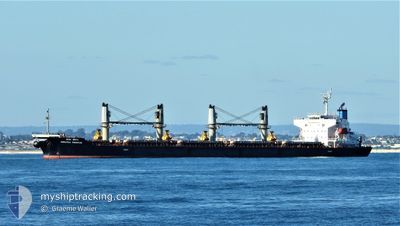
MARATHA PRESTIGE
Bulk Carrier
Current Trip
SINGAPORE
| Time Travelled | 8 days |
|---|---|
| Remaining Time | --- |
| Distance Travelled | 2406.58 nm |
| Remaining Distance | --- |
| AVG Speed | 11.8 Knopen |
| MAX Speed | 11.8 Knopen |
| AVG Wind | 9 knots |
| MAX Wind | 21.9 knots |
| MIN Temp | 26°C / 78.8°F |
| MAX Temp | 30.7°C / 87.26°F |
| Diepgang | 7.5 M |
| Positie ontvangen | 2 d geleden |
Current Position
| Lengtegraad | 77.36956° |
|---|---|
| Breedtegraat | 7.60246° |
| Status | Under way using engine |
| Snelheid | 12.1 Knopen |
| Koers | 125.3° |
| Gebied | Laccadive Sea |
| Station | T-AIS |
| Positie ontvangen | 2 d geleden |
Info
Information
The current position of MARATHA PRESTIGE is in Laccadive Sea with coordinates 7.60246° / 77.36956° as reported on 2024-04-28 19:10 by AIS to our vessel tracker app. The vessel's current speed is 12.1 Knopen
The vessel MARATHA PRESTIGE (IMO: 9561332, MMSI: 419000160) is a Bulk Carrier that was built in 2010 ( 14 Jaar oud ). It's sailing under the flag of [IN] India.
In this page you can find informations about the vessels current position, last detected port calls, and current voyage information. If the vessels is not in coverage by AIS you will find the latest position.
The current position of MARATHA PRESTIGE is detected by our AIS receivers and we are not responsible for the reliability of the data. The last position was recorded while the vessel was in Coverage by the Ais receivers of our vessel tracking app.
The current draught of MARATHA PRESTIGE as reported by AIS is 7.5 meters
Weather
| Temperature | 29.5°C / 85.1°F |
|---|---|
| Wind Speed | 2 knots |
| Direction | 265° W |
| Pressure | 1007.7 hPa |
| Humidity | 71.2 % |
| Cloud Coverage | 100 % |
Featured Company
Last Trips
| Origin | Departure | Destination | Arrival | Distance | |
|---|---|---|---|---|---|
| 2024-04-11 14:08 | 2024-04-15 00:33 | 470.19 nm | |||
| 2024-02-10 17:30 | 2024-04-04 22:44 | 6908.33 nm |
Events
| Tijd | Evenement | Details | Positie / Bestemming | Info |
|---|---|---|---|---|
| 2024-04-28 19:10 | Buitenbereik |
7.60246 / 77.36956
Laccadive Sea
|
Snelheid: 12.1 kn Koers: 125.3° |
|
| 2024-04-28 16:31 | ETA Changed | 2024/04/05 11:15 2024/05/05 20:01 |
7.89809 / 76.92726
SINGAPORE
|
Snelheid: 11.8 kn Koers: 126.5° |
| 2024-04-28 15:47 | Status Changed | Under way using engine Default |
7.97995 / 76.81101
SINGAPORE
|
Snelheid: 11.7 kn Koers: 124° |
| 2024-04-28 15:47 | Binnenbereik |
7.97624 / 76.81642
Laccadive Sea
SINGAPORE
|
Snelheid: 11.8 kn Koers: 124.5° |
|
| 2024-04-28 11:13 | Status Changed | Default Under way using engine |
8.47761 / 76.08510
SINGAPORE
|
Snelheid: 12 kn Koers: 148.5° |
| 2024-04-28 11:11 | Buitenbereik |
8.48353 / 76.08117
Laccadive Sea
SINGAPORE
|
Snelheid: 12 kn Koers: 148.5° |
|
| 2024-04-28 11:11 | Gevonden in zee | Indian part of the Laccadive Sea |
8.48353 / 76.08117
Laccadive Sea
SINGAPORE
|
Snelheid: 12 kn Koers: 148.5° |
| 2024-04-28 11:11 | Status Changed | Under way using engine Default |
8.48401 / 76.08088
SINGAPORE
|
Snelheid: 12.2 kn Koers: 149° |
| 2024-04-28 11:11 | Binnenbereik |
8.48353 / 76.08117
Laccadive Sea
SINGAPORE
|
Snelheid: 12 kn Koers: 148.5° |
|
| 2024-04-23 09:12 | Buitenbereik |
25.64187 / 57.15462
Gulf of Oman
SINGAPORE
|
Snelheid: 12.8 kn Koers: 140.3° |