
MAPLE MARINA
Cargo
Current Trip
GT PRQL TOWING
| Time Travelled | 35 days |
|---|---|
| Remaining Time | --- |
| Distance Travelled | 7976.10 nm |
| Remaining Distance | --- |
| AVG Speed | 10.4 Knopen |
| MAX Speed | 14.8 Knopen |
| AVG Wind | 17.2 knots |
| MAX Wind | 40 knots |
| MIN Temp | --- |
| MAX Temp | 28°C / 82.4°F |
| Diepgang | 9.3 M |
| Positie ontvangen | 53 m geleden |
Current Position
| Lengtegraad | --- |
|---|---|
| Breedtegraat | --- |
| Status | Under way using engine |
| Snelheid | 12 Knopen |
| Koers | 106° |
| Gebied | North Pacific Ocean |
| Station | T-AIS |
| Positie ontvangen | 53 m geleden |
Info
Information
The current position of MAPLE MARINA is in North Pacific Ocean with coordinates 16.69500° / -101.96200° as reported on 2026-01-03 16:04 by AIS to our vessel tracker app. The vessel's current speed is 12 Knopen
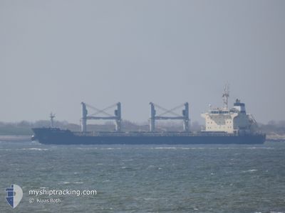
The vessel MAPLE MARINA (MMSI: 440152000) is a Cargo It's sailing under the flag of [KR] Korea.
In this page you can find informations about the vessels current position, last detected port calls, and current voyage information. If the vessels is not in coverage by AIS you will find the latest position.
The current position of MAPLE MARINA is detected by our AIS receivers and we are not responsible for the reliability of the data. The last position was recorded while the vessel was in Coverage by the Ais receivers of our vessel tracking app.
The current draught of MAPLE MARINA as reported by AIS is 9.3 meters
Weather
| Temperature | 27.9°C / 82.22°F |
|---|---|
| Wind Speed | 4 knots |
| Direction | 235° SW |
| Pressure | 1013.5 hPa |
| Humidity | 63.5 % |
| Cloud Coverage | 81 % |
Featured Company
Events
| Tijd | Evenement | Details | Positie / Bestemming | Info |
|---|---|---|---|---|
| 2026-01-03 16:57 | Status Changed | Under way using engine Default |
16.63580 / -101.76700
GT PRQL TOWING
|
Snelheid: 12 kn Koers: 107° |
| 2026-01-03 16:23 | Status Changed | Default Under way using engine |
16.66889 / -101.87306
GT PRQL TOWING
|
Snelheid: 12 kn Koers: 106° |
| 2026-01-03 15:48 | Status Changed | Under way using engine Default |
16.70740 / -101.99900
GT PRQL TOWING
|
Snelheid: 12.3 kn Koers: 108° |
| 2026-01-03 15:30 | Status Changed | Default Under way using engine |
16.72384 / -102.05489
GT PRQL TOWING
|
Snelheid: 11.9 kn Koers: 107° |
| 2026-01-03 15:10 | Status Changed | Under way using engine Default |
16.75020 / -102.14200
GT PRQL TOWING
|
Snelheid: 11.9 kn Koers: 107° |
| 2026-01-03 14:46 | Status Changed | Default Under way using engine |
16.76809 / -102.20172
GT PRQL TOWING
|
Snelheid: 12 kn Koers: 105° |
| 2026-01-03 14:34 | Status Changed | Under way using engine Default |
16.78330 / -102.25500
GT PRQL TOWING
|
Snelheid: 12 kn Koers: 105° |
| 2026-01-03 14:30 | Status Changed | Default Under way using engine |
16.78333 / -102.25500
GT PRQL TOWING
|
Snelheid: 11 kn Koers: 106° |
| 2026-01-03 14:20 | Status Changed | Under way using engine Default |
16.79500 / -102.29500
GT PRQL TOWING
|
Snelheid: 11 kn Koers: 106° |
| 2026-01-03 14:18 | Status Changed | Default Under way using engine |
16.79500 / -102.29500
GT PRQL TOWING
|
Snelheid: 11 kn Koers: 106° |