
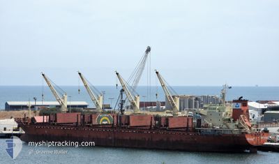
MAPLE FORTUNE
Bulk Carrier
Current Trip
| Time Travelled | 9 days |
|---|---|
| Remaining Time | --- |
| Distance Travelled | 2067.04 nm |
| Remaining Distance | --- |
| AVG Speed | 10.6 Knopen |
| MAX Speed | 13.7 Knopen |
| AVG Wind | 15.8 knots |
| MAX Wind | 33 knots |
| MIN Temp | 12.3°C / 54.14°F |
| MAX Temp | 20.4°C / 68.72°F |
| Diepgang | 10 M |
| Positie ontvangen | 6 d geleden |
Current Position
| Lengtegraad | -54.84613° |
|---|---|
| Breedtegraat | -35.11330° |
| Status | Under way using engine |
| Snelheid | 12.7 Knopen |
| Koers | 98.2° |
| Gebied | South Atlantic Ocean |
| Station | T-AIS |
| Positie ontvangen | 6 d geleden |
Info
Information
The current position of MAPLE FORTUNE is in South Atlantic Ocean with coordinates -35.11330° / -54.84613° as reported on 2024-04-28 18:39 by AIS to our vessel tracker app. The vessel's current speed is 12.7 Knopen and is heading at the port of FUJAIRAH. The estimated time of arrival as calculated by MyShipTracking vessel tracking app is 2024-05-28 07:00 LT
The vessel MAPLE FORTUNE (IMO: 9473432, MMSI: 477744100) is a Bulk Carrier that was built in 2010 ( 14 Jaar oud ). It's sailing under the flag of [HK] Hong Kong.
In this page you can find informations about the vessels current position, last detected port calls, and current voyage information. If the vessels is not in coverage by AIS you will find the latest position.
The current position of MAPLE FORTUNE is detected by our AIS receivers and we are not responsible for the reliability of the data. The last position was recorded while the vessel was in Coverage by the Ais receivers of our vessel tracking app.
The current draught of MAPLE FORTUNE as reported by AIS is 10 meters
Weather
| Temperature | 16.2°C / 61.16°F |
|---|---|
| Wind Speed | 19 knots |
| Direction | 222° SW |
| Pressure | 1017.8 hPa |
| Humidity | 58.3 % |
| Cloud Coverage | 46 % |
Featured Company
Last Port Calls
| Port | Arrival | Departure | Time In Port |
|---|---|---|---|
| 2024-04-19 17:48 | 2024-04-26 02:57 | 6 d | |
| 2024-03-19 16:25 | 2024-03-22 14:59 | 2 d | |
| 2024-03-14 18:59 |
Most Visited Ports (Last year)
| Port | Arrivals | |
|---|---|---|
| 1 | ||
| 1 | ||
| 1 | ||
| 1 | ||
| 1 | ||
| 1 |
Last Trips
| Origin | Departure | Destination | Arrival | Distance | |
|---|---|---|---|---|---|
| 2024-03-22 16:59 | 2024-04-19 14:48 | 4904.78 nm | |||
| 2024-01-27 08:04 | 2024-03-14 20:59 | 11146.53 nm |
Events
| Tijd | Evenement | Details | Positie / Bestemming | Info |
|---|---|---|---|---|
| 2024-04-28 18:42 | Status Changed | Default Under way using engine |
-35.11500 / -54.83333
AE FJR
|
Snelheid: 12.7 kn Koers: 98.2° |
| 2024-04-28 18:39 | Buitenbereik |
-35.11330 / -54.84613
South Atlantic Ocean
AE FJR
|
Snelheid: 12.7 kn Koers: 98.2° |
|
| 2024-04-28 17:59 | Status Changed | Under way using engine Default |
-35.08704 / -55.01412
AE FJR
|
Snelheid: 12 kn Koers: 99° |
| 2024-04-28 17:50 | Status Changed | Default Under way using engine |
-35.08099 / -55.05232
AE FJR
|
Snelheid: 12.3 kn Koers: 102° |
| 2024-04-28 17:37 | Wijzig zee gebeid | Uruguayan part of the South Atlantic Ocean Uruguayan part of the Rio de La Plata |
-35.07173 / -55.10415
South Atlantic Ocean
AE FJR
|
Snelheid: 12.2 kn Koers: 100.4° |
| 2024-04-28 16:48 | Draught Changed | 10 10.1 |
-35.06345 / -55.31195
AE FJR
|
Snelheid: 11.9 kn Koers: 85° |
| 2024-04-28 16:48 | Destination Changed | AE FJR ZONA COMUM |
-35.06345 / -55.31195
AE FJR
|
Snelheid: 11.9 kn Koers: 85° |
| 2024-04-28 16:48 | ETA Changed | 2024/05/28 07:00 2024/04/26 17:30 |
-35.06345 / -55.31195
AE FJR
|
Snelheid: 11.9 kn Koers: 85° |
| 2024-04-28 16:43 | Wijzig zee gebeid | Uruguayan part of the Rio de La Plata Argentinean part of the Rio de La Plata |
-35.06405 / -55.33132
Rio de La Plata
|
Snelheid: 11.8 kn Koers: 88.8° |
| 2024-04-28 16:41 | Status Changed | Under way using engine Default |
-35.06432 / -55.34042
ZONA COMUM
|
Snelheid: 11 kn Koers: 86° |