

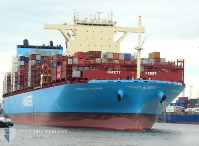
MAERSK EL PALOMAR
Cargo

Current Trip
| Time Travelled | 5 days |
|---|---|
| Remaining Time | 9 days |
| Distance Travelled | 95.79 nm |
| Remaining Distance | 6198.85 nm |
| AVG Speed | 15.6 Knopen |
| MAX Speed | 18.8 Knopen |
| AVG Wind | 16.6 knots |
| MAX Wind | 23 knots |
| MIN Temp | 14.4°C / 57.92°F |
| MAX Temp | 15.3°C / 59.54°F |
| Diepgang | 15.2 M |
| Positie ontvangen | 4 d geleden |
Current Position
| Lengtegraad | --- |
|---|---|
| Breedtegraat | --- |
| Status | Under way using engine |
| Snelheid | 18.2 Knopen |
| Koers | 85° |
| Gebied | North Pacific Ocean |
| Station | T-AIS |
| Positie ontvangen | 4 d geleden |
Information
The current position of MAERSK EL PALOMAR is in North Pacific Ocean with coordinates 34.80525° / 141.04624° as reported on 2025-03-13 17:53 by AIS to our vessel tracker app. The vessel's current speed is 18.2 Knopen and is heading at the port of LAZARO CARDENAS. The estimated time of arrival as calculated by MyShipTracking vessel tracking app is 2025-03-27 14:09 LT
The vessel MAERSK EL PALOMAR (IMO: 9964481, MMSI: 563220200) is a Cargo It's sailing under the flag of [SG] Singapore.
In this page you can find informations about the vessels current position, last detected port calls, and current voyage information. If the vessels is not in coverage by AIS you will find the latest position.
The current position of MAERSK EL PALOMAR is detected by our AIS receivers and we are not responsible for the reliability of the data. The last position was recorded while the vessel was in Coverage by the Ais receivers of our vessel tracking app.
The current draught of MAERSK EL PALOMAR as reported by AIS is 15.2 meters
Weather
| Temperature | 14.5°C / 58.1°F |
|---|---|
| Wind Speed | 22 knots |
| Direction | 60° ENE |
| Pressure | 1016.4 hPa |
| Humidity | 71.6 % |
| Cloud Coverage | 96 % |


Featured Company
Most Visited Ports (Last year)
| Port | Arrivals | |
|---|---|---|
| 7 | ||
| 4 | ||
| 4 | ||
| 3 | ||
| 3 | ||
| 3 |
Last Trips
| Origin | Departure | Destination | Arrival | Distance | |
|---|---|---|---|---|---|
| 2025-02-23 01:29 | 2025-03-13 00:19 | 1580.38 nm | |||
| 2025-02-18 21:30 | 2025-02-22 13:59 | 1416.62 nm | |||
| 2025-01-05 10:58 | 2025-02-17 08:01 | 10254.42 nm | |||
| 2024-12-22 15:23 | 2025-01-03 23:32 | 4377.25 nm |
Events
| Tijd | Evenement | Details | Positie / Bestemming | Info |
|---|---|---|---|---|
| 2025-03-13 17:53 | Buitenbereik |
34.80525 / 141.04624
North Pacific Ocean
JPYOK>>MXLZC
|
Snelheid: 18.2 kn Koers: 85° |
|
| 2025-03-13 14:31 | Binnenbereik |
34.82759 / 139.83518
North Pacific Ocean
JPYOK>>MXLZC
|
Snelheid: 17.9 kn Koers: 119.3° |
|
| 2025-03-13 13:25 | Buitenbereik |
35.12571 / 139.73234
North Pacific Ocean
JPYOK>>MXLZC
|
Snelheid: 14.7 kn Koers: 199.7° |
|
| 2025-03-13 12:29 | Draught Changed | 15.2 15.5 |
35.29285 / 139.73734
JPYOK>>MXLZC
|
Snelheid: 13.3 kn Koers: 144.1° |
| 2025-03-13 12:29 | Destination Changed | JPYOK>>MXLZC JPYOKXX |
35.29285 / 139.73734
JPYOK>>MXLZC
|
Snelheid: 13.3 kn Koers: 144.1° |
| 2025-03-13 12:29 | ETA Changed | 2025/03/27 15:00 2025/03/12 14:00 |
35.29285 / 139.73734
JPYOK>>MXLZC
|
Snelheid: 13.3 kn Koers: 144.1° |
| 2025-03-13 12:03 | Vertrekhaven |
|
35.37866 / 139.68747
JPYOKXX
|
Snelheid: 8.2 kn Koers: 138° |
| 2025-03-13 11:57 | Start beweging |
35.38936 / 139.67805
[JP] YOKOHAMA
|
Snelheid: 6.1 kn Koers: 135° |
|
| 2025-03-13 10:50 | Status Changed | Under way using engine Moored |
35.39789 / 139.68007
[JP] YOKOHAMA
|
Snelheid: Koers: 45° |
| 2025-03-13 10:00 | Binnenbereik |
35.39796 / 139.68010
North Pacific Ocean
[JP] YOKOHAMA
|
Snelheid: Koers: 123.4° |