
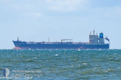
MAERSK BELFAST
Oil/Chemical Tanker
Current Trip
| Trip Time | 2 days |
|---|---|
| Trip Distance | 293.95 nm |
| AVG Speed | 10.9 Knopen |
| MAX Speed | 15.6 Knopen |
| Diepgang | 7.5 M |
| AVG Wind | 13.7 knots |
| MAX Wind | 34.6 knots |
| MIN Temp | 6.2°C / 43.16°F |
| MAX Temp | 15.5°C / 59.9°F |
| Positie ontvangen | 4 h, 48 m geleden |
Current Position
| Lengtegraad | -0.20838° |
|---|---|
| Breedtegraat | 53.64809° |
| Status | Moored |
| Snelheid | |
| Koers | 324° |
| Gebied | North Sea |
| Station | T-AIS |
| Positie ontvangen | 4 h, 48 m geleden |
Info
Information
The current position of MAERSK BELFAST is in North Sea with coordinates 53.64809° / -0.20838° as reported on 2024-04-30 21:09 by AIS to our vessel tracker app. The vessel's current speed is 0 Knopen and is currently inside the port of IMMINGHAM.
The vessel MAERSK BELFAST (IMO: 9299446, MMSI: 566503000) is a Oil/Chemical Tanker that was built in 2005 ( 19 Jaar oud ). It's sailing under the flag of [SG] Singapore.
In this page you can find informations about the vessels current position, last detected port calls, and current voyage information. If the vessels is not in coverage by AIS you will find the latest position.
The current position of MAERSK BELFAST is detected by our AIS receivers and we are not responsible for the reliability of the data. The last position was recorded while the vessel was in Coverage by the Ais receivers of our vessel tracking app.
The current draught of MAERSK BELFAST as reported by AIS is 7.5 meters
Weather
| Temperature | 8.8°C / 47.84°F |
|---|---|
| Wind Speed | 5 knots |
| Direction | 126° SE |
| Pressure | 1009.6 hPa |
| Humidity | 95.8 % |
| Cloud Coverage | --- |
Featured Company
Events
| Tijd | Evenement | Details | Positie / Bestemming | Info |
|---|---|---|---|---|
| 2024-04-30 21:12 | Status Changed | Default Moored |
53.64810 / -.20836
[GB] IMMINGHAM
|
Snelheid: Koers: 324° |
| 2024-04-30 21:09 | Buitenbereik |
53.64809 / -.20838
North Sea
[GB] IMMINGHAM
|
Snelheid: Koers: 308.2° |
|
| 2024-04-30 12:03 | Status Changed | Moored Default |
53.64811 / -.20840
[GB] IMMINGHAM
|
Snelheid: Koers: 324° |
| 2024-04-30 12:00 | Status Changed | Default Moored |
53.64814 / -.20837
[GB] IMMINGHAM
|
Snelheid: Koers: 324° |
| 2024-04-30 10:24 | Status Changed | Moored Under way using engine |
53.64813 / -.20839
[GB] IMMINGHAM
|
Snelheid: Koers: 324° |
| 2024-04-30 10:01 | Stop beweging |
53.64819 / -.20826
[GB] IMMINGHAM
|
Snelheid: 0.3 kn Koers: 332° |
|
| 2024-04-30 09:48 | Aankomsthaven |
|
53.64139 / -.19653
[GB] IMMINGHAM
|
Snelheid: 4.6 kn Koers: 314° |
| 2024-04-30 06:35 | Start beweging | 17.9 nm, East of GRIMSBY |
53.60784 / .42991
GBIMM
|
Snelheid: 3.4 kn Koers: 191° |
| 2024-04-30 06:24 | Status Changed | Under way using engine At anchor |
53.61160 / .42525
GBIMM
|
Snelheid: 0.4 kn Koers: 61° |
| 2024-04-30 05:34 | Status Changed | At anchor Default |
53.61297 / .42327
GBIMM
|
Snelheid: 0.1 kn Koers: 104° |