
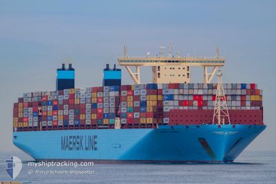
MADRID MAERSK
Cargo
Current Trip
| Time Travelled | 2 days |
|---|---|
| Remaining Time | 3 h, 41 mins |
| Distance Travelled | 720.77 nm |
| Remaining Distance | 29.36 nm |
| AVG Speed | 10.2 Knopen |
| MAX Speed | 15 Knopen |
| AVG Wind | 9.2 knots |
| MAX Wind | 19 knots |
| MIN Temp | 9.9°C / 49.82°F |
| MAX Temp | 19.3°C / 66.74°F |
| Diepgang | 14.8 M |
| Positie ontvangen | 1 m geleden |
Current Position
| Lengtegraad | 128.79143° |
|---|---|
| Breedtegraat | 34.60998° |
| Status | Under way using engine |
| Snelheid | 6.3 Knopen |
| Koers | 49.5° |
| Gebied | Japan Sea |
| Station | T-AIS |
| Positie ontvangen | 1 m geleden |
Info
Information
The current position of MADRID MAERSK is in Japan Sea with coordinates 34.60998° / 128.79143° as reported on 2024-04-27 07:24 by AIS to our vessel tracker app. The vessel's current speed is 6.3 Knopen and is heading at the port of BUSAN NEW PORT. The estimated time of arrival as calculated by MyShipTracking vessel tracking app is 2024-04-27 11:07 LT
The vessel MADRID MAERSK (IMO: 9778791, MMSI: 219836000) is a Cargo It's sailing under the flag of [DK] Denmark.
In this page you can find informations about the vessels current position, last detected port calls, and current voyage information. If the vessels is not in coverage by AIS you will find the latest position.
The current position of MADRID MAERSK is detected by our AIS receivers and we are not responsible for the reliability of the data. The last position was recorded while the vessel was in Coverage by the Ais receivers of our vessel tracking app.
The current draught of MADRID MAERSK as reported by AIS is 14.8 meters
Weather
| Temperature | 19.2°C / 66.56°F |
|---|---|
| Wind Speed | 3 knots |
| Direction | 272° W |
| Pressure | 1010.4 hPa |
| Humidity | 60.4 % |
| Cloud Coverage | --- |
Featured Company
Last Port Calls
| Port | Arrival | Departure | Time In Port |
|---|---|---|---|
| 2024-04-23 07:32 | 2024-04-24 09:24 | 1 d | |
| 2024-04-08 17:02 | 2024-04-10 08:14 | 1 d | |
| 2024-03-12 07:23 | 2024-03-13 14:20 | 1 d | |
| 2024-03-10 05:56 | 2024-03-11 01:04 | 19 h | |
| 2024-03-03 18:10 | 2024-03-04 18:25 | 1 d | |
| 2024-03-02 01:10 | 2024-03-03 14:16 | 1 d | |
| 2024-02-28 03:58 | 2024-02-29 17:48 | 1 d | |
| 2024-02-25 02:58 | 2024-02-27 17:48 | 2 d | |
| 2024-02-22 07:06 | 2024-02-24 05:17 | 1 d | |
| 2024-02-19 06:52 | 2024-02-21 05:09 | 1 d |
Most Visited Ports (Last year)
| Port | Arrivals | |
|---|---|---|
| 7 | ||
| 5 | ||
| 4 | ||
| 4 | ||
| 4 | ||
| 4 |
Last Trips
| Origin | Departure | Destination | Arrival | Distance | |
|---|---|---|---|---|---|
| 2024-04-10 16:14 | 2024-04-23 15:32 | 2979.11 nm | |||
| 2024-03-13 14:20 | 2024-04-09 01:02 | 10730.87 nm | |||
| 2024-03-11 02:04 | 2024-03-12 07:23 | 132.35 nm | |||
| 2024-03-04 19:25 | 2024-03-10 06:56 | 1679.82 nm | |||
| 2024-03-03 15:16 | 2024-03-03 19:10 | 49.84 nm | |||
| 2024-02-29 18:48 | 2024-03-02 02:10 | 508.68 nm | |||
| 2024-02-27 18:48 | 2024-02-28 04:58 | 138.46 nm | |||
| 2024-02-24 06:17 | 2024-02-25 03:58 | 386.65 nm | |||
| 2024-02-21 06:09 | 2024-02-22 08:06 | 274.47 nm | |||
| 2024-01-21 12:32 | 2024-02-19 07:52 | 11854.82 nm |
Events
| Tijd | Evenement | Details | Positie / Bestemming | Info |
|---|---|---|---|---|
| 2024-04-27 04:46 | Draught Changed | 14.8 14.9 |
34.40298 / 128.48143
CNHSK>>KRBUS
|
Snelheid: 8.1 kn Koers: 57° |
| 2024-04-27 04:46 | Destination Changed | CNHSK>>KRBUS SGSIN>>CNSGH |
34.40298 / 128.48143
CNHSK>>KRBUS
|
Snelheid: 8.1 kn Koers: 57° |
| 2024-04-27 04:46 | ETA Changed | 2024/04/27 11:00 2024/04/16 09:00 |
34.40298 / 128.48143
CNHSK>>KRBUS
|
Snelheid: 8.1 kn Koers: 57° |
| 2024-04-27 04:23 | Gevonden in zee | South Korean part of the Japan Sea |
34.37938 / 128.42915
Japan Sea
|
Snelheid: 8.2 kn Koers: 63° |
| 2024-04-27 04:23 | Status Changed | Under way using engine Default |
34.37938 / 128.42915
SGSIN>>CNSGH
|
Snelheid: 8.3 kn Koers: 66° |
| 2024-04-27 04:12 | Binnenbereik |
34.37938 / 128.42915
Japan Sea
|
Snelheid: 8.2 kn Koers: 63° |
|
| 2024-04-25 23:07 | Status Changed | Default Under way using engine |
35.68787 / 124.13136
SGSIN>>CNSGH
|
Snelheid: 10.4 kn Koers: 168.7° |
| 2024-04-25 23:01 | Buitenbereik |
35.70447 / 124.12612
Yellow Sea
|
Snelheid: 10.4 kn Koers: 168.7° |
|
| 2024-04-25 22:55 | Wijzig zee gebeid | South Korean part of the Yellow Sea Chinese part of the Yellow Sea |
35.72048 / 124.12220
Yellow Sea
|
Snelheid: 10.3 kn Koers: 167.9° |
| 2024-04-25 22:55 | Status Changed | Under way using engine Default |
35.72048 / 124.12220
SGSIN>>CNSGH
|
Snelheid: 10.3 kn Koers: 164° |