
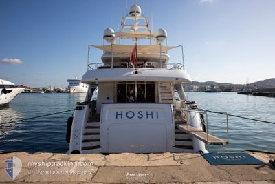
M/Y HOSHI
Pleasure Craft
Current Trip
| Trip Time | 7 h, 17 mins |
|---|---|
| Trip Distance | 103.87 nm |
| AVG Speed | 13.1 Knopen |
| MAX Speed | 15.5 Knopen |
| Diepgang | 2.2 M |
| AVG Wind | 13.1 knots |
| MAX Wind | 18 knots |
| MIN Temp | 15.2°C / 59.36°F |
| MAX Temp | 16.5°C / 61.7°F |
| Positie ontvangen | 5 m geleden |
Current Position
| Lengtegraad | 7.59878° |
|---|---|
| Breedtegraat | 43.78753° |
| Status | Moored |
| Snelheid | |
| Koers | 356° |
| Gebied | Ligurian Sea |
| Station | T-AIS |
| Positie ontvangen | 5 m geleden |
Info
Information
The current position of M/Y HOSHI is in Ligurian Sea with coordinates 43.78753° / 7.59878° as reported on 2024-05-02 10:43 by AIS to our vessel tracker app. The vessel's current speed is 0 Knopen and is currently inside the port of CALA DEL FORTE.
The vessel M/Y HOSHI (MMSI: 229707000) is a Pleasure Craft It's sailing under the flag of [MT] Malta.
In this page you can find informations about the vessels current position, last detected port calls, and current voyage information. If the vessels is not in coverage by AIS you will find the latest position.
The current position of M/Y HOSHI is detected by our AIS receivers and we are not responsible for the reliability of the data. The last position was recorded while the vessel was in Coverage by the Ais receivers of our vessel tracking app.
The current draught of M/Y HOSHI as reported by AIS is 2.2 meters
Weather
| Temperature | 13.1°C / 55.58°F |
|---|---|
| Wind Speed | 14 knots |
| Direction | 214° SW |
| Pressure | 1005.7 hPa |
| Humidity | 74.2 % |
| Cloud Coverage | 55 % |
Featured Company
Last Port Calls
| Port | Arrival | Departure | Time In Port |
|---|---|---|---|
| 2024-05-01 15:09 | |||
| 2024-03-18 12:14 | 2024-05-01 07:52 | ||
| 2024-03-14 09:57 | 2024-03-18 09:30 | 3 d | |
| 2024-03-14 08:58 |
Most Visited Ports (Last year)
| Port | Arrivals | |
|---|---|---|
| 16 | ||
| 8 | ||
| 7 | ||
| 5 | ||
| 4 | ||
| 3 |
Events
| Tijd | Evenement | Details | Positie / Bestemming | Info |
|---|---|---|---|---|
| 2024-05-01 15:25 | Status Changed | Moored Under way using engine |
43.78755 / 7.59880
[IT] CALA DEL FORTE
|
Snelheid: Koers: 1° |
| 2024-05-01 15:14 | Stop beweging |
43.78808 / 7.59883
[IT] CALA DEL FORTE
|
Snelheid: 0.2 kn Koers: 351° |
|
| 2024-05-01 15:09 | Aankomsthaven |
|
43.78785 / 7.59633
[IT] CALA DEL FORTE
|
Snelheid: 2.6 kn Koers: 97° |
| 2024-05-01 13:30 | Binnenbereik |
43.80215 / 8.07908
Ligurian Sea
VENTIMIGLIA
|
Snelheid: 14.6 kn Koers: 255° |
|
| 2024-05-01 12:18 | Buitenbereik |
43.85217 / 8.48955
Ligurian Sea
VENTIMIGLIA
|
Snelheid: 14.9 kn Koers: 259° |
|
| 2024-05-01 09:07 | ETA Changed | 2024/05/01 15:00 2024/05/01 16:00 |
43.97797 / 9.54380
VENTIMIGLIA
|
Snelheid: 14 kn Koers: 261° |
| 2024-05-01 08:14 | Wijzig zee gebeid | Italian part of the Ligurian Sea Italian part of the Tyrrhenian Sea |
44.01060 / 9.83425
Ligurian Sea
VENTIMIGLIA
|
Snelheid: 14.3 kn Koers: 255° |
| 2024-05-01 08:12 | Destination Changed | VENTIMIGLIA IT SPE |
44.01253 / 9.84337
VENTIMIGLIA
|
Snelheid: 14.5 kn Koers: 251° |
| 2024-05-01 08:12 | ETA Changed | 2024/05/01 16:00 2025/03/18 12:00 |
44.01253 / 9.84337
VENTIMIGLIA
|
Snelheid: 14.5 kn Koers: 251° |
| 2024-05-01 07:59 | Status Changed | Under way using engine Moored |
44.05205 / 9.86168
IT SPE
|
Snelheid: 12.4 kn Koers: 164° |