
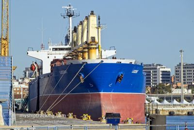
LUCENT
Bulk Carrier
Current Trip
| Time Travelled | 16 h, 11 mins |
|---|---|
| Remaining Time | 2 days |
| Distance Travelled | 173.55 nm |
| Remaining Distance | 601.25 nm |
| AVG Speed | 10.3 Knopen |
| MAX Speed | 11.9 Knopen |
| AVG Wind | 7 knots |
| MAX Wind | 15 knots |
| MIN Temp | 27.2°C / 80.96°F |
| MAX Temp | 28.9°C / 84.02°F |
| Diepgang | 6 M |
| Positie ontvangen | 12 h, 25 m geleden |
Current Position
| Lengtegraad | --- |
|---|---|
| Breedtegraat | --- |
| Status | Under way using engine |
| Snelheid | 11.6 Knopen |
| Koers | 316.7° |
| Gebied | Java Sea |
| Station | T-AIS |
| Positie ontvangen | 12 h, 25 m geleden |
Info
Information
The current position of LUCENT is in Java Sea with coordinates -6.58368° / 112.53867° as reported on 2025-03-17 05:35 by AIS to our vessel tracker app. The vessel's current speed is 11.6 Knopen and is heading at the port of SINGAPORE. The estimated time of arrival as calculated by MyShipTracking vessel tracking app is 2025-03-20 05:30 LT
The vessel LUCENT (IMO: 9142215, MMSI: 370234000) is a Bulk Carrier that was built in 1997 ( 28 Jaar oud ). It's sailing under the flag of [PA] Panama.
In this page you can find informations about the vessels current position, last detected port calls, and current voyage information. If the vessels is not in coverage by AIS you will find the latest position.
The current position of LUCENT is detected by our AIS receivers and we are not responsible for the reliability of the data. The last position was recorded while the vessel was in Coverage by the Ais receivers of our vessel tracking app.
The current draught of LUCENT as reported by AIS is 6 meters
Weather
| Temperature | 28.3°C / 82.94°F |
|---|---|
| Wind Speed | 13 knots |
| Direction | 291° WNW |
| Pressure | 1008.8 hPa |
| Humidity | 77.7 % |
| Cloud Coverage | 85 % |
Featured Company
Last Port Calls
| Port | Arrival | Departure | Time In Port |
|---|---|---|---|
| 2025-03-09 17:05 | 2025-03-17 08:49 | 7 d | |
| 2025-02-10 20:01 | 2025-02-13 03:58 | 2 d | |
| 2025-01-24 17:33 | 2025-01-30 14:14 | 5 d | |
| 2025-01-21 04:13 | 2025-01-21 13:18 | 9 h |
Most Visited Ports (Last year)
| Port | Arrivals | |
|---|---|---|
| 6 | ||
| 2 | ||
| 1 | ||
| 1 | ||
| 1 | ||
| 1 |
Last Trips
| Origin | Departure | Destination | Arrival | Distance | |
|---|---|---|---|---|---|
| 2025-02-13 03:58 | 2025-03-09 17:05 | 5783.41 nm | |||
| 2025-01-30 14:14 | 2025-02-10 20:01 | 1050.66 nm | |||
| 2024-12-12 01:10 | 2025-01-24 17:33 | 2736.80 nm | |||
| 2024-12-12 01:10 | 2025-01-21 04:13 | 1993.52 nm |
Events
| Tijd | Evenement | Details | Positie / Bestemming | Info |
|---|---|---|---|---|
| 2025-03-17 05:37 | Status Changed | Default Under way using engine |
-6.57779 / 112.53310
SG SIN
|
Snelheid: 11.6 kn Koers: 316.7° |
| 2025-03-17 05:35 | Buitenbereik |
-6.58368 / 112.53867
Java Sea
SG SIN
|
Snelheid: 11.6 kn Koers: 316.7° |
|
| 2025-03-17 05:34 | Status Changed | Under way using engine Default |
-6.58603 / 112.54091
SG SIN
|
Snelheid: 11.5 kn Koers: 317° |
| 2025-03-17 05:32 | Status Changed | Default Under way using engine |
-6.58962 / 112.54425
SG SIN
|
Snelheid: 11.7 kn Koers: 316.9° |
| 2025-03-17 05:07 | Status Changed | Under way using engine Default |
-6.64993 / 112.59941
SG SIN
|
Snelheid: 11.8 kn Koers: 319° |
| 2025-03-17 04:52 | Status Changed | Default Under way using engine |
-6.68660 / 112.63039
SG SIN
|
Snelheid: 11.8 kn Koers: 316.1° |
| 2025-03-17 04:38 | Destination Changed | SG SIN ID GRE |
-6.73288 / 112.67261
SG SIN
|
Snelheid: 11.8 kn Koers: 319.6° |
| 2025-03-17 04:38 | ETA Changed | 2025/03/20 04:00 2025/03/07 18:00 |
-6.73288 / 112.67261
SG SIN
|
Snelheid: 11.8 kn Koers: 319.6° |
| 2025-03-17 01:49 | Vertrekhaven |
|
-7.12921 / 112.65824
ID GRE
|
Snelheid: 7.1 kn Koers: 357° |
| 2025-03-17 01:41 | Start beweging |
-7.14134 / 112.66026
[ID] GRESIK
|
Snelheid: 3.1 kn Koers: 342° |