
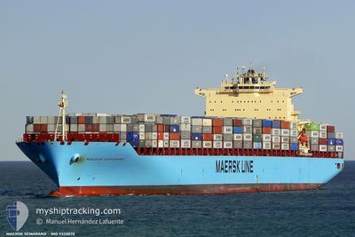
LUANDA EXPRESS
Container Ship
Current Trip
SGSIN PWBGA
| Time Travelled | 6 days |
|---|---|
| Remaining Time | --- |
| Distance Travelled | 2789.53 nm |
| Remaining Distance | --- |
| AVG Speed | 16.9 Knopen |
| MAX Speed | 21.7 Knopen |
| AVG Wind | 15.1 knots |
| MAX Wind | 22.1 knots |
| MIN Temp | 14.6°C / 58.28°F |
| MAX Temp | 22.6°C / 72.68°F |
| Diepgang | 14 M |
| Positie ontvangen | 2024-03-31 10:52 |
Current Position
| Lengtegraad | 103.76052° |
|---|---|
| Breedtegraat | 1.28517° |
| Status | Under way using engine |
| Snelheid | 1.2 Knopen |
| Koers | 141° |
| Gebied | Singapore Strait |
| Station | T-AIS |
| Positie ontvangen | 2024-03-31 10:52 |
Info
Information
The current position of LUANDA EXPRESS is in Singapore Strait with coordinates 1.28517° / 103.76052° as reported on 2024-03-31 10:52 by AIS to our vessel tracker app. The vessel's current speed is 1.2 Knopen
The vessel LUANDA EXPRESS (IMO: 9330070, MMSI: 636092986) is a Container Ship that was built in 2007 ( 17 Jaar oud ). It's sailing under the flag of [LR] Liberia.
In this page you can find informations about the vessels current position, last detected port calls, and current voyage information. If the vessels is not in coverage by AIS you will find the latest position.
The current position of LUANDA EXPRESS is detected by our AIS receivers and we are not responsible for the reliability of the data. The last position was recorded while the vessel was in Coverage by the Ais receivers of our vessel tracking app.
The current draught of LUANDA EXPRESS as reported by AIS is 14 meters
Weather
| Temperature | 22.4°C / 72.32°F |
|---|---|
| Wind Speed | 17 knots |
| Direction | 127° SE |
| Pressure | 1022.7 hPa |
| Humidity | 60.9 % |
| Cloud Coverage | 4 % |
Featured Company
Last Port Calls
| Port | Arrival | Departure | Time In Port |
|---|---|---|---|
| 2024-05-07 17:07 | 2024-05-09 08:51 | 1 d | |
| 2024-05-01 00:40 | 2024-05-04 21:49 | 3 d | |
| 2024-04-21 17:51 | 2024-04-24 06:35 | 2 d | |
| 2024-03-30 17:26 | 2024-03-31 11:20 | 17 h | |
| 2024-03-28 17:08 | 2024-03-29 10:53 | 17 h | |
| 2024-03-24 02:00 | 2024-03-24 13:37 | 11 h | |
| 2024-03-19 11:08 | 2024-03-20 01:38 | 14 h | |
| 2024-03-09 04:59 | 2024-03-10 07:03 | 1 d | |
| 2024-03-07 12:05 |
Most Visited Ports (Last year)
| Port | Arrivals | |
|---|---|---|
| 8 | ||
| 4 | ||
| 4 | ||
| 4 | ||
| 4 | ||
| 4 |
Last Trips
| Origin | Departure | Destination | Arrival | Distance | |
|---|---|---|---|---|---|
| 2024-05-04 22:49 | 2024-05-07 19:07 | 1001.97 nm | |||
| 2024-04-24 07:35 | 2024-05-01 01:40 | 1574.22 nm | |||
| 2024-03-31 19:20 | 2024-04-21 18:51 | 7718.29 nm | |||
| 2024-03-29 18:53 | 2024-03-31 01:26 | 58.85 nm | |||
| 2024-03-24 21:37 | 2024-03-29 01:08 | 1526.17 nm | |||
| 2024-03-20 09:38 | 2024-03-24 10:00 | 1080.95 nm | |||
| 2024-03-10 15:03 | 2024-03-19 19:08 | 2735.79 nm | |||
| 2024-03-07 20:05 | 2024-03-09 12:59 | 113.35 nm |
Events
| Tijd | Evenement | Details | Positie / Bestemming | Info |
|---|---|---|---|---|
| 2024-05-09 08:51 | Vertrekhaven |
|
-22.92694 / 14.49748
SGSIN PWBGA
|
Snelheid: 6.8 kn Koers: 2° |
| 2024-05-09 08:47 | Start beweging |
-22.93643 / 14.49706
[NA] WALVIS BAY
|
Snelheid: 6.8 kn Koers: 2° |
|
| 2024-05-07 17:39 | Stop beweging |
-22.95022 / 14.48617
[NA] WALVIS BAY
|
Snelheid: Koers: 25° |
|
| 2024-05-07 17:07 | Aankomsthaven |
|
-22.94048 / 14.49672
[NA] WALVIS BAY
|
Snelheid: 6.9 kn Koers: 182° |
| 2024-05-07 15:07 | Start beweging | 11.44 nm, North of WALVIS BAY |
-22.75487 / 14.44664
SGSIN PWBGA
|
Snelheid: 3.6 kn Koers: 264° |
| 2024-05-07 12:46 | Stop beweging | 9.24 nm, North West of WALVIS BAY |
-22.80333 / 14.42167
SGSIN PWBGA
|
Snelheid: Koers: -1° |
| 2024-05-07 10:20 | Start beweging | 9.57 nm, North of WALVIS BAY |
-22.78445 / 14.45815
SGSIN PWBGA
|
Snelheid: 3.1 kn Koers: 169° |
| 2024-05-07 06:11 | Stop beweging | 8.78 nm, North West of WALVIS BAY |
-22.80578 / 14.43494
SGSIN PWBGA
|
Snelheid: 0.3 kn Koers: 67° |
| 2024-05-07 05:43 | Start beweging | 9.27 nm, North of WALVIS BAY |
-22.79510 / 14.43970
SGSIN PWBGA
|
Snelheid: 3.2 kn Koers: 6° |
| 2024-05-07 03:59 | Stop beweging | 9.08 nm, North West of WALVIS BAY |
-22.80187 / 14.43145
SGSIN PWBGA
|
Snelheid: 0.2 kn Koers: 41° |