
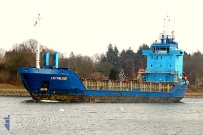
LOTTALAND
General Cargo
Current Trip
| Time Travelled | 2 days |
|---|---|
| Remaining Time | 1 day |
| Distance Travelled | 567.84 nm |
| Remaining Distance | 427.51 nm |
| AVG Speed | 7.8 Knopen |
| MAX Speed | 12.3 Knopen |
| AVG Wind | 9.8 knots |
| MAX Wind | 22 knots |
| MIN Temp | 1.8°C / 35.24°F |
| MAX Temp | 7.4°C / 45.32°F |
| Diepgang | 5.8 M |
| Positie ontvangen | Nu |
Current Position
| Lengtegraad | --- |
|---|---|
| Breedtegraat | --- |
| Status | Under way using engine |
| Snelheid | 9.9 Knopen |
| Koers | 38.8° |
| Gebied | Kattegat |
| Station | T-AIS |
| Positie ontvangen | Nu |
Information
The current position of LOTTALAND is in Kattegat with coordinates 55.30225° / 14.55213° as reported on 2025-03-04 00:20 by AIS to our vessel tracker app. The vessel's current speed is 9.9 Knopen and is heading at the port of GAVLE. The estimated time of arrival as calculated by MyShipTracking vessel tracking app is 2025-03-05 19:24 LT
The vessel LOTTALAND (IMO: 9155975, MMSI: 275504000) is a General Cargo that was built in 1997 ( 28 Jaar oud ). It's sailing under the flag of [LV] Latvia.
In this page you can find informations about the vessels current position, last detected port calls, and current voyage information. If the vessels is not in coverage by AIS you will find the latest position.
The current position of LOTTALAND is detected by our AIS receivers and we are not responsible for the reliability of the data. The last position was recorded while the vessel was in Coverage by the Ais receivers of our vessel tracking app.
The current draught of LOTTALAND as reported by AIS is 5.8 meters
Weather
| Temperature | 3.8°C / 38.84°F |
|---|---|
| Wind Speed | 22 knots |
| Direction | 260° W |
| Pressure | 1020.8 hPa |
| Humidity | 94.8 % |
| Cloud Coverage | 62 % |
Featured Company
Last Port Calls
| Port | Arrival | Departure | Time In Port |
|---|---|---|---|
| 2025-02-27 15:42 | 2025-03-01 09:03 | 1 d | |
| 2025-02-27 09:48 | 2025-02-27 10:36 | 48 m | |
| 2025-02-24 13:12 | 2025-02-27 08:39 | 2 d | |
| 2025-02-24 11:36 | 2025-02-24 12:43 | 1 h | |
| 2025-02-18 12:38 | 2025-02-19 17:34 | 1 d | |
| 2025-02-16 11:14 | 2025-02-18 07:11 | 1 d | |
| 2025-02-12 17:47 | 2025-02-13 17:47 | 1 d | |
| 2025-02-09 19:23 | 2025-02-10 21:19 | 1 d | |
| 2025-02-04 18:01 | 2025-02-05 17:41 | 23 h | |
| 2025-02-03 04:08 | 2025-02-04 07:16 | 1 d |
Last Trips
| Origin | Departure | Destination | Arrival | Distance | |
|---|---|---|---|---|---|
| 2025-02-27 11:36 | 2025-02-27 16:42 | 48.02 nm | |||
| 2025-02-27 09:39 | 2025-02-27 10:48 | 5.26 nm | |||
| 2025-02-24 13:43 | 2025-02-24 14:12 | 1.84 nm | |||
| 2025-02-19 19:34 | 2025-02-24 12:36 | 990.80 nm | |||
| 2025-02-18 09:11 | 2025-02-18 14:38 | 51.12 nm | |||
| 2025-02-13 18:47 | 2025-02-16 13:14 | 562.32 nm | |||
| 2025-02-10 22:19 | 2025-02-12 18:47 | 304.96 nm | |||
| 2025-02-05 19:41 | 2025-02-09 20:23 | 889.74 nm | |||
| 2025-02-04 09:16 | 2025-02-04 20:01 | 114.27 nm | |||
| 2025-01-31 04:56 | 2025-02-03 06:08 | 680.98 nm |
Events
| Tijd | Evenement | Details | Positie / Bestemming | Info |
|---|---|---|---|---|
| 2025-03-03 21:55 | Gevonden in zee | Danish part of the Kattegat |
55.01427 / 14.07110
Kattegat
SEGVX VIA NOK
|
Snelheid: 9.9 kn Koers: 67.7° |
| 2025-03-03 21:25 | Gevonden in zee | Swedish part of the Baltic Sea |
54.98453 / 13.93184
Baltic Sea
SEGVX VIA NOK
|
Snelheid: 10.3 kn Koers: 70.9° |
| 2025-03-03 14:02 | Wijzig zee gebeid | German part of the Baltic Sea Danish part of the Baltic Sea |
54.40588 / 12.09652
Baltic Sea
SEGVX VIA NOK
|
Snelheid: 10.3 kn Koers: 87.8° |
| 2025-03-03 11:46 | Wijzig zee gebeid | Danish part of the Baltic Sea German part of the Baltic Sea |
54.50014 / 11.44020
Baltic Sea
SEGVX VIA NOK
|
Snelheid: 11.8 kn Koers: 119.1° |
| 2025-03-03 09:35 | Gevonden in zee | German part of the Baltic Sea |
54.56262 / 10.77181
Baltic Sea
SEGVX VIA NOK
|
Snelheid: 9.7 kn Koers: 84.4° |
| 2025-03-03 09:05 | Wijzig zee gebeid | Danish part of the Baltic Sea German part of the Baltic Sea |
54.55165 / 10.63362
Baltic Sea
SEGVX VIA NOK
|
Snelheid: 9.8 kn Koers: 79.8° |
| 2025-03-03 07:38 | Wijzig zee gebeid | German part of the Baltic Sea German part of the North Sea |
54.46285 / 10.27226
Baltic Sea
SEGVX VIA NOK
|
Snelheid: 10.5 kn Koers: 38.8° |
| 2025-03-03 06:52 | Start beweging | 1.32 nm, South West of STICKENHΟRN SPORT |
54.36504 / 10.14599
SEGVX VIA NOK
|
Snelheid: 3.8 kn Koers: 101° |
| 2025-03-03 06:16 | Stop beweging | 1.36 nm, South West of STICKENHΟRN SPORT |
54.36557 / 10.14295
SEGVX VIA NOK
|
Snelheid: 0.3 kn Koers: 102° |
| 2025-03-03 02:52 | Start beweging | 3.67 nm, South West of RENDSBURG |
54.26783 / 9.62804
SEGVX VIA NOK
|
Snelheid: 3.1 kn Koers: 21° |