

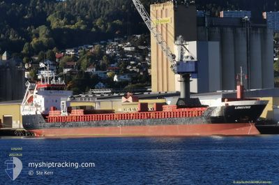
LONGVIND
General Cargo

Current Trip
| Time Travelled | 1 day |
|---|---|
| Remaining Time | 16 h, 0 mins |
| Distance Travelled | 296.13 nm |
| Remaining Distance | 170.44 nm |
| AVG Speed | 11.4 Knopen |
| MAX Speed | 12.2 Knopen |
| AVG Wind | 13.4 knots |
| MAX Wind | 17.9 knots |
| MIN Temp | -1.2°C / 29.84°F |
| MAX Temp | 2.7°C / 36.86°F |
| Diepgang | 4.2 M |
| Positie ontvangen | 12 h, 7 m geleden |
Current Position
| Lengtegraad | --- |
|---|---|
| Breedtegraat | --- |
| Status | Under way using engine |
| Snelheid | 11.5 Knopen |
| Koers | 59° |
| Gebied | Baltic Sea |
| Station | T-AIS |
| Positie ontvangen | 12 h, 7 m geleden |
Information
The current position of LONGVIND is in Baltic Sea with coordinates 55.98743° / 16.59948° as reported on 2025-02-18 16:04 by AIS to our vessel tracker app. The vessel's current speed is 11.5 Knopen and is heading at the port of RIGA. The estimated time of arrival as calculated by MyShipTracking vessel tracking app is 2025-02-19 20:11 LT
The vessel LONGVIND (IMO: 9547336, MMSI: 246668000) is a General Cargo that was built in 2011 ( 14 Jaar oud ). It's sailing under the flag of [NL] Netherlands.
In this page you can find informations about the vessels current position, last detected port calls, and current voyage information. If the vessels is not in coverage by AIS you will find the latest position.
The current position of LONGVIND is detected by our AIS receivers and we are not responsible for the reliability of the data. The last position was recorded while the vessel was in Coverage by the Ais receivers of our vessel tracking app.
The current draught of LONGVIND as reported by AIS is 4.2 meters
Weather
| Temperature | 1.4°C / 34.52°F |
|---|---|
| Wind Speed | 14 knots |
| Direction | 349° N |
| Pressure | 1028.3 hPa |
| Humidity | 62.1 % |
| Cloud Coverage | 97 % |


Featured Company
Last Port Calls
| Port | Arrival | Departure | Time In Port |
|---|---|---|---|
| 2025-02-16 08:32 | 2025-02-18 01:19 | 1 d | |
| 2025-02-12 18:01 | 2025-02-14 14:37 | 1 d | |
| 2025-02-08 13:29 | 2025-02-09 17:06 | 1 d | |
| 2025-02-06 17:06 | 2025-02-08 12:05 | 1 d | |
| 2025-02-03 13:12 | 2025-02-04 14:57 | 1 d | |
| 2025-01-29 16:01 | 2025-02-01 21:35 | 3 d | |
| 2025-01-26 01:01 | 2025-01-27 15:05 | 1 d | |
| 2025-01-22 00:54 | 2025-01-22 16:59 | 16 h | |
| 2025-01-20 07:43 | 2025-01-21 23:33 | 1 d | |
| 2025-01-14 08:08 | 2025-01-15 13:08 | 1 d |
Last Trips
| Origin | Departure | Destination | Arrival | Distance | |
|---|---|---|---|---|---|
| 2025-02-14 16:37 | 2025-02-16 09:32 | 466.37 nm | |||
| 2025-02-09 18:06 | 2025-02-12 20:01 | 468.96 nm | |||
| 2025-02-08 13:05 | 2025-02-08 14:29 | 14.33 nm | |||
| 2025-02-04 16:57 | 2025-02-06 18:06 | 435.82 nm | |||
| 2025-02-01 22:35 | 2025-02-03 15:12 | 436.67 nm | |||
| 2025-01-27 17:05 | 2025-01-29 17:01 | 467.12 nm | |||
| 2025-01-22 17:59 | 2025-01-26 03:01 | 458.42 nm | |||
| 2025-01-22 00:33 | 2025-01-22 01:54 | 14.29 nm | |||
| 2025-01-15 14:08 | 2025-01-20 08:43 | 928.75 nm | |||
| 2025-01-11 17:12 | 2025-01-14 09:08 | 476.54 nm |
Events
| Tijd | Evenement | Details | Positie / Bestemming | Info |
|---|---|---|---|---|
| 2025-02-18 16:09 | Status Changed | Default Under way using engine |
55.99605 / 16.62572
LVRIX
|
Snelheid: 11.5 kn Koers: 59° |
| 2025-02-18 16:04 | Buitenbereik |
55.98743 / 16.59948
Baltic Sea
LVRIX
|
Snelheid: 11.5 kn Koers: 59° |
|
| 2025-02-18 12:02 | Gevonden in zee | Swedish part of the Baltic Sea |
55.60648 / 15.41903
Baltic Sea
LVRIX
|
Snelheid: 11.3 kn Koers: 61° |
| 2025-02-18 07:53 | Wijzig zee gebeid | Danish part of the Kattegat Swedish part of the Baltic Sea |
55.16988 / 14.28408
Kattegat
LVRIX
|
Snelheid: 11.3 kn Koers: 77° |
| 2025-02-18 03:02 | Wijzig zee gebeid | Swedish part of the Baltic Sea Danish part of the Baltic Sea |
55.29080 / 12.66380
Baltic Sea
LVRIX
|
Snelheid: 12 kn Koers: 112° |
| 2025-02-18 02:50 | Wijzig zee gebeid | Danish part of the Baltic Sea Danish part of the Kattegat |
55.31357 / 12.60770
Baltic Sea
LVRIX
|
Snelheid: 11.6 kn Koers: 134° |
| 2025-02-18 01:31 | Status Changed | Under way using engine Moored |
55.56302 / 12.48932
LVRIX
|
Snelheid: 11.4 kn Koers: 179° |
| 2025-02-18 01:19 | Vertrekhaven |
|
55.59630 / 12.48578
LVRIX
|
Snelheid: 6.8 kn Koers: 175° |
| 2025-02-18 01:18 | Start beweging |
55.59873 / 12.48518
[DK] AVEDORE
|
Snelheid: 4.9 kn Koers: 170° |
|
| 2025-02-17 19:43 | ETA Changed | 2025/02/19 20:00 2025/02/19 05:00 |
55.60072 / 12.48567
[DK] AVEDORE
|
Snelheid: Koers: 96° |