
LILA
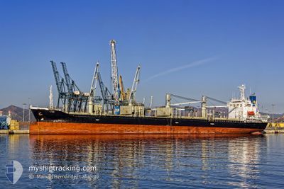
Bulk Carrier
Current Trip
| Time Travelled | 7 days |
|---|---|
| Remaining Time | --- |
| Distance Travelled | 941.99 nm |
| Remaining Distance | --- |
| AVG Speed | 10.3 Knopen |
| MAX Speed | 13.3 Knopen |
| AVG Wind | 8.4 knots |
| MAX Wind | 24 knots |
| MIN Temp | 9.2°C / 48.56°F |
| MAX Temp | 25°C / 77°F |
| Diepgang | 9.9 M |
| Positie ontvangen | 2 d geleden |
Current Position
| Lengtegraad | -54.75279° |
|---|---|
| Breedtegraat | -35.06871° |
| Status | Under way using engine |
| Snelheid | 12.3 Knopen |
| Koers | 86.2° |
| Gebied | South Atlantic Ocean |
| Station | T-AIS |
| Positie ontvangen | 2 d geleden |
Info
Information
The current position of LILA is in South Atlantic Ocean with coordinates -35.06871° / -54.75279° as reported on 2024-05-03 15:53 by AIS to our vessel tracker app. The vessel's current speed is 12.3 Knopen and is heading at the port of TRIPOLI. The estimated time of arrival as calculated by MyShipTracking vessel tracking app is 2024-05-31 06:00 LT
The vessel LILA (IMO: 9278923, MMSI: 312546000) is a Bulk Carrier that was built in 2003 ( 21 Jaar oud ). It's sailing under the flag of [BZ] Belize.
In this page you can find informations about the vessels current position, last detected port calls, and current voyage information. If the vessels is not in coverage by AIS you will find the latest position.
The current position of LILA is detected by our AIS receivers and we are not responsible for the reliability of the data. The last position was recorded while the vessel was in Coverage by the Ais receivers of our vessel tracking app.
The current draught of LILA as reported by AIS is 9.9 meters
Weather
| Temperature | 25.1°C / 77.18°F |
|---|---|
| Wind Speed | 11 knots |
| Direction | 31° NNE |
| Pressure | 1016.2 hPa |
| Humidity | 91.3 % |
| Cloud Coverage | --- |
Featured Company
Last Port Calls
| Port | Arrival | Departure | Time In Port |
|---|---|---|---|
| 2024-04-25 17:45 | 2024-04-28 12:57 | 2 d | |
| 2024-03-23 22:35 | 2024-04-05 14:01 | 12 d |
Most Visited Ports (Last year)
| Port | Arrivals | |
|---|---|---|
| 4 | ||
| 2 | ||
| 1 | ||
| 1 | ||
| 1 | ||
| 1 |
Last Trips
| Origin | Departure | Destination | Arrival | Distance | |
|---|---|---|---|---|---|
| 2024-04-05 14:01 | 2024-04-25 14:45 | 5429.51 nm | |||
| 2024-02-25 09:23 | 2024-03-23 22:35 | 2397.08 nm |
Events
| Tijd | Evenement | Details | Positie / Bestemming | Info |
|---|---|---|---|---|
| 2024-05-03 16:00 | Status Changed | Default Under way using engine |
-35.06665 / -54.72434
LB/KYE
|
Snelheid: 12.3 kn Koers: 86.2° |
| 2024-05-03 15:53 | Buitenbereik |
-35.06871 / -54.75279
South Atlantic Ocean
LB/KYE
|
Snelheid: 12.3 kn Koers: 86.2° |
|
| 2024-05-03 14:32 | Wijzig zee gebeid | Uruguayan part of the South Atlantic Ocean Uruguayan part of the Rio de La Plata |
-35.06993 / -55.09674
South Atlantic Ocean
LB/KYE
|
Snelheid: 12.1 kn Koers: 90.3° |
| 2024-05-03 14:26 | Wijzig zee gebeid | Uruguayan part of the Rio de La Plata Argentinean part of the Rio de La Plata |
-35.06948 / -55.12152
Rio de La Plata
LB/KYE
|
Snelheid: 12.2 kn Koers: 91.8° |
| 2024-05-03 14:25 | Draught Changed | 9.9 9.8 |
-35.06945 / -55.12291
LB/KYE
|
Snelheid: 12.3 kn Koers: 92° |
| 2024-05-03 14:25 | ETA Changed | 2024/05/31 06:00 2024/05/27 12:00 |
-35.06945 / -55.12291
LB/KYE
|
Snelheid: 12.3 kn Koers: 92° |
| 2024-05-03 14:24 | Status Changed | Under way using engine Default |
-35.06932 / -55.12854
LB/KYE
|
Snelheid: 12.5 kn Koers: 96° |
| 2024-05-03 14:24 | Binnenbereik |
-35.06948 / -55.12152
Rio de La Plata
LB/KYE
|
Snelheid: 12.2 kn Koers: 91.8° |
|
| 2024-05-03 01:03 | Start beweging | 7.86 nm, North of LA PLATA |
-34.71983 / -57.86162
LB/KYE
|
Snelheid: 3.5 kn Koers: 48° |
| 2024-05-02 11:00 | Buitenbereik |
-34.72093 / -57.86402
Rio de La Plata
LB/KYE
|
Snelheid: Koers: 44.6° |