

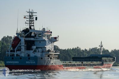
LENNEBORG
General Cargo

Current Trip
| Time Travelled | 1 day |
|---|---|
| Remaining Time | 1 day |
| Distance Travelled | 227.16 nm |
| Remaining Distance | 479.09 nm |
| AVG Speed | 10.5 Knopen |
| MAX Speed | 11.2 Knopen |
| AVG Wind | 10.8 knots |
| MAX Wind | 16 knots |
| MIN Temp | 11.1°C / 51.98°F |
| MAX Temp | 13.3°C / 55.94°F |
| Diepgang | 4.2 M |
| Positie ontvangen | 2 d geleden |
Current Position
| Lengtegraad | --- |
|---|---|
| Breedtegraat | --- |
| Status | Under way using engine |
| Snelheid | 6.5 Knopen |
| Koers | 324.8° |
| Gebied | Mediterranean Sea - Western Basin |
| Station | T-AIS |
| Positie ontvangen | 2 d geleden |
Information
The current position of LENNEBORG is in Mediterranean Sea - Western Basin with coordinates 43.36548° / 3.78896° as reported on 2025-02-18 07:30 by AIS to our vessel tracker app. The vessel's current speed is 6.5 Knopen and is heading at the port of TENES. The estimated time of arrival as calculated by MyShipTracking vessel tracking app is 2025-02-22 13:53 LT
The vessel LENNEBORG (IMO: 9421075, MMSI: 244630729) is a General Cargo that was built in 2008 ( 17 Jaar oud ). It's sailing under the flag of [NL] Netherlands.
In this page you can find informations about the vessels current position, last detected port calls, and current voyage information. If the vessels is not in coverage by AIS you will find the latest position.
The current position of LENNEBORG is detected by our AIS receivers and we are not responsible for the reliability of the data. The last position was recorded while the vessel was in Coverage by the Ais receivers of our vessel tracking app.
The current draught of LENNEBORG as reported by AIS is 4.2 meters
Weather
| Temperature | 13.4°C / 56.12°F |
|---|---|
| Wind Speed | 6 knots |
| Direction | 88° E |
| Pressure | 1027.1 hPa |
| Humidity | 81.6 % |
| Cloud Coverage | 50 % |


Featured Company
Last Port Calls
| Port | Arrival | Departure | Time In Port |
|---|---|---|---|
| 2025-02-18 08:22 | 2025-02-19 19:04 | 1 d | |
| 2025-02-13 16:17 | 2025-02-16 11:05 | 2 d | |
| 2025-02-05 12:09 | 2025-02-09 08:04 | 3 d | |
| 2025-02-03 16:55 | 2025-02-03 21:37 | 4 h | |
| 2025-01-20 23:16 | 2025-01-25 09:54 | 4 d | |
| 2025-01-14 11:02 | 2025-01-16 15:21 | 2 d | |
| 2025-01-07 21:34 | 2025-01-10 20:47 | 2 d | |
| 2024-12-31 15:46 | 2025-01-04 16:37 | 4 d | |
| 2024-12-27 07:14 | 2024-12-27 17:39 | 10 h | |
| 2024-12-17 12:28 | 2024-12-17 21:40 | 9 h |
Most Visited Ports (Last year)
| Port | Arrivals | |
|---|---|---|
| 3 | ||
| 3 | ||
| 3 | ||
| 3 | ||
| 3 | ||
| 2 |
Last Trips
| Origin | Departure | Destination | Arrival | Distance | |
|---|---|---|---|---|---|
| 2025-02-16 12:05 | 2025-02-18 09:22 | 425.90 nm | |||
| 2025-02-09 09:04 | 2025-02-13 17:17 | 291.28 nm | |||
| 2025-02-03 22:37 | 2025-02-05 13:09 | 325.59 nm | |||
| 2025-01-25 10:54 | 2025-02-03 17:55 | 1829.33 nm | |||
| 2025-01-16 16:21 | 2025-01-21 00:16 | 437.11 nm | |||
| 2025-01-10 21:47 | 2025-01-14 12:02 | 783.16 nm | |||
| 2025-01-04 16:37 | 2025-01-07 22:34 | 399.87 nm | |||
| 2024-12-27 17:39 | 2024-12-31 15:46 | 882.04 nm | |||
| 2024-12-17 21:40 | 2024-12-27 07:14 | 836.45 nm | |||
| 2024-12-14 14:46 | 2024-12-17 12:28 | 659.42 nm |
Events
| Tijd | Evenement | Details | Positie / Bestemming | Info |
|---|---|---|---|---|
| 2025-02-19 19:04 | Vertrekhaven |
|
43.40114 / 3.73890
DZTEN
|
Snelheid: 3.8 kn Koers: 88° |
| 2025-02-19 18:57 | Start beweging |
43.39954 / 3.71927
[FR] SETE
|
Snelheid: 3.8 kn Koers: 88° |
|
| 2025-02-18 08:22 | Stop beweging |
43.40110 / 3.71613
[FR] SETE
|
Snelheid: 0.1 kn Koers: 340° |
|
| 2025-02-18 08:22 | Aankomsthaven |
|
43.40110 / 3.71613
[FR] SETE
|
Snelheid: 1 kn Koers: 312° |
| 2025-02-18 07:30 | Status Changed | Default Under way using engine |
43.36595 / 3.78849
DZTEN
|
Snelheid: 6.5 kn Koers: 324.8° |
| 2025-02-18 07:30 | Status Changed | Under way using engine Default |
43.36548 / 3.78896
DZTEN
|
Snelheid: 8.6 kn Koers: 326° |
| 2025-02-18 07:30 | Wijzig zee gebeid | French part of the Mediterranean Sea - Western Basin Algerian part of the Mediterranean Sea - Western Basin |
43.36548 / 3.78896
Mediterranean Sea - Western Basin
|
Snelheid: 6.5 kn Koers: 324.8° |
| 2025-02-18 07:30 | Buitenbereik |
43.36548 / 3.78896
Mediterranean Sea - Western Basin
[FR] SETE
|
Snelheid: 6.5 kn Koers: 324.8° |
|
| 2025-02-18 07:15 | Binnenbereik |
43.36548 / 3.78896
Mediterranean Sea - Western Basin
|
Snelheid: 6.5 kn Koers: 324.8° |
|
| 2025-02-16 11:05 | Vertrekhaven |
|
36.90154 / 6.90154
DZTEN
|
Snelheid: 3.9 kn Koers: 311° |