

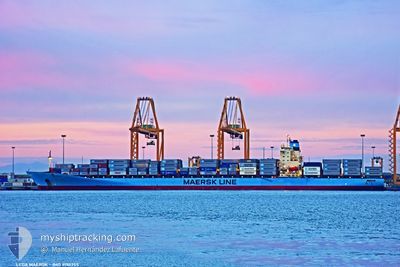
LEDA MAERSK
Container Ship

Current Trip
| Time Travelled | 8 h, 32 mins |
|---|---|
| Remaining Time | --- |
| Distance Travelled | 27.58 nm |
| Remaining Distance | --- |
| AVG Speed | 5.9 Knopen |
| MAX Speed | 11.6 Knopen |
| AVG Wind | 10.9 knots |
| MAX Wind | 16 knots |
| MIN Temp | 24.5°C / 76.1°F |
| MAX Temp | 27.5°C / 81.5°F |
| Diepgang | 11.2 M |
| Positie ontvangen | 2 m geleden |
Current Position
| Lengtegraad | --- |
|---|---|
| Breedtegraat | --- |
| Status | Under way using engine |
| Snelheid | 7.3 Knopen |
| Koers | 179.5° |
| Gebied | Caribbean Sea |
| Station | T-AIS |
| Positie ontvangen | 2 m geleden |
Information
The current position of LEDA MAERSK is in Caribbean Sea with coordinates 9.33582° / -79.91924° as reported on 2025-03-29 07:24 by AIS to our vessel tracker app. The vessel's current speed is 7.3 Knopen and is heading at the port of PANAMA CITY. The estimated time of arrival as calculated by MyShipTracking vessel tracking app is 2025-03-28 22:00 LT
The vessel LEDA MAERSK (IMO: 9190755, MMSI: 477648800) is a Container Ship that was built in 2001 ( 24 Jaar oud ). It's sailing under the flag of [HK] Hong Kong.
In this page you can find informations about the vessels current position, last detected port calls, and current voyage information. If the vessels is not in coverage by AIS you will find the latest position.
The current position of LEDA MAERSK is detected by our AIS receivers and we are not responsible for the reliability of the data. The last position was recorded while the vessel was in Coverage by the Ais receivers of our vessel tracking app.
The current draught of LEDA MAERSK as reported by AIS is 11.2 meters
Weather
| Temperature | 24.5°C / 76.1°F |
|---|---|
| Wind Speed | 5 knots |
| Direction | 19° NNE |
| Pressure | 1010.6 hPa |
| Humidity | 82.2 % |
| Cloud Coverage | 100 % |


Featured Company
Last Port Calls
| Port | Arrival | Departure | Time In Port |
|---|---|---|---|
| 2025-03-27 18:08 | 2025-03-28 17:54 | 23 h | |
| 2025-03-21 04:20 | 2025-03-21 18:32 | 14 h | |
| 2025-03-11 00:57 | 2025-03-11 18:04 | 17 h | |
| 2025-03-04 00:38 | 2025-03-05 02:16 | 1 d | |
| 2025-02-28 23:58 | 2025-03-03 04:03 | 2 d | |
| 2025-02-27 19:49 | 2025-02-28 16:26 | 20 h | |
| 2025-02-25 14:13 | 2025-02-26 13:04 | 22 h | |
| 2025-02-23 22:53 | 2025-02-24 19:37 | 20 h | |
| 2025-02-19 13:21 | 2025-02-20 03:46 | 14 h | |
| 2025-02-18 08:13 | 2025-02-19 02:45 | 18 h |
Most Visited Ports (Last year)
| Port | Arrivals | |
|---|---|---|
| 12 | ||
| 10 | ||
| 10 | ||
| 9 | ||
| 6 | ||
| 6 |
Last Trips
| Origin | Departure | Destination | Arrival | Distance | |
|---|---|---|---|---|---|
| 2025-03-21 18:32 | 2025-03-27 18:08 | 2005.51 nm | |||
| 2025-03-11 18:04 | 2025-03-21 04:20 | 3568.88 nm | |||
| 2025-03-05 02:16 | 2025-03-11 00:57 | 1936.44 nm | |||
| 2025-03-03 04:03 | 2025-03-04 00:38 | 84.70 nm | |||
| 2025-02-28 16:26 | 2025-02-28 23:58 | 61.57 nm | |||
| 2025-02-26 13:04 | 2025-02-27 19:49 | 373.69 nm | |||
| 2025-02-24 19:37 | 2025-02-25 14:13 | 307.78 nm | |||
| 2025-02-20 03:46 | 2025-02-23 22:53 | 1524.45 nm | |||
| 2025-02-19 02:45 | 2025-02-19 13:21 | 69.25 nm | |||
| 2025-02-07 18:21 | 2025-02-18 08:13 | 4348.73 nm |
Events
| Tijd | Evenement | Details | Positie / Bestemming | Info |
|---|---|---|---|---|
| 2025-03-29 05:43 | Start beweging | 6.06 nm, North of SAMBA BONITA |
9.49209 / -79.84317
PAMIT>PAPTY
|
Snelheid: 3.2 kn Koers: 305° |
| 2025-03-29 04:53 | Stop beweging | 6.59 nm, North of SAMBA BONITA |
9.50108 / -79.84171
PAMIT>PAPTY
|
Snelheid: Koers: 340° |
| 2025-03-29 04:36 | Start beweging | 6.27 nm, North of SAMBA BONITA |
9.49579 / -79.83640
PAMIT>PAPTY
|
Snelheid: 3.1 kn Koers: 21° |
| 2025-03-29 03:55 | Stop beweging | 6.59 nm, North of SAMBA BONITA |
9.50120 / -79.83433
PAMIT>PAPTY
|
Snelheid: 0.3 kn Koers: 25° |
| 2025-03-29 03:31 | Start beweging | 6.05 nm, North of SAMBA BONITA |
9.49201 / -79.83775
PAMIT>PAPTY
|
Snelheid: 3.1 kn Koers: 63° |
| 2025-03-29 02:33 | Status Changed | Under way using engine Default |
9.50437 / -79.83549
PAMIT>PAPTY
|
Snelheid: 1.3 kn Koers: 90° |
| 2025-03-29 02:32 | Status Changed | Default Under way using engine |
9.50440 / -79.83566
PAMIT>PAPTY
|
Snelheid: 0.6 kn Koers: 74° |
| 2025-03-29 02:14 | Stop beweging | 6.9 nm, North of SAMBA BONITA |
9.50631 / -79.83538
PAMIT>PAPTY
|
Snelheid: 0.3 kn Koers: 40° |
| 2025-03-29 01:45 | Start beweging | 5.76 nm, North of SAMBA BONITA |
9.48725 / -79.83872
PAMIT>PAPTY
|
Snelheid: 3.4 kn Koers: 25° |
| 2025-03-29 00:34 | Status Changed | Under way using engine Default |
9.49499 / -79.82964
PAMIT>PAPTY
|
Snelheid: 0.6 kn Koers: 90° |