

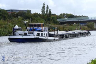
LAURA
Cargo

Current Trip
LAURA is out of coverage. Learn how you can join the community and extend the coverage to your area by clicking here!
NIJMEGEN
Unknown Port
ETA*
2025-12-18 16:00 UTC
| Time Travelled | 3 days |
|---|---|
| Remaining Time | --- |
| Distance Travelled | 97.72 nm |
| Remaining Distance | --- |
| AVG Speed | 6.4 Knopen |
| MAX Speed | 7.5 Knopen |
| AVG Wind | 4.5 knots |
| MAX Wind | 8 knots |
| MIN Temp | 3.3°C / 37.94°F |
| MAX Temp | 14.4°C / 57.92°F |
| Diepgang | 0 M |
| Positie ontvangen | 6 h, 3 m geleden |
Current Position
| Lengtegraad | --- |
|---|---|
| Breedtegraat | --- |
| Status | Under way using engine |
| Snelheid | 5.8 Knopen |
| Koers | 106.2° |
| Gebied | North Sea |
| Station | T-AIS |
| Positie ontvangen | 6 h, 3 m geleden |
Information
The current position of LAURA is in North Sea with coordinates 52.40559° / 9.74750° as reported on 2025-03-29 05:54 by AIS to our vessel tracker app. The vessel's current speed is 5.8 Knopen
The vessel LAURA (MMSI: 244750523) is a Cargo It's sailing under the flag of [NL] Netherlands.
In this page you can find informations about the vessels current position, last detected port calls, and current voyage information. If the vessels is not in coverage by AIS you will find the latest position.
The current position of LAURA is detected by our AIS receivers and we are not responsible for the reliability of the data. The last position was recorded while the vessel was in Coverage by the Ais receivers of our vessel tracking app.
Weather
| Temperature | 7.7°C / 45.86°F |
|---|---|
| Wind Speed | 8 knots |
| Direction | 322° NW |
| Pressure | 1012.8 hPa |
| Humidity | 88.3 % |
| Cloud Coverage | 97 % |


Featured Company
Limited time offer - Install a base station receiver to your area and list your company on MyShipTracking Free forever!
Last Port Calls
| Port | Arrival | Departure | Time In Port |
|---|---|---|---|
| 2025-03-26 09:47 | 2025-03-26 10:56 | 1 h | |
| 2025-03-21 08:34 | 2025-03-21 10:39 | 2 h | |
| 2025-03-15 09:29 | 2025-03-15 11:28 | 1 h | |
| 2025-03-14 17:57 | 2025-03-14 19:32 | 1 h | |
| 2025-03-01 14:15 | 2025-03-02 13:24 | 23 h | |
| 2025-02-22 16:08 | |||
| 2025-02-15 08:50 | 2025-02-15 10:26 | 1 h | |
| 2025-01-31 10:29 | 2025-02-01 08:12 | 21 h | |
| 2025-01-24 13:15 | 2025-01-25 09:40 | 20 h | |
| 2025-01-23 13:13 | 2025-01-24 08:25 | 19 h |
Most Visited Ports (Last year)
| Port | Arrivals | |
|---|---|---|
| 19 | ||
| 18 | ||
| 9 | ||
| 5 | ||
| 4 | ||
| 3 |
Last Trips
| Origin | Departure | Destination | Arrival | Distance | |
|---|---|---|---|---|---|
| 2025-03-21 10:39 | 2025-03-26 09:47 | 33.43 nm | |||
| 2025-03-15 11:28 | 2025-03-21 08:34 | 141.22 nm | |||
| 2025-03-14 19:32 | 2025-03-15 09:29 | 17.70 nm | |||
| 2025-03-02 13:24 | 2025-03-14 17:57 | 181.52 nm | |||
| 2025-02-22 16:08 | 2025-03-01 14:15 | 34.38 nm | |||
| 2025-02-01 08:12 | 2025-02-15 08:50 | 146.93 nm | |||
| 2025-01-25 09:40 | 2025-01-31 10:29 | 100.81 nm | |||
| 2025-01-24 08:25 | 2025-01-24 13:15 | 33.87 nm | |||
| 2025-01-11 10:13 | 2025-01-23 13:13 | 340.58 nm | |||
| 2024-12-13 14:33 | 2025-01-11 08:37 | 15.94 nm |
Events
| Tijd | Evenement | Details | Positie / Bestemming | Info |
|---|---|---|---|---|
| 2025-03-29 05:54 | Buitenbereik |
52.40559 / 9.74750
North Sea
|
Snelheid: 5.8 kn Koers: 106.2° |
|
| 2025-03-29 05:32 | Binnenbereik |
52.42258 / 9.69612
North Sea
|
Snelheid: 6.5 kn Koers: 108.7° |
|
| 2025-03-28 09:30 | Buitenbereik |
52.42307 / 9.67694
North Sea
|
Snelheid: 5.7 kn Koers: 87.7° |
|
| 2025-03-28 07:54 | Binnenbereik |
52.39216 / 9.41182
North Sea
|
Snelheid: 6.8 kn Koers: 85.1° |
|
| 2025-03-28 06:36 | Buitenbereik |
52.38272 / 9.26131
North Sea
|
Snelheid: Koers: 0° |
|
| 2025-03-28 05:22 | Status Changed | Under way using engine Default |
52.38271 / 9.26131
NIJMEGEN
|
Snelheid: Koers: -1° |
| 2025-03-28 05:16 | Status Changed | Default Under way using engine |
52.38269 / 9.26133
NIJMEGEN
|
Snelheid: Koers: 511° |
| 2025-03-28 03:30 | Status Changed | Under way using engine Default |
52.38270 / 9.26128
NIJMEGEN
|
Snelheid: Koers: -1° |
| 2025-03-28 03:14 | Status Changed | Default Under way using engine |
52.38273 / 9.26128
NIJMEGEN
|
Snelheid: Koers: 511° |
| 2025-03-28 00:19 | Status Changed | Under way using engine Default |
52.38275 / 9.26127
NIJMEGEN
|
Snelheid: Koers: -1° |