

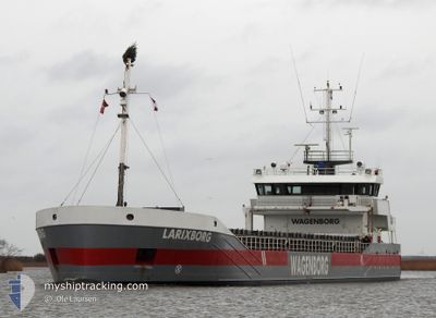
LARIXBORG
General Cargo

Current Trip
| Time Travelled | 2 days |
|---|---|
| Remaining Time | 5 days |
| Distance Travelled | 212.23 nm |
| Remaining Distance | 779.17 nm |
| AVG Speed | 8.2 Knopen |
| MAX Speed | 12.1 Knopen |
| AVG Wind | 5.8 knots |
| MAX Wind | 12 knots |
| MIN Temp | 3.3°C / 37.94°F |
| MAX Temp | 9.9°C / 49.82°F |
| Diepgang | 5.1 M |
| Positie ontvangen | 1 m geleden |
Current Position
| Lengtegraad | --- |
|---|---|
| Breedtegraat | --- |
| Status | Moored |
| Snelheid | 6.5 Knopen |
| Koers | 54.7° |
| Gebied | Kattegat |
| Station | T-AIS |
| Positie ontvangen | 1 m geleden |
Information
The current position of LARIXBORG is in Kattegat with coordinates 56.71232° / 10.11243° as reported on 2025-03-27 18:04 by AIS to our vessel tracker app. The vessel's current speed is 6.5 Knopen and is heading at the port of HAMINA. The estimated time of arrival as calculated by MyShipTracking vessel tracking app is 2025-04-02 12:25 LT
The vessel LARIXBORG (IMO: 9489546, MMSI: 246639000) is a General Cargo that was built in 2009 ( 16 Jaar oud ). It's sailing under the flag of [NL] Netherlands.
In this page you can find informations about the vessels current position, last detected port calls, and current voyage information. If the vessels is not in coverage by AIS you will find the latest position.
The current position of LARIXBORG is detected by our AIS receivers and we are not responsible for the reliability of the data. The last position was recorded while the vessel was in Coverage by the Ais receivers of our vessel tracking app.
The current draught of LARIXBORG as reported by AIS is 5.1 meters
Weather
| Temperature | 8.8°C / 47.84°F |
|---|---|
| Wind Speed | 12 knots |
| Direction | 235° SW |
| Pressure | 1012.5 hPa |
| Humidity | 78.9 % |
| Cloud Coverage | 89 % |


Featured Company
Last Port Calls
| Port | Arrival | Departure | Time In Port |
|---|---|---|---|
| 2025-03-22 15:46 | 2025-03-25 15:54 | 3 d | |
| 2025-03-18 08:22 | 2025-03-19 02:27 | 18 h | |
| 2025-03-18 07:55 | 2025-03-18 08:15 | 20 m | |
| 2025-03-11 02:33 | 2025-03-13 00:14 | 1 d | |
| 2025-03-08 02:09 | 2025-03-08 02:48 | 38 m | |
| 2025-03-06 16:56 | 2025-03-08 01:45 | 1 d | |
| 2025-03-06 16:06 | 2025-03-06 16:36 | 30 m | |
| 2025-03-04 20:44 | 2025-03-05 10:16 | 13 h | |
| 2025-03-02 07:22 | 2025-03-03 21:33 | 1 d | |
| 2025-02-23 23:14 | 2025-02-25 03:25 | 1 d |
Last Trips
| Origin | Departure | Destination | Arrival | Distance | |
|---|---|---|---|---|---|
| 2025-03-19 02:27 | 2025-03-22 15:46 | 638.42 nm | |||
| 2025-03-18 08:15 | 2025-03-18 08:22 | 0.12 nm | |||
| 2025-03-13 00:14 | 2025-03-18 07:55 | 509.36 nm | |||
| 2025-03-08 02:48 | 2025-03-11 02:33 | 538.97 nm | |||
| 2025-03-08 01:45 | 2025-03-08 02:09 | 1.88 nm | |||
| 2025-03-06 16:36 | 2025-03-06 16:56 | 1.92 nm | |||
| 2025-03-05 10:16 | 2025-03-06 16:06 | 152.45 nm | |||
| 2025-03-03 21:33 | 2025-03-04 20:44 | 110.69 nm | |||
| 2025-02-25 03:25 | 2025-03-02 07:22 | 1064.37 nm | |||
| 2025-02-22 20:12 | 2025-02-23 23:14 | 145.27 nm |
Events
| Tijd | Evenement | Details | Positie / Bestemming | Info |
|---|---|---|---|---|
| 2025-03-27 17:28 | Start beweging | 13.46 nm, North of RANDERS |
56.68446 / 10.03823
HAMINA
|
Snelheid: 4 kn Koers: 4° |
| 2025-03-27 10:57 | Draught Changed | 5.1 3.8 |
56.68272 / 10.03792
HAMINA
|
Snelheid: 0.1 kn Koers: 34° |
| 2025-03-27 10:57 | ETA Changed | 2025/03/31 01:00 2025/03/26 17:00 |
56.68272 / 10.03792
HAMINA
|
Snelheid: 0.1 kn Koers: 34° |
| 2025-03-27 10:50 | Destination Changed | HAMINA MARIAGER |
56.68271 / 10.03792
HAMINA
|
Snelheid: Koers: 34° |
| 2025-03-26 19:13 | Status Changed | Moored Under way using engine |
56.68261 / 10.03778
MARIAGER
|
Snelheid: Koers: 34° |
| 2025-03-26 19:02 | Stop beweging | 13.35 nm, North of RANDERS |
56.68258 / 10.03774
MARIAGER
|
Snelheid: 0.3 kn Koers: 34° |
| 2025-03-26 16:26 | Start beweging | 19.67 nm, South of HALS |
56.68121 / 10.50250
MARIAGER
|
Snelheid: 3.3 kn Koers: 269° |
| 2025-03-26 16:25 | Status Changed | Under way using engine At anchor |
56.68178 / 10.50308
MARIAGER
|
Snelheid: 0.5 kn Koers: 225° |
| 2025-03-26 14:01 | Stop beweging | 19.52 nm, South of HALS |
56.68332 / 10.49967
MARIAGER
|
Snelheid: 0.3 kn Koers: 123° |
| 2025-03-26 13:55 | Status Changed | At anchor Under way using engine |
56.68323 / 10.50083
MARIAGER
|
Snelheid: 0.4 kn Koers: 159° |