
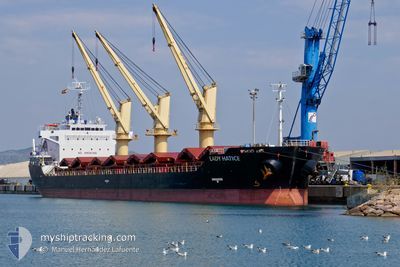
LADY HATICE
Bulk Carrier
Current Trip
| Time Travelled | 3 days |
|---|---|
| Remaining Time | --- |
| Distance Travelled | 716.85 nm |
| Remaining Distance | --- |
| AVG Speed | 10.2 Knopen |
| MAX Speed | 14.4 Knopen |
| AVG Wind | 14.1 knots |
| MAX Wind | 25 knots |
| MIN Temp | 15.2°C / 59.36°F |
| MAX Temp | 18.7°C / 65.66°F |
| Diepgang | 8.3 M |
| Positie ontvangen | 2 d geleden |
Current Position
| Lengtegraad | --- |
|---|---|
| Breedtegraat | --- |
| Status | Under way using engine |
| Snelheid | 9.9 Knopen |
| Koers | 295.4° |
| Gebied | Mediterranean Sea - Eastern Basin |
| Station | T-AIS |
| Positie ontvangen | 2 d geleden |
Information
The current position of LADY HATICE is in Mediterranean Sea - Eastern Basin with coordinates 33.21616° / 27.69468° as reported on 2025-03-26 22:02 by AIS to our vessel tracker app. The vessel's current speed is 9.9 Knopen and is heading at the port of CORK. The estimated time of arrival as calculated by MyShipTracking vessel tracking app is 2025-04-07 08:00 LT
The vessel LADY HATICE (IMO: 9413078, MMSI: 356300000) is a Bulk Carrier that was built in 2009 ( 16 Jaar oud ). It's sailing under the flag of [PA] Panama.
In this page you can find informations about the vessels current position, last detected port calls, and current voyage information. If the vessels is not in coverage by AIS you will find the latest position.
The current position of LADY HATICE is detected by our AIS receivers and we are not responsible for the reliability of the data. The last position was recorded while the vessel was in Coverage by the Ais receivers of our vessel tracking app.
The current draught of LADY HATICE as reported by AIS is 8.3 meters
Weather
| Temperature | 15.2°C / 59.36°F |
|---|---|
| Wind Speed | 25 knots |
| Direction | 261° W |
| Pressure | 1006.4 hPa |
| Humidity | 76.9 % |
| Cloud Coverage | 40 % |
Featured Company
Last Port Calls
| Port | Arrival | Departure | Time In Port |
|---|---|---|---|
| 2025-03-14 11:17 | 2025-03-26 00:11 | 11 d | |
| 2025-02-26 19:50 | 2025-03-09 18:42 | 10 d | |
| 2025-02-18 06:03 | 2025-02-19 04:02 | 21 h | |
| 2025-02-14 06:16 | 2025-02-14 17:57 | 11 h | |
| 2025-01-29 07:30 | 2025-02-11 20:46 | 13 d | |
| 2025-01-19 03:06 | 2025-01-19 10:49 | 7 h | |
| 2025-01-16 06:40 | 2025-01-18 17:29 | 2 d | |
| 2025-01-02 14:02 | 2025-01-07 10:04 | 4 d |
Last Trips
| Origin | Departure | Destination | Arrival | Distance | |
|---|---|---|---|---|---|
| 2025-03-09 20:42 | 2025-03-14 13:17 | 186.81 nm | |||
| 2025-02-19 06:02 | 2025-02-26 21:50 | 490.12 nm | |||
| 2025-02-14 19:57 | 2025-02-18 08:03 | 3.63 nm | |||
| 2025-02-11 22:46 | 2025-02-14 08:16 | 485.76 nm | |||
| 2025-01-19 13:49 | 2025-01-29 09:30 | 663.51 nm | |||
| 2025-01-18 19:29 | 2025-01-19 06:06 | 98.69 nm | |||
| 2025-01-07 11:04 | 2025-01-16 08:40 | 856.24 nm | |||
| 2024-12-28 14:07 | 2025-01-02 15:02 | 982.40 nm |
Events
| Tijd | Evenement | Details | Positie / Bestemming | Info |
|---|---|---|---|---|
| 2025-03-26 22:11 | Status Changed | Default Under way using engine |
33.22739 / 27.66684
IEORK
|
Snelheid: 9.9 kn Koers: 295.4° |
| 2025-03-26 22:02 | Status Changed | Under way using engine Default |
33.21616 / 27.69468
IEORK
|
Snelheid: 10.1 kn Koers: 296° |
| 2025-03-26 22:02 | Buitenbereik |
33.21616 / 27.69468
Mediterranean Sea - Eastern Basin
IEORK
|
Snelheid: 9.9 kn Koers: 295.4° |
|
| 2025-03-26 21:52 | Status Changed | Default Under way using engine |
33.20399 / 27.72433
IEORK
|
Snelheid: 10.2 kn Koers: 295.7° |
| 2025-03-26 21:40 | Status Changed | Under way using engine Default |
33.18862 / 27.76141
IEORK
|
Snelheid: 10.5 kn Koers: 296° |
| 2025-03-26 21:30 | Binnenbereik |
33.18862 / 27.76141
Mediterranean Sea - Eastern Basin
IEORK
|
Snelheid: 10.3 kn Koers: 296.4° |
|
| 2025-03-26 14:13 | Status Changed | Default Under way using engine |
32.62149 / 29.33983
IEORK
|
Snelheid: 11.1 kn Koers: 291.3° |
| 2025-03-26 14:09 | Status Changed | Under way using engine Default |
32.61620 / 29.35587
IEORK
|
Snelheid: 11.1 kn Koers: 291° |
| 2025-03-26 14:09 | Buitenbereik |
32.61620 / 29.35587
Mediterranean Sea - Eastern Basin
IEORK
|
Snelheid: 11.1 kn Koers: 291.3° |
|
| 2025-03-26 14:05 | Status Changed | Default Under way using engine |
32.61269 / 29.36670
IEORK
|
Snelheid: 11.1 kn Koers: 290.6° |