
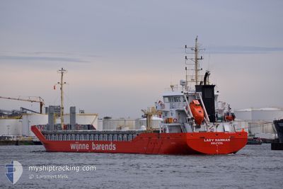
LADY HANNAH
Cargo
Current Trip
| Time Travelled | 5 days |
|---|---|
| Remaining Time | --- |
| Distance Travelled | 711.26 nm |
| Remaining Distance | --- |
| AVG Speed | 10.7 Knopen |
| MAX Speed | 13.7 Knopen |
| AVG Wind | 9.5 knots |
| MAX Wind | 17 knots |
| MIN Temp | 4.5°C / 40.1°F |
| MAX Temp | 15.8°C / 60.44°F |
| Diepgang | 5.5 M |
| Positie ontvangen | Nu |
Current Position
| Lengtegraad | 17.53154° |
|---|---|
| Breedtegraat | 56.49394° |
| Status | Under way using engine |
| Snelheid | 10.6 Knopen |
| Koers | 230.5° |
| Gebied | Baltic Sea |
| Station | T-AIS |
| Positie ontvangen | Nu |
Info
Information
The current position of LADY HANNAH is in Baltic Sea with coordinates 56.49394° / 17.53154° as reported on 2024-05-05 06:25 by AIS to our vessel tracker app. The vessel's current speed is 10.6 Knopen and is heading at the port of CAEN. The estimated time of arrival as calculated by MyShipTracking vessel tracking app is 2024-05-09 15:00 LT
The vessel LADY HANNAH (IMO: 9835018, MMSI: 245399000) is a Cargo It's sailing under the flag of [NL] Netherlands.
In this page you can find informations about the vessels current position, last detected port calls, and current voyage information. If the vessels is not in coverage by AIS you will find the latest position.
The current position of LADY HANNAH is detected by our AIS receivers and we are not responsible for the reliability of the data. The last position was recorded while the vessel was in Coverage by the Ais receivers of our vessel tracking app.
The current draught of LADY HANNAH as reported by AIS is 5.5 meters
Weather
| Temperature | 6.9°C / 44.42°F |
|---|---|
| Wind Speed | 6 knots |
| Direction | 162° SSE |
| Pressure | 1010.5 hPa |
| Humidity | 97.2 % |
| Cloud Coverage | 100 % |
Featured Company
Last Port Calls
| Port | Arrival | Departure | Time In Port |
|---|---|---|---|
| 2024-04-28 00:49 | 2024-04-29 12:24 | 1 d | |
| 2024-04-19 19:45 | 2024-04-22 20:10 | 3 d | |
| 2024-04-17 04:13 | 2024-04-18 17:00 | 1 d | |
| 2024-03-12 08:19 | 2024-04-08 10:13 | 27 d | |
| 2024-03-09 14:48 | 2024-03-10 17:13 | 1 d |
Most Visited Ports (Last year)
| Port | Arrivals | |
|---|---|---|
| 7 | ||
| 6 | ||
| 5 | ||
| 4 | ||
| 3 | ||
| 3 |
Last Trips
| Origin | Departure | Destination | Arrival | Distance | |
|---|---|---|---|---|---|
| 2024-04-22 22:10 | 2024-04-28 02:49 | 1233.41 nm | |||
| 2024-04-18 19:00 | 2024-04-19 21:45 | 296.29 nm | |||
| 2024-04-08 13:13 | 2024-04-17 06:13 | 1279.34 nm | |||
| 2024-03-10 19:13 | 2024-03-12 10:19 | 113.81 nm | |||
| 2024-02-28 20:56 | 2024-03-09 16:48 | 1791.09 nm |
Events
| Tijd | Evenement | Details | Positie / Bestemming | Info |
|---|---|---|---|---|
| 2024-05-05 05:29 | Status Changed | Under way using engine Default |
56.59851 / 17.76919
FRCFR
|
Snelheid: 10.7 kn Koers: 232° |
| 2024-05-05 05:29 | Binnenbereik |
56.59851 / 17.76919
Baltic Sea
FRCFR
|
Snelheid: 10.7 kn Koers: 232° |
|
| 2024-05-04 20:48 | Status Changed | Default Under way using engine |
57.72928 / 19.57401
FRCFR
|
Snelheid: 10.8 kn Koers: 213.6° |
| 2024-05-04 20:46 | Status Changed | Under way using engine Default |
57.73552 / 19.58176
FRCFR
|
Snelheid: 10.8 kn Koers: 214° |
| 2024-05-04 20:46 | Buitenbereik |
57.73552 / 19.58176
Baltic Sea
FRCFR
|
Snelheid: 10.8 kn Koers: 213.6° |
|
| 2024-05-04 19:55 | Status Changed | Default Under way using engine |
57.85823 / 19.74816
FRCFR
|
Snelheid: 10.5 kn Koers: 218.8° |
| 2024-05-04 19:53 | Status Changed | Under way using engine Default |
57.86429 / 19.75732
FRCFR
|
Snelheid: 10.4 kn Koers: 219° |
| 2024-05-04 19:53 | Binnenbereik |
57.86429 / 19.75732
Baltic Sea
FRCFR
|
Snelheid: 10.5 kn Koers: 218.8° |
|
| 2024-05-04 19:53 | Gevonden in zee | Swedish part of the Baltic Sea |
57.86429 / 19.75732
Baltic Sea
FRCFR
|
Snelheid: 10.5 kn Koers: 218.8° |
| 2024-05-04 11:10 | Buitenbereik |
59.07595 / 21.46647
Baltic Sea
FRCFR
|
Snelheid: 10.4 kn Koers: 217° |