
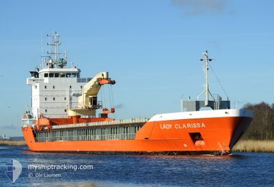
LADY CLARISSA
General Cargo
Current Trip
| Trip Time | 1 day |
|---|---|
| Trip Distance | 247.19 nm |
| AVG Speed | 10.8 Knopen |
| MAX Speed | 14.9 Knopen |
| Diepgang | 5.8 M |
| AVG Wind | 8.3 knots |
| MAX Wind | 14.6 knots |
| MIN Temp | 8.8°C / 47.84°F |
| MAX Temp | 15.8°C / 60.44°F |
| Positie ontvangen | Nu |
Current Position
| Lengtegraad | 0.34200° |
|---|---|
| Breedtegraat | 51.46187° |
| Status | Moored |
| Snelheid | |
| Koers | 338° |
| Gebied | North Sea |
| Station | T-AIS |
| Positie ontvangen | Nu |
Info
Information
The current position of LADY CLARISSA is in North Sea with coordinates 51.46187° / 0.34200° as reported on 2024-05-13 07:12 by AIS to our vessel tracker app. The vessel's current speed is 0 Knopen and is currently inside the port of TILBURY.
The vessel LADY CLARISSA (IMO: 9201803, MMSI: 246447000) is a General Cargo that was built in 2000 ( 24 Jaar oud ). It's sailing under the flag of [NL] Netherlands.
In this page you can find informations about the vessels current position, last detected port calls, and current voyage information. If the vessels is not in coverage by AIS you will find the latest position.
The current position of LADY CLARISSA is detected by our AIS receivers and we are not responsible for the reliability of the data. The last position was recorded while the vessel was in Coverage by the Ais receivers of our vessel tracking app.
The current draught of LADY CLARISSA as reported by AIS is 5.8 meters
Weather
| Temperature | 14.7°C / 58.46°F |
|---|---|
| Wind Speed | 7 knots |
| Direction | 206° SSW |
| Pressure | 1008.7 hPa |
| Humidity | 73.9 % |
| Cloud Coverage | 6 % |
Featured Company
Last Port Calls
| Port | Arrival | Departure | Time In Port |
|---|---|---|---|
| 2024-05-13 03:03 | |||
| 2024-05-10 18:48 | 2024-05-11 20:06 | 1 d | |
| 2024-05-03 00:16 | 2024-05-06 14:08 | 3 d | |
| 2024-05-01 06:04 | 2024-05-02 08:04 | 1 d | |
| 2024-04-28 16:12 | 2024-04-29 10:16 | 18 h | |
| 2024-04-25 20:16 | 2024-04-26 22:56 | 1 d | |
| 2024-04-23 03:39 | 2024-04-23 19:21 | 15 h | |
| 2024-04-20 20:22 | 2024-04-20 20:25 | 3 m | |
| 2024-04-17 04:30 | 2024-04-18 17:47 | 1 d | |
| 2024-04-10 07:53 | 2024-04-11 23:07 | 1 d |
Most Visited Ports (Last year)
| Port | Arrivals | |
|---|---|---|
| 8 | ||
| 7 | ||
| 6 | ||
| 4 | ||
| 3 | ||
| 3 |
Last Trips
| Origin | Departure | Destination | Arrival | Distance | |
|---|---|---|---|---|---|
| 2024-05-11 21:06 | 2024-05-13 04:03 | 247.19 nm | |||
| 2024-05-06 17:08 | 2024-05-10 19:48 | 1187.50 nm | |||
| 2024-05-02 11:04 | 2024-05-03 03:16 | 208.49 nm | |||
| 2024-04-29 13:16 | 2024-05-01 09:04 | 519.48 nm | |||
| 2024-04-27 01:56 | 2024-04-28 19:12 | 522.50 nm | |||
| 2024-04-23 22:21 | 2024-04-25 23:16 | 532.45 nm | |||
| 2024-04-20 22:25 | 2024-04-23 06:39 | 561.36 nm | |||
| 2024-04-18 19:47 | 2024-04-20 22:22 | 496.81 nm | |||
| 2024-04-12 02:07 | 2024-04-17 06:30 | 1216.16 nm | |||
| 2024-04-09 17:05 | 2024-04-10 10:53 | 214.19 nm |
Events
| Tijd | Evenement | Details | Positie / Bestemming | Info |
|---|---|---|---|---|
| 2024-05-13 03:47 | Status Changed | Moored Under way using engine |
51.46189 / .34200
[GB] TILBURY
|
Snelheid: Koers: 339° |
| 2024-05-13 03:03 | Stop beweging |
51.45483 / .34152
[GB] TILBURY
|
Snelheid: 0.3 kn Koers: 96° |
|
| 2024-05-13 03:03 | Aankomsthaven |
|
51.45483 / .34148
[GB] TILBURY
|
Snelheid: 0.6 kn Koers: 97° |
| 2024-05-12 21:52 | Start beweging | 11.79 nm, North of RAMSGATE |
51.51290 / 1.51591
GBLON
|
Snelheid: 3.1 kn Koers: 172° |
| 2024-05-12 21:47 | Status Changed | Under way using engine At anchor |
51.51489 / 1.51439
GBLON
|
Snelheid: 0.2 kn Koers: 56° |
| 2024-05-12 12:20 | Status Changed | At anchor Under way using engine |
51.51494 / 1.51342
GBLON
|
Snelheid: 0.9 kn Koers: 99° |
| 2024-05-12 12:16 | Stop beweging | 11.91 nm, North of RAMSGATE |
51.51544 / 1.51362
GBLON
|
Snelheid: 0.3 kn Koers: 85° |
| 2024-05-12 07:26 | Status Changed | Under way using engine Default |
52.32854 / 2.07247
GBLON
|
Snelheid: 11.7 kn Koers: 160° |
| 2024-05-12 07:24 | Status Changed | Default Under way using engine |
52.33365 / 2.06961
GBLON
|
Snelheid: 11.6 kn Koers: 160.4° |
| 2024-05-12 07:17 | Status Changed | Under way using engine Default |
52.35499 / 2.05708
GBLON
|
Snelheid: 11.5 kn Koers: 160° |