

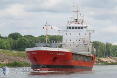
LADY CARINA
General Cargo

Current Trip
| Trip Time | 3 days |
|---|---|
| Trip Distance | 668.47 nm |
| AVG Speed | 11.3 Knopen |
| MAX Speed | 15.6 Knopen |
| Diepgang | 4.8 M |
| AVG Wind | 10.3 knots |
| MAX Wind | 25.3 knots |
| MIN Temp | 3.6°C / 38.48°F |
| MAX Temp | 15.1°C / 59.18°F |
| Positie ontvangen | 3 m geleden |
Current Position
| Lengtegraad | --- |
|---|---|
| Breedtegraat | --- |
| Status | Moored |
| Snelheid | 0.1 Knopen |
| Koers | 302° |
| Gebied | North Sea |
| Station | T-AIS |
| Positie ontvangen | 3 m geleden |
Information
The current position of LADY CARINA is in North Sea with coordinates 60.70045° / 5.55482° as reported on 2025-03-29 06:51 by AIS to our vessel tracker app. The vessel's current speed is 0.1 Knopen and is currently inside the port of EIKEFET.
The vessel LADY CARINA (IMO: 9201827, MMSI: 244621000) is a General Cargo that was built in 2001 ( 24 Jaar oud ). It's sailing under the flag of [NL] Netherlands.
In this page you can find informations about the vessels current position, last detected port calls, and current voyage information. If the vessels is not in coverage by AIS you will find the latest position.
The current position of LADY CARINA is detected by our AIS receivers and we are not responsible for the reliability of the data. The last position was recorded while the vessel was in Coverage by the Ais receivers of our vessel tracking app.
The current draught of LADY CARINA as reported by AIS is 4.8 meters
Weather
| Temperature | 2.4°C / 36.32°F |
|---|---|
| Wind Speed | 9 knots |
| Direction | 201° SSW |
| Pressure | 1003.2 hPa |
| Humidity | 98.3 % |
| Cloud Coverage | 100 % |


Featured Company
Last Port Calls
| Port | Arrival | Departure | Time In Port |
|---|---|---|---|
| 2025-03-28 19:08 | |||
| 2025-03-24 17:39 | 2025-03-24 19:36 | 1 h | |
| 2025-03-22 22:02 | 2025-03-22 23:23 | 1 h | |
| 2025-03-19 13:42 | 2025-03-20 20:10 | 1 d | |
| 2025-03-17 09:39 | 2025-03-18 14:19 | 1 d | |
| 2025-03-10 02:34 | 2025-03-11 17:44 | 1 d | |
| 2025-03-06 23:51 | 2025-03-09 17:08 | 2 d | |
| 2025-03-01 22:55 | 2025-03-03 08:51 | 1 d | |
| 2025-02-22 15:29 | 2025-02-25 19:56 | 3 d | |
| 2025-02-18 03:01 | 2025-02-19 04:33 | 1 d |
Last Trips
| Origin | Departure | Destination | Arrival | Distance | |
|---|---|---|---|---|---|
| 2025-03-24 19:36 | 2025-03-28 19:08 | 668.47 nm | |||
| 2025-03-22 23:23 | 2025-03-24 17:39 | 401.59 nm | |||
| 2025-03-20 20:10 | 2025-03-22 22:02 | 667.05 nm | |||
| 2025-03-18 14:19 | 2025-03-19 13:42 | 288.37 nm | |||
| 2025-03-11 17:44 | 2025-03-17 09:39 | 1525.26 nm | |||
| 2025-03-09 17:08 | 2025-03-10 02:34 | 32.10 nm | |||
| 2025-03-03 08:51 | 2025-03-06 23:51 | 616.56 nm | |||
| 2025-02-25 19:56 | 2025-03-01 22:55 | 93.60 nm | |||
| 2025-02-19 04:33 | 2025-02-22 15:29 | 913.67 nm | |||
| 2025-02-15 15:17 | 2025-02-18 03:01 | 697.63 nm |
Events
| Tijd | Evenement | Details | Positie / Bestemming | Info |
|---|---|---|---|---|
| 2025-03-28 18:34 | Status Changed | Moored Under way using engine |
60.70035 / 5.55481
[NO] EIKEFET
|
Snelheid: Koers: 302° |
| 2025-03-28 18:15 | Stop beweging |
60.70026 / 5.55462
[NO] EIKEFET
|
Snelheid: 0.3 kn Koers: 303° |
|
| 2025-03-28 18:08 | Aankomsthaven |
|
60.69881 / 5.55732
[NO] EIKEFET
|
Snelheid: 1.8 kn Koers: 329° |
| 2025-03-28 01:17 | Status Changed | Under way using engine Default |
57.62198 / 4.73990
NO EKF
|
Snelheid: 12.5 kn Koers: 347° |
| 2025-03-28 00:37 | Status Changed | Default Under way using engine |
57.48568 / 4.79289
NO EKF
|
Snelheid: 12.4 kn Koers: 348.8° |
| 2025-03-27 23:48 | Status Changed | Under way using engine Default |
57.32044 / 4.85290
NO EKF
|
Snelheid: 12.2 kn Koers: 348° |
| 2025-03-27 23:39 | Binnenbereik |
57.32044 / 4.85290
North Sea
NO EKF
|
Snelheid: 12.3 kn Koers: 348.1° |
|
| 2025-03-27 21:30 | Status Changed | Default Under way using engine |
56.85211 / 5.03180
NO EKF
|
Snelheid: 12.7 kn Koers: 349.7° |
| 2025-03-27 21:18 | Buitenbereik |
56.80837 / 5.04853
North Sea
NO EKF
|
Snelheid: 12.7 kn Koers: 349.7° |
|
| 2025-03-27 20:25 | Wijzig zee gebeid | Norwegian part of the North Sea Danish part of the North Sea |
56.62649 / 5.11654
North Sea
NO EKF
|
Snelheid: 12.6 kn Koers: 348.2° |