
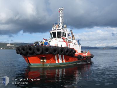
KURTARMA 16
Tug
Current Trip
AKBAS
| Time Travelled | 7 h, 51 mins |
|---|---|
| Remaining Time | --- |
| Distance Travelled | 45.87 nm |
| Remaining Distance | --- |
| AVG Speed | 10 Knopen |
| MAX Speed | 13.3 Knopen |
| AVG Wind | 11.6 knots |
| MAX Wind | 16 knots |
| MIN Temp | 7.5°C / 45.5°F |
| MAX Temp | 15.7°C / 60.26°F |
| Diepgang | 6.2 M |
| Positie ontvangen | 15 m geleden |
Current Position
| Lengtegraad | --- |
|---|---|
| Breedtegraat | --- |
| Status | Under way using engine |
| Snelheid | 10.8 Knopen |
| Koers | 44.2° |
| Gebied | Sea of Marmara |
| Station | T-AIS |
| Positie ontvangen | 15 m geleden |
Info
Information
The current position of KURTARMA 16 is in Sea of Marmara with coordinates 40.26586° / 26.50330° as reported on 2025-01-07 11:41 by AIS to our vessel tracker app. The vessel's current speed is 10.8 Knopen
The vessel KURTARMA 16 (IMO: 9915052, MMSI: 271048882) is a Tug It's sailing under the flag of [TR] Turkey.
In this page you can find informations about the vessels current position, last detected port calls, and current voyage information. If the vessels is not in coverage by AIS you will find the latest position.
The current position of KURTARMA 16 is detected by our AIS receivers and we are not responsible for the reliability of the data. The last position was recorded while the vessel was in Coverage by the Ais receivers of our vessel tracking app.
The current draught of KURTARMA 16 as reported by AIS is 6.2 meters
Weather
| Temperature | 15.6°C / 60.08°F |
|---|---|
| Wind Speed | 16 knots |
| Direction | 200° SSW |
| Pressure | 1019.9 hPa |
| Humidity | 69.2 % |
| Cloud Coverage | 100 % |
Featured Company
Last Port Calls
| Port | Arrival | Departure | Time In Port |
|---|---|---|---|
| 2025-01-06 14:06 | 2025-01-07 04:05 | 13 h | |
| 2025-01-03 02:19 | 2025-01-03 12:19 | 10 h | |
| 2025-01-02 08:14 | 2025-01-02 08:19 | 4 m | |
| 2025-01-01 11:28 | 2025-01-01 12:48 | 1 h | |
| 2024-12-31 16:21 | 2025-01-01 06:21 | 14 h | |
| 2024-12-30 15:07 | 2024-12-31 10:36 | 19 h | |
| 2024-12-30 07:02 | 2024-12-30 10:18 | 3 h | |
| 2024-12-29 13:45 | 2024-12-30 04:54 | 15 h | |
| 2024-12-28 14:18 | 2024-12-29 08:18 | 18 h | |
| 2024-12-23 10:36 | 2024-12-23 14:28 | 3 h |
Last Trips
| Origin | Departure | Destination | Arrival | Distance | |
|---|---|---|---|---|---|
| 2025-01-03 15:19 | 2025-01-06 17:06 | 201.85 nm | |||
| 2025-01-02 11:19 | 2025-01-03 05:19 | 57.52 nm | |||
| 2025-01-01 15:48 | 2025-01-02 11:14 | 46.07 nm | |||
| 2025-01-01 09:21 | 2025-01-01 14:28 | 52.59 nm | |||
| 2024-12-31 13:36 | 2024-12-31 19:21 | 56.45 nm | |||
| 2024-12-30 13:18 | 2024-12-30 18:07 | 50.94 nm | |||
| 2024-12-30 07:54 | 2024-12-30 10:02 | 8.48 nm | |||
| 2024-12-29 11:18 | 2024-12-29 16:45 | 54.04 nm | |||
| 2024-12-23 17:28 | 2024-12-28 17:18 | 62.91 nm | |||
| 2024-12-23 08:32 | 2024-12-23 13:36 | 52.16 nm |
Events
| Tijd | Evenement | Details | Positie / Bestemming | Info |
|---|---|---|---|---|
| 2025-01-07 11:41 | Status Changed | Default Under way using engine |
40.26625 / 26.50381
AKBAS
|
Snelheid: 10.8 kn Koers: 44.2° |
| 2025-01-07 11:16 | Start beweging | 4.51 nm, North of CANAKKALE |
40.22701 / 26.42959
AKBAS
|
Snelheid: 6.7 kn Koers: 103.5° |
| 2025-01-07 11:10 | Status Changed | Under way using engine Moored |
40.22729 / 26.42681
AKBAS
|
Snelheid: Koers: 173° |
| 2025-01-07 08:05 | Status Changed | Moored Under way using engine |
40.22726 / 26.42683
AKBAS
|
Snelheid: Koers: 172° |
| 2025-01-07 08:00 | Stop beweging | 4.49 nm, North of CANAKKALE |
40.22728 / 26.42697
AKBAS
|
Snelheid: 0.3 kn Koers: 174° |
| 2025-01-07 07:14 | Status Changed | Under way using engine Default |
40.29411 / 26.56274
AKBAS
|
Snelheid: 10.3 kn Koers: 224° |
| 2025-01-07 06:57 | Binnenbereik |
40.29231 / 26.55987
Sea of Marmara
AKBAS
|
Snelheid: 10.3 kn Koers: 231.6° |
|
| 2025-01-07 05:17 | Status Changed | Default Under way using engine |
40.29438 / 26.57245
AKBAS
|
Snelheid: 12.2 kn Koers: 43.4° |
| 2025-01-07 05:07 | Buitenbereik |
40.27188 / 26.54100
Sea of Marmara
AKBAS
|
Snelheid: 12.2 kn Koers: 43.4° |
|
| 2025-01-07 04:05 | Vertrekhaven |
|
40.15522 / 26.39467
AKBAS
|
Snelheid: 8.2 kn Koers: 344° |