

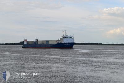
KUGELBAKE
Ro-Ro Cargo

Current Trip
| Time Travelled | 21 h, 53 mins |
|---|---|
| Remaining Time | 2 h, 39 mins |
| Distance Travelled | 200.53 nm |
| Remaining Distance | 33.40 nm |
| AVG Speed | 9.5 Knopen |
| MAX Speed | 13.4 Knopen |
| AVG Wind | 7.5 knots |
| MAX Wind | 12.7 knots |
| MIN Temp | 2.2°C / 35.96°F |
| MAX Temp | 11.5°C / 52.7°F |
| Diepgang | 2.8 M |
| Positie ontvangen | 4 m geleden |
Current Position
| Lengtegraad | --- |
|---|---|
| Breedtegraat | --- |
| Status | Under way using engine |
| Snelheid | 10.6 Knopen |
| Koers | 109.2° |
| Gebied | North Sea |
| Station | T-AIS |
| Positie ontvangen | 4 m geleden |
Information
The current position of KUGELBAKE is in North Sea with coordinates 53.86383° / 7.90908° as reported on 2025-03-27 15:17 by AIS to our vessel tracker app. The vessel's current speed is 10.6 Knopen and is heading at the port of NORDENHAM. The estimated time of arrival as calculated by MyShipTracking vessel tracking app is 2025-03-27 19:00 LT
The vessel KUGELBAKE (IMO: 9510747, MMSI: 218172000) is a Ro-Ro Cargo that was built in 2009 ( 16 Jaar oud ). It's sailing under the flag of [DE] Germany.
In this page you can find informations about the vessels current position, last detected port calls, and current voyage information. If the vessels is not in coverage by AIS you will find the latest position.
The current position of KUGELBAKE is detected by our AIS receivers and we are not responsible for the reliability of the data. The last position was recorded while the vessel was in Coverage by the Ais receivers of our vessel tracking app.
The current draught of KUGELBAKE as reported by AIS is 2.8 meters
Weather
| Temperature | 9.7°C / 49.46°F |
|---|---|
| Wind Speed | 9 knots |
| Direction | 285° WNW |
| Pressure | 1018.3 hPa |
| Humidity | 76.7 % |
| Cloud Coverage | 21 % |


Featured Company
Last Port Calls
| Port | Arrival | Departure | Time In Port |
|---|---|---|---|
| 2025-03-26 06:18 | 2025-03-26 18:28 | 12 h | |
| 2025-03-24 17:28 | 2025-03-25 07:20 | 13 h | |
| 2025-03-22 05:52 | 2025-03-23 18:04 | 1 d | |
| 2025-03-20 23:23 | 2025-03-21 08:14 | 8 h | |
| 2025-03-20 09:04 | 2025-03-20 11:39 | 2 h | |
| 2025-03-19 06:17 | 2025-03-19 20:05 | 13 h | |
| 2025-03-17 17:56 | 2025-03-18 07:59 | 14 h | |
| 2025-03-15 06:42 | 2025-03-16 20:10 | 1 d | |
| 2025-03-13 22:26 | 2025-03-14 07:04 | 8 h | |
| 2025-03-13 08:22 | 2025-03-13 11:24 | 3 h |
Most Visited Ports (Last year)
| Port | Arrivals | |
|---|---|---|
| 174 | ||
| 41 | ||
| 2 | ||
| 1 | ||
| 1 |
Last Trips
| Origin | Departure | Destination | Arrival | Distance | |
|---|---|---|---|---|---|
| 2025-03-25 07:20 | 2025-03-26 06:18 | 231.16 nm | |||
| 2025-03-23 18:04 | 2025-03-24 17:28 | 223.07 nm | |||
| 2025-03-21 08:14 | 2025-03-22 05:52 | 220.72 nm | |||
| 2025-03-20 11:39 | 2025-03-20 23:23 | 112.63 nm | |||
| 2025-03-19 20:05 | 2025-03-20 09:04 | 111.97 nm | |||
| 2025-03-18 07:59 | 2025-03-19 06:17 | 222.95 nm | |||
| 2025-03-16 20:10 | 2025-03-17 17:56 | 223.73 nm | |||
| 2025-03-14 07:04 | 2025-03-15 06:42 | 222.98 nm | |||
| 2025-03-13 11:24 | 2025-03-13 22:26 | 113.54 nm | |||
| 2025-03-12 19:26 | 2025-03-13 08:22 | 110.81 nm |
Events
| Tijd | Evenement | Details | Positie / Bestemming | Info |
|---|---|---|---|---|
| 2025-03-27 14:53 | Status Changed | Under way using engine Default |
53.92813 / 7.94502
DENHA
|
Snelheid: 10.8 kn Koers: 222° |
| 2025-03-27 14:38 | Status Changed | Default Under way using engine |
53.96059 / 7.99505
DENHA
|
Snelheid: 11.2 kn Koers: 220.2° |
| 2025-03-27 14:27 | Status Changed | Under way using engine Default |
53.98540 / 8.03247
DENHA
|
Snelheid: 11.8 kn Koers: 223° |
| 2025-03-27 13:58 | Status Changed | Default Under way using engine |
54.01083 / 8.18401
DENHA
|
Snelheid: 13 kn Koers: 273.7° |
| 2025-03-27 13:50 | Status Changed | Under way using engine Default |
54.01059 / 8.23148
DENHA
|
Snelheid: 13.1 kn Koers: 276° |
| 2025-03-27 13:10 | Status Changed | Default Under way using engine |
53.97921 / 8.48062
DENHA
|
Snelheid: 12.8 kn Koers: 280.3° |
| 2025-03-27 07:20 | Draught Changed | 2.8 2 |
53.56284 / 9.74518
DENHA
|
Snelheid: 11.4 kn Koers: 278.7° |
| 2025-03-27 07:20 | ETA Changed | 2025/03/27 18:00 |
53.56284 / 9.74518
DENHA
|
Snelheid: 11.4 kn Koers: 278.7° |
| 2025-03-27 07:14 | Draught Changed | 2 2.8 |
53.56005 / 9.77650
DENHA
|
Snelheid: 10.8 kn Koers: 281.5° |
| 2025-03-27 06:59 | Start beweging | 4.95 nm, East of WEDEL |
53.54678 / 9.83360
DENHA
|
Snelheid: 5.5 kn Koers: 78.7° |