
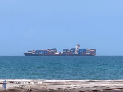
KOTA LUMAYAN
Container Ship
Current Trip
| Time Travelled | 9 days |
|---|---|
| Remaining Time | --- |
| Distance Travelled | 3872.81 nm |
| Remaining Distance | 143.97 nm |
| AVG Speed | 17.5 Knopen |
| MAX Speed | 20.9 Knopen |
| AVG Wind | 14.1 knots |
| MAX Wind | 25.3 knots |
| MIN Temp | 16.6°C / 61.88°F |
| MAX Temp | 29°C / 84.2°F |
| Diepgang | 11.4 M |
| Positie ontvangen | 5 d geleden |
Current Position
| Lengtegraad | --- |
|---|---|
| Breedtegraat | --- |
| Status | Under way using engine |
| Snelheid | 16 Knopen |
| Koers | 283.9° |
| Gebied | Indian Ocean |
| Station | T-AIS |
| Positie ontvangen | 5 d geleden |
Info
Information
The current position of KOTA LUMAYAN is in Indian Ocean with coordinates -35.56389° / 117.13532° as reported on 2025-03-09 07:49 by AIS to our vessel tracker app. The vessel's current speed is 16 Knopen and is heading at the port of SINGAPORE. The estimated time of arrival as calculated by MyShipTracking vessel tracking app is 2025-03-15 21:00 LT
The vessel KOTA LUMAYAN (IMO: 9494541, MMSI: 477302800) is a Container Ship that was built in 2010 ( 15 Jaar oud ). It's sailing under the flag of [HK] Hong Kong.
In this page you can find informations about the vessels current position, last detected port calls, and current voyage information. If the vessels is not in coverage by AIS you will find the latest position.
The current position of KOTA LUMAYAN is detected by our AIS receivers and we are not responsible for the reliability of the data. The last position was recorded while the vessel was in Coverage by the Ais receivers of our vessel tracking app.
The current draught of KOTA LUMAYAN as reported by AIS is 11.4 meters
Weather
| Temperature | 27.9°C / 82.22°F |
|---|---|
| Wind Speed | 8 knots |
| Direction | 66° ENE |
| Pressure | 1009.5 hPa |
| Humidity | 78.1 % |
| Cloud Coverage | 98 % |
Featured Company
Last Port Calls
| Port | Arrival | Departure | Time In Port |
|---|---|---|---|
| 2025-03-05 15:14 | 2025-03-06 13:16 | 22 h | |
| 2025-02-27 10:29 | 2025-03-01 06:33 | 1 d | |
| 2025-02-23 05:10 | 2025-02-24 16:58 | 1 d | |
| 2025-02-12 06:48 | 2025-02-13 03:29 | 20 h | |
| 2025-02-08 04:09 | 2025-02-10 08:21 | 2 d | |
| 2025-02-05 07:16 | 2025-02-05 18:58 | 11 h | |
| 2025-02-04 08:39 | 2025-02-05 05:56 | 21 h | |
| 2025-01-24 00:33 | 2025-01-25 11:13 | 1 d | |
| 2025-01-21 01:06 | 2025-01-22 12:19 | 1 d | |
| 2025-01-14 16:18 | 2025-01-16 05:18 | 1 d |
Most Visited Ports (Last year)
| Port | Arrivals | |
|---|---|---|
| 34 | ||
| 11 | ||
| 10 | ||
| 9 | ||
| 9 |
Last Trips
| Origin | Departure | Destination | Arrival | Distance | |
|---|---|---|---|---|---|
| 2025-03-01 06:33 | 2025-03-05 15:14 | 1054.63 nm | |||
| 2025-02-24 16:58 | 2025-02-27 10:29 | 596.78 nm | |||
| 2025-02-13 03:29 | 2025-02-23 05:10 | 3917.62 nm | |||
| 2025-02-10 08:21 | 2025-02-12 06:48 | 795.62 nm | |||
| 2025-02-05 18:58 | 2025-02-08 04:09 | 814.33 nm | |||
| 2025-02-05 05:56 | 2025-02-05 07:16 | 9.51 nm | |||
| 2025-01-25 11:13 | 2025-02-04 08:39 | 3788.29 nm | |||
| 2025-01-22 12:19 | 2025-01-24 00:33 | 551.50 nm | |||
| 2025-01-16 05:18 | 2025-01-21 01:06 | 717.97 nm | |||
| 2025-01-05 04:25 | 2025-01-14 16:18 | 3920.92 nm |
Events
| Tijd | Evenement | Details | Positie / Bestemming | Info |
|---|---|---|---|---|
| 2025-03-09 07:56 | Status Changed | Default Under way using engine |
-35.55779 / 117.10123
SGSIN PEBGA
|
Snelheid: 16 kn Koers: 283.9° |
| 2025-03-09 07:49 | Buitenbereik |
-35.56389 / 117.13532
Indian Ocean
SGSIN PEBGA
|
Snelheid: 16 kn Koers: 283.9° |
|
| 2025-03-09 07:29 | Status Changed | Under way using engine Default |
-35.58640 / 117.24403
SGSIN PEBGA
|
Snelheid: 15.9 kn Koers: 284° |
| 2025-03-09 07:16 | Status Changed | Default Under way using engine |
-35.60155 / 117.31550
SGSIN PEBGA
|
Snelheid: 16.6 kn Koers: 285.9° |
| 2025-03-09 04:22 | ETA Changed | 2025/03/15 13:00 2025/03/16 02:00 |
-35.78985 / 118.31343
SGSIN PEBGA
|
Snelheid: 17.8 kn Koers: 284.8° |
| 2025-03-09 04:04 | Wijzig zee gebeid | Australian part of the Indian Ocean Australian part of the Great Australian Bight |
-35.81138 / 118.41788
Indian Ocean
SGSIN PEBGA
|
Snelheid: 17.6 kn Koers: 285.5° |
| 2025-03-09 04:02 | Status Changed | Under way using engine Default |
-35.81449 / 118.43204
SGSIN PEBGA
|
Snelheid: 17.7 kn Koers: 286° |
| 2025-03-09 03:58 | Binnenbereik |
-35.81138 / 118.41788
Indian Ocean
SGSIN PEBGA
|
Snelheid: 17.6 kn Koers: 285.5° |
|
| 2025-03-06 11:15 | Status Changed | Default Under way using engine |
-38.93854 / 142.60797
SGSIN PEBGA
|
Snelheid: 17.1 kn Koers: 275.2° |
| 2025-03-06 11:14 | Buitenbereik |
-38.93874 / 142.61101
Great Australian Bight
SGSIN PEBGA
|
Snelheid: 17.1 kn Koers: 275.2° |