
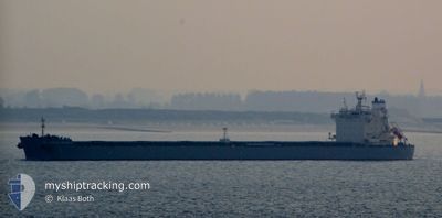
KMARIN GOTEBORG
Bulk Carrier
Current Trip
US NNS
| Time Travelled | 29 days |
|---|---|
| Remaining Time | --- |
| Distance Travelled | 292.95 nm |
| Remaining Distance | --- |
| AVG Speed | 11.5 Knopen |
| MAX Speed | 16 Knopen |
| AVG Wind | 11.4 knots |
| MAX Wind | 30 knots |
| MIN Temp | 4.2°C / 39.56°F |
| MAX Temp | 24.3°C / 75.74°F |
| Diepgang | 7.3 M |
| Positie ontvangen | 3 m geleden |
Current Position
| Lengtegraad | -76.14073° |
|---|---|
| Breedtegraat | 37.26334° |
| Status | At anchor |
| Snelheid | |
| Koers | 11° |
| Gebied | North Atlantic Ocean |
| Station | T-AIS |
| Positie ontvangen | 3 m geleden |
Info
Information
The current position of KMARIN GOTEBORG is in North Atlantic Ocean with coordinates 37.26334° / -76.14073° as reported on 2024-04-28 14:40 by AIS to our vessel tracker app. The vessel's current speed is 0 Knopen
The vessel KMARIN GOTEBORG (IMO: 9643300, MMSI: 538007419) is a Bulk Carrier that was built in 2013 ( 11 Jaar oud ). It's sailing under the flag of [MH] Marshall Is.
In this page you can find informations about the vessels current position, last detected port calls, and current voyage information. If the vessels is not in coverage by AIS you will find the latest position.
The current position of KMARIN GOTEBORG is detected by our AIS receivers and we are not responsible for the reliability of the data. The last position was recorded while the vessel was in Coverage by the Ais receivers of our vessel tracking app.
The current draught of KMARIN GOTEBORG as reported by AIS is 7.3 meters
Weather
| Temperature | 18.1°C / 64.58°F |
|---|---|
| Wind Speed | 12 knots |
| Direction | 239° WSW |
| Pressure | 1023.8 hPa |
| Humidity | 80.1 % |
| Cloud Coverage | 13 % |
Featured Company
Last Port Calls
| Port | Arrival | Departure | Time In Port |
|---|---|---|---|
| 2024-03-29 15:53 | 2024-03-30 00:22 | 8 h | |
| 2024-03-09 13:21 | 2024-03-15 15:21 | 6 d | |
| 2024-02-19 21:36 | 2024-02-21 13:55 | 1 d | |
| 2024-02-13 17:04 | 2024-02-13 21:04 | 4 h |
Most Visited Ports (Last year)
| Port | Arrivals | |
|---|---|---|
| 3 | ||
| 2 | ||
| 1 | ||
| 1 | ||
| 1 | ||
| 1 |
Last Trips
| Origin | Departure | Destination | Arrival | Distance | |
|---|---|---|---|---|---|
| 2024-03-15 16:21 | 2024-03-29 11:53 | 3579.29 nm | |||
| 2024-02-21 08:55 | 2024-03-09 14:21 | 3148.99 nm | |||
| 2024-02-13 16:04 | 2024-02-19 16:36 | 32.72 nm | |||
| 2024-01-30 03:08 | 2024-02-13 12:04 | 3366.11 nm |
Events
| Tijd | Evenement | Details | Positie / Bestemming | Info |
|---|---|---|---|---|
| 2024-04-28 14:31 | Status Changed | At anchor Default |
37.26328 / -76.14052
US NNS
|
Snelheid: Koers: 9° |
| 2024-04-28 14:28 | Status Changed | Default At anchor |
37.26334 / -76.14052
US NNS
|
Snelheid: Koers: 10° |
| 2024-04-28 13:31 | Status Changed | At anchor Default |
37.26348 / -76.14125
US NNS
|
Snelheid: Koers: 13° |
| 2024-04-28 13:28 | Status Changed | Default At anchor |
37.26346 / -76.14124
US NNS
|
Snelheid: Koers: 11° |
| 2024-04-28 12:55 | Status Changed | At anchor Default |
37.26341 / -76.14101
US NNS
|
Snelheid: Koers: 6° |
| 2024-04-28 12:52 | Status Changed | Default At anchor |
37.26345 / -76.14097
US NNS
|
Snelheid: Koers: 4° |
| 2024-04-28 12:46 | Status Changed | At anchor Default |
37.26342 / -76.14093
US NNS
|
Snelheid: Koers: 3° |
| 2024-04-28 12:40 | Status Changed | Default At anchor |
37.26345 / -76.14087
US NNS
|
Snelheid: Koers: 0° |
| 2024-04-28 11:34 | Status Changed | At anchor Default |
37.26354 / -76.14011
US NNS
|
Snelheid: Koers: 338° |
| 2024-04-28 11:28 | Status Changed | Default At anchor |
37.26358 / -76.14002
US NNS
|
Snelheid: Koers: 334° |