

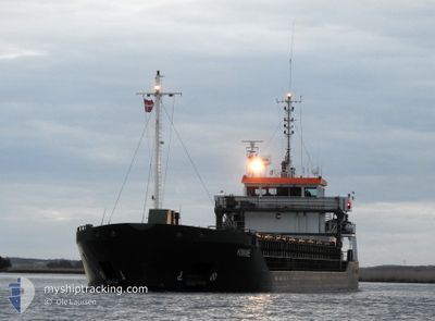
KINNE
General Cargo

Current Trip
| Time Travelled | 16 h, 30 mins |
|---|---|
| Remaining Time | --- |
| Distance Travelled | 153.75 nm |
| Remaining Distance | --- |
| AVG Speed | 8 Knopen |
| MAX Speed | 12.4 Knopen |
| AVG Wind | 6.7 knots |
| MAX Wind | 22.3 knots |
| MIN Temp | 3.5°C / 38.3°F |
| MAX Temp | 10.4°C / 50.72°F |
| Diepgang | 3.7 M |
| Positie ontvangen | 1 h, 37 m geleden |
Current Position
| Lengtegraad | --- |
|---|---|
| Breedtegraat | --- |
| Status | Under way using engine |
| Snelheid | 5.3 Knopen |
| Koers | 346.1° |
| Gebied | Kattegat |
| Station | T-AIS |
| Positie ontvangen | 1 h, 37 m geleden |
Information
The current position of KINNE is in Kattegat with coordinates 58.05103° / 12.14577° as reported on 2025-03-26 00:52 by AIS to our vessel tracker app. The vessel's current speed is 5.3 Knopen and is heading at the port of OTTERBACKEN. The estimated time of arrival as calculated by MyShipTracking vessel tracking app is 2025-03-25 22:00 LT
The vessel KINNE (IMO: 9306689, MMSI: 245057000) is a General Cargo that was built in 2004 ( 21 Jaar oud ). It's sailing under the flag of [NL] Netherlands.
In this page you can find informations about the vessels current position, last detected port calls, and current voyage information. If the vessels is not in coverage by AIS you will find the latest position.
The current position of KINNE is detected by our AIS receivers and we are not responsible for the reliability of the data. The last position was recorded while the vessel was in Coverage by the Ais receivers of our vessel tracking app.
The current draught of KINNE as reported by AIS is 3.7 meters
Weather
| Temperature | 3.9°C / 39.02°F |
|---|---|
| Wind Speed | 4 knots |
| Direction | 24° NNE |
| Pressure | 1010.2 hPa |
| Humidity | 98 % |
| Cloud Coverage | 67 % |


Featured Company
Last Port Calls
| Port | Arrival | Departure | Time In Port |
|---|---|---|---|
| 2025-03-24 09:47 | 2025-03-25 11:00 | 1 d | |
| 2025-03-18 20:47 | 2025-03-20 18:48 | 1 d | |
| 2025-03-15 07:20 | 2025-03-18 03:07 | 2 d | |
| 2025-03-11 23:18 | 2025-03-12 17:38 | 18 h | |
| 2025-03-10 01:54 | 2025-03-11 19:09 | 1 d | |
| 2025-02-27 11:16 | 2025-03-03 14:47 | 4 d | |
| 2025-02-21 04:25 | 2025-02-21 20:17 | 15 h | |
| 2025-02-20 08:05 | 2025-02-21 00:21 | 16 h | |
| 2025-02-16 05:40 | 2025-02-18 15:39 | 2 d | |
| 2025-02-14 11:18 | 2025-02-15 13:08 | 1 d |
Most Visited Ports (Last year)
| Port | Arrivals | |
|---|---|---|
| 10 | ||
| 10 | ||
| 6 | ||
| 5 | ||
| 4 | ||
| 4 |
Last Trips
| Origin | Departure | Destination | Arrival | Distance | |
|---|---|---|---|---|---|
| 2025-03-20 18:48 | 2025-03-24 09:47 | 219.63 nm | |||
| 2025-03-18 03:07 | 2025-03-18 20:47 | 178.97 nm | |||
| 2025-03-12 17:38 | 2025-03-15 07:20 | 412.10 nm | |||
| 2025-03-11 19:09 | 2025-03-11 23:18 | 44.92 nm | |||
| 2025-03-03 14:47 | 2025-03-10 01:54 | 959.36 nm | |||
| 2025-02-21 20:17 | 2025-02-27 11:16 | 500.32 nm | |||
| 2025-02-21 00:21 | 2025-02-21 04:25 | 42.43 nm | |||
| 2025-02-18 15:39 | 2025-02-20 08:05 | 273.83 nm | |||
| 2025-02-15 13:08 | 2025-02-16 05:40 | 140.71 nm | |||
| 2025-02-12 18:16 | 2025-02-14 11:18 | 276.93 nm |
Events
| Tijd | Evenement | Details | Positie / Bestemming | Info |
|---|---|---|---|---|
| 2025-03-26 02:10 | Stop beweging | 8.77 nm, East of KOLHATTAN |
58.13695 / 12.11820
SEOTT
|
Snelheid: 0.2 kn Koers: 39° |
| 2025-03-26 00:58 | Status Changed | Default Under way using engine |
58.05951 / 12.14170
SEOTT
|
Snelheid: 5.3 kn Koers: 346.1° |
| 2025-03-26 00:52 | Buitenbereik |
58.05103 / 12.14577
Kattegat
SEOTT
|
Snelheid: 5.3 kn Koers: 346.1° |
|
| 2025-03-25 18:38 | Wijzig zee gebeid | Swedish part of the Kattegat Swedish part of the Skaggerak |
57.85758 / 11.24144
Kattegat
SEOTT
|
Snelheid: 11.4 kn Koers: 149.5° |
| 2025-03-25 13:50 | Wijzig zee gebeid | Swedish part of the Skaggerak Norwegian part of the Skaggerak |
58.57717 / 10.28815
Skaggerak
SEOTT
|
Snelheid: 10.1 kn Koers: 145.7° |
| 2025-03-25 10:00 | Vertrekhaven |
|
59.11979 / 9.60275
SEOTT
|
Snelheid: 7.4 kn Koers: 226° |
| 2025-03-25 09:58 | Start beweging |
59.12359 / 9.60914
[NO] PORSGRUNN
|
Snelheid: 7.4 kn Koers: 226° |
|
| 2025-03-25 08:34 | Draught Changed | 3.7 5.8 |
59.12594 / 9.61662
[NO] PORSGRUNN
|
Snelheid: Koers: 45° |
| 2025-03-25 08:34 | ETA Changed | 2025/03/25 21:00 2025/03/21 15:00 |
59.12594 / 9.61662
[NO] PORSGRUNN
|
Snelheid: Koers: 45° |
| 2025-03-25 08:29 | Status Changed | Under way using engine Moored |
59.12594 / 9.61662
[NO] PORSGRUNN
|
Snelheid: Koers: 45° |