
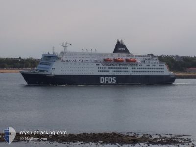
KING SEAWAYS
Ro-Ro/Passenger Ship
Current Trip
| Trip Time | 15 h, 28 mins |
|---|---|
| Trip Distance | 282.91 nm |
| AVG Speed | 17.1 Knopen |
| MAX Speed | 19.6 Knopen |
| Diepgang | 6.2 M |
| AVG Wind | 22.9 knots |
| MAX Wind | 26 knots |
| MIN Temp | 8.9°C / 48.02°F |
| MAX Temp | 13.5°C / 56.3°F |
| Positie ontvangen | 3 m geleden |
Current Position
| Lengtegraad | --- |
|---|---|
| Breedtegraat | --- |
| Status | Moored |
| Snelheid | |
| Koers | 301° |
| Gebied | North Sea |
| Station | T-AIS |
| Positie ontvangen | 3 m geleden |
Info
Information
The current position of KING SEAWAYS is in North Sea with coordinates 52.46251° / 4.58470° as reported on 2024-09-28 08:21 by AIS to our vessel tracker app. The vessel's current speed is 0 Knopen and is currently inside the port of IJMUIDEN.
The vessel KING SEAWAYS (IMO: 8502406, MMSI: 220449000) is a Ro-Ro/Passenger Ship that was built in 1987 ( 37 Jaar oud ). It's sailing under the flag of [DK] Denmark.
In this page you can find informations about the vessels current position, last detected port calls, and current voyage information. If the vessels is not in coverage by AIS you will find the latest position.
The current position of KING SEAWAYS is detected by our AIS receivers and we are not responsible for the reliability of the data. The last position was recorded while the vessel was in Coverage by the Ais receivers of our vessel tracking app.
The current draught of KING SEAWAYS as reported by AIS is 6.2 meters
Weather
| Temperature | 13.1°C / 55.58°F |
|---|---|
| Wind Speed | 20 knots |
| Direction | 322° NW |
| Pressure | 1017.7 hPa |
| Humidity | 62.2 % |
| Cloud Coverage | 47 % |
Featured Company
Last Port Calls
| Port | Arrival | Departure | Time In Port |
|---|---|---|---|
| 2024-09-28 07:20 | |||
| 2024-09-27 07:52 | 2024-09-27 15:52 | 7 h | |
| 2024-09-26 07:32 | 2024-09-26 15:29 | 7 h | |
| 2024-09-25 07:57 | 2024-09-25 16:03 | 8 h | |
| 2024-09-24 07:22 | 2024-09-24 15:24 | 8 h | |
| 2024-09-23 07:50 | 2024-09-23 15:51 | 8 h | |
| 2024-09-22 07:26 | 2024-09-22 15:10 | 7 h | |
| 2024-09-21 07:45 | 2024-09-21 15:55 | 8 h | |
| 2024-09-20 07:27 | 2024-09-20 15:15 | 7 h | |
| 2024-09-19 07:52 | 2024-09-19 15:58 | 8 h |
Last Trips
| Origin | Departure | Destination | Arrival | Distance | |
|---|---|---|---|---|---|
| 2024-09-27 16:52 | 2024-09-28 09:20 | 282.91 nm | |||
| 2024-09-26 17:29 | 2024-09-27 08:52 | 281.14 nm | |||
| 2024-09-25 17:03 | 2024-09-26 09:32 | 264.43 nm | |||
| 2024-09-24 17:24 | 2024-09-25 08:57 | 264.38 nm | |||
| 2024-09-23 16:51 | 2024-09-24 09:22 | 263.49 nm | |||
| 2024-09-22 17:10 | 2024-09-23 08:50 | 262.04 nm | |||
| 2024-09-21 16:55 | 2024-09-22 09:26 | 264.28 nm | |||
| 2024-09-20 17:15 | 2024-09-21 08:45 | 262.83 nm | |||
| 2024-09-19 16:58 | 2024-09-20 09:27 | 263.50 nm | |||
| 2024-09-18 17:25 | 2024-09-19 08:52 | 264.98 nm |
Events
| Tijd | Evenement | Details | Positie / Bestemming | Info |
|---|---|---|---|---|
| 2024-09-28 07:49 | Status Changed | Moored Under way using engine |
52.46251 / 4.58471
[NL] IJMUIDEN
|
Snelheid: Koers: 301° |
| 2024-09-28 07:27 | Stop beweging |
52.46357 / 4.57933
[NL] IJMUIDEN
|
Snelheid: 0.3 kn Koers: 272° |
|
| 2024-09-28 07:20 | Aankomsthaven |
|
52.46675 / 4.58382
[NL] IJMUIDEN
|
Snelheid: 2.9 kn Koers: 143° |
| 2024-09-28 05:16 | Wijzig zee gebeid | Dutch part of the North Sea United Kingdom part of the North Sea |
52.42134 / 3.70605
North Sea
NLIJM
|
Snelheid: 17.6 kn Koers: 112.9° |
| 2024-09-28 05:15 | Status Changed | Under way using engine Default |
52.42354 / 3.69786
NLIJM
|
Snelheid: 17.7 kn Koers: 114° |
| 2024-09-28 05:15 | Binnenbereik |
52.42134 / 3.70605
North Sea
NLIJM
|
Snelheid: 17.6 kn Koers: 112.9° |
|
| 2024-09-28 01:33 | Status Changed | Default Under way using engine |
52.79652 / 1.92019
NLIJM
|
Snelheid: 18.8 kn Koers: 117.5° |
| 2024-09-28 01:28 | Buitenbereik |
52.80857 / 1.88229
North Sea
NLIJM
|
Snelheid: 18.8 kn Koers: 117.5° |
|
| 2024-09-27 23:18 | Status Changed | Under way using engine Default |
53.30558 / 1.17934
NLIJM
|
Snelheid: 19.2 kn Koers: 158° |
| 2024-09-27 23:17 | Status Changed | Default Under way using engine |
53.31035 / 1.17609
NLIJM
|
Snelheid: 18.7 kn Koers: 158.5° |