
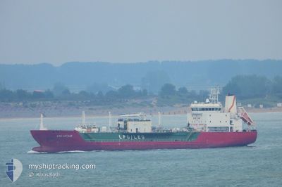
KING ARTHUR
Lpg Tanker
Current Trip
| Trip Time | 15 h, 47 mins |
|---|---|
| Trip Distance | 138.97 nm |
| AVG Speed | 9.6 Knopen |
| MAX Speed | 12.5 Knopen |
| Diepgang | 6.6 M |
| AVG Wind | 3 knots |
| MAX Wind | 8 knots |
| MIN Temp | 11.6°C / 52.88°F |
| MAX Temp | 15.3°C / 59.54°F |
| Positie ontvangen | 6 m geleden |
Current Position
| Lengtegraad | --- |
|---|---|
| Breedtegraat | --- |
| Status | Under way using engine |
| Snelheid | 10 Knopen |
| Koers | 304° |
| Gebied | North Atlantic Ocean |
| Station | T-AIS |
| Positie ontvangen | 6 m geleden |
Info
Information
The current position of KING ARTHUR is in North Atlantic Ocean with coordinates 37.14843° / -6.88078° as reported on 2025-02-27 18:55 by AIS to our vessel tracker app. The vessel's current speed is 10 Knopen and is currently inside the port of HUELVA.
The vessel KING ARTHUR (IMO: 9480382, MMSI: 247293900) is a Lpg Tanker that was built in 2011 ( 14 Jaar oud ). It's sailing under the flag of [IT] Italy.
In this page you can find informations about the vessels current position, last detected port calls, and current voyage information. If the vessels is not in coverage by AIS you will find the latest position.
The current position of KING ARTHUR is detected by our AIS receivers and we are not responsible for the reliability of the data. The last position was recorded while the vessel was in Coverage by the Ais receivers of our vessel tracking app.
The current draught of KING ARTHUR as reported by AIS is 6.6 meters
Weather
| Temperature | 13.9°C / 57.02°F |
|---|---|
| Wind Speed | 6 knots |
| Direction | 172° S |
| Pressure | 1017 hPa |
| Humidity | 73.8 % |
| Cloud Coverage | 53 % |
Featured Company
Last Port Calls
| Port | Arrival | Departure | Time In Port |
|---|---|---|---|
| 2025-02-27 18:43 | |||
| 2025-02-25 23:13 | 2025-02-27 02:56 | 1 d | |
| 2025-02-24 09:07 | 2025-02-25 09:28 | 1 d | |
| 2025-02-21 09:48 | 2025-02-22 20:35 | 1 d | |
| 2025-02-19 23:20 | 2025-02-20 21:14 | 21 h | |
| 2025-02-16 07:55 | 2025-02-17 13:52 | 1 d | |
| 2025-02-14 15:20 | 2025-02-15 17:55 | 1 d | |
| 2025-02-11 23:30 | 2025-02-13 03:51 | 1 d | |
| 2025-02-07 10:53 | 2025-02-08 16:54 | 1 d | |
| 2025-02-05 14:21 | 2025-02-06 22:47 | 1 d |
Most Visited Ports (Last year)
| Port | Arrivals | |
|---|---|---|
| 69 | ||
| 65 | ||
| 8 | ||
| 1 | ||
| 1 |
Last Trips
| Origin | Departure | Destination | Arrival | Distance | |
|---|---|---|---|---|---|
| 2025-02-27 03:56 | 2025-02-27 19:43 | 138.97 nm | |||
| 2025-02-25 10:28 | 2025-02-26 00:13 | 141.19 nm | |||
| 2025-02-22 21:35 | 2025-02-24 10:07 | 137.32 nm | |||
| 2025-02-20 22:14 | 2025-02-21 10:48 | 137.47 nm | |||
| 2025-02-17 14:52 | 2025-02-20 00:20 | 135.25 nm | |||
| 2025-02-15 18:55 | 2025-02-16 08:55 | 140.29 nm | |||
| 2025-02-13 04:51 | 2025-02-14 16:20 | 133.47 nm | |||
| 2025-02-08 17:54 | 2025-02-12 00:30 | 259.82 nm | |||
| 2025-02-06 23:47 | 2025-02-07 11:53 | 131.65 nm | |||
| 2025-02-01 22:03 | 2025-02-05 15:21 | 298.79 nm |
Events
| Tijd | Evenement | Details | Positie / Bestemming | Info |
|---|---|---|---|---|
| 2025-02-27 18:43 | Status Changed | Under way using engine Default |
37.13267 / -6.84518
[ES] HUELVA
|
Snelheid: 9.9 kn Koers: 340° |
| 2025-02-27 18:43 | Aankomsthaven |
|
37.13267 / -6.84518
[ES] HUELVA
|
Snelheid: 9.9 kn Koers: 340° |
| 2025-02-27 18:31 | Binnenbereik |
37.13267 / -6.84518
North Atlantic Ocean
[ES] HUELVA
|
Snelheid: 10 kn Koers: 301.7° |
|
| 2025-02-27 17:46 | Start beweging | 3.59 nm, South of HUELVA |
37.08700 / -6.86587
ESHUE
|
Snelheid: 8.8 kn Koers: 149° |
| 2025-02-27 15:28 | Stop beweging | 2.47 nm, South of HUELVA |
37.10532 / -6.87893
ESHUE
|
Snelheid: 0.2 kn Koers: 302° |
| 2025-02-27 11:48 | Status Changed | Default Under way using engine |
36.46740 / -6.73016
ESHUE
|
Snelheid: 11.3 kn Koers: 326.7° |
| 2025-02-27 11:41 | Buitenbereik |
36.45037 / -6.71679
North Atlantic Ocean
ESHUE
|
Snelheid: 11.3 kn Koers: 326.7° |
|
| 2025-02-27 11:30 | Status Changed | Under way using engine Default |
36.41886 / -6.69184
ESHUE
|
Snelheid: 11.4 kn Koers: 327° |
| 2025-02-27 11:24 | Status Changed | Default Under way using engine |
36.40304 / -6.67931
ESHUE
|
Snelheid: 11.4 kn Koers: 326.3° |
| 2025-02-27 11:02 | ETA Changed | 2025/02/27 15:00 2025/02/27 16:00 |
36.34262 / -6.63504
ESHUE
|
Snelheid: 11.9 kn Koers: 330.8° |