
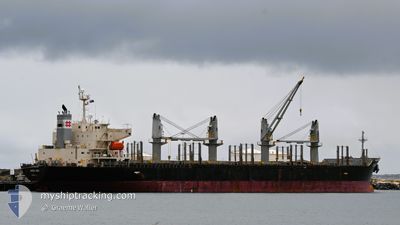
KEN REI
Bulk Carrier
Current Trip
| Trip Time | 1 day |
|---|---|
| Trip Distance | 253.80 nm |
| AVG Speed | 9 Knopen |
| MAX Speed | 12.2 Knopen |
| Diepgang | 5.7 M |
| AVG Wind | 13.2 knots |
| MAX Wind | 22.2 knots |
| MIN Temp | 15.6°C / 60.08°F |
| MAX Temp | 17.6°C / 63.68°F |
| Positie ontvangen | 1 d geleden |
Current Position
| Lengtegraad | 178.72925° |
|---|---|
| Breedtegraat | -38.23999° |
| Status | Under way using engine |
| Snelheid | 10.8 Knopen |
| Koers | 196.4° |
| Gebied | South Pacific Ocean |
| Station | T-AIS |
| Positie ontvangen | 1 d geleden |
Info
Information
The current position of KEN REI is in South Pacific Ocean with coordinates -38.23999° / 178.72925° as reported on 2024-04-29 20:14 by AIS to our vessel tracker app. The vessel's current speed is 10.8 Knopen and is currently inside the port of GISBORNE.
The vessel KEN REI (IMO: 9310006, MMSI: 352573000) is a Bulk Carrier that was built in 2006 ( 18 Jaar oud ). It's sailing under the flag of [PA] Panama.
In this page you can find informations about the vessels current position, last detected port calls, and current voyage information. If the vessels is not in coverage by AIS you will find the latest position.
The current position of KEN REI is detected by our AIS receivers and we are not responsible for the reliability of the data. The last position was recorded while the vessel was in Coverage by the Ais receivers of our vessel tracking app.
The current draught of KEN REI as reported by AIS is 5.7 meters
Weather
| Temperature | 12.9°C / 55.22°F |
|---|---|
| Wind Speed | 12 knots |
| Direction | 285° WNW |
| Pressure | 1006.2 hPa |
| Humidity | 64.6 % |
| Cloud Coverage | 4 % |
Featured Company
Most Visited Ports (Last year)
| Port | Arrivals | |
|---|---|---|
| 4 | ||
| 2 | ||
| 2 | ||
| 2 | ||
| 1 | ||
| 1 |
Events
| Tijd | Evenement | Details | Positie / Bestemming | Info |
|---|---|---|---|---|
| 2024-04-30 04:50 | Stop beweging |
-38.67465 / 178.02409
[NZ] GISBORNE
|
Snelheid: 0.1 kn Koers: 238° |
|
| 2024-04-30 04:39 | Aankomsthaven |
|
-38.67546 / 178.02177
[NZ] GISBORNE
|
Snelheid: 4.4 kn Koers: 52° |
| 2024-04-29 20:18 | Status Changed | Default Under way using engine |
-38.25301 / 178.72447
NZ GIS
|
Snelheid: 10.8 kn Koers: 196.4° |
| 2024-04-29 20:14 | Buitenbereik |
-38.23999 / 178.72925
South Pacific Ocean
NZ GIS
|
Snelheid: 10.8 kn Koers: 196.4° |
|
| 2024-04-29 20:14 | Status Changed | Under way using engine Default |
-38.23945 / 178.72945
NZ GIS
|
Snelheid: 10.8 kn Koers: 199° |
| 2024-04-29 19:17 | Status Changed | Default Under way using engine |
-38.08065 / 178.79909
NZ GIS
|
Snelheid: 10.3 kn Koers: 200.3° |
| 2024-04-29 19:14 | Status Changed | Under way using engine Default |
-38.07104 / 178.80335
NZ GIS
|
Snelheid: 10.2 kn Koers: 197° |
| 2024-04-29 18:59 | Status Changed | Default Under way using engine |
-38.02895 / 178.82095
NZ GIS
|
Snelheid: 10.7 kn Koers: 195.7° |
| 2024-04-29 18:47 | Status Changed | Under way using engine Default |
-37.99433 / 178.83392
NZ GIS
|
Snelheid: 10.4 kn Koers: 195° |
| 2024-04-29 18:38 | Binnenbereik |
-37.99433 / 178.83392
South Pacific Ocean
NZ GIS
|
Snelheid: 10.4 kn Koers: 196.9° |