

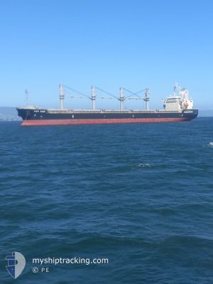
KEN KON
Cargo

Current Trip
| Time Travelled | 1 day |
|---|---|
| Remaining Time | 1 day |
| Distance Travelled | 275.18 nm |
| Remaining Distance | 351.43 nm |
| AVG Speed | 12 Knopen |
| MAX Speed | 12 Knopen |
| AVG Wind | 8.9 knots |
| MAX Wind | 18 knots |
| MIN Temp | 11.9°C / 53.42°F |
| MAX Temp | 29.7°C / 85.46°F |
| Diepgang | 9.2 M |
| Positie ontvangen | 38 m geleden |
Current Position
| Lengtegraad | --- |
|---|---|
| Breedtegraat | --- |
| Status | Under way using engine |
| Snelheid | 12.3 Knopen |
| Koers | 162° |
| Gebied | North Pacific Ocean |
| Station | T-AIS |
| Positie ontvangen | 38 m geleden |
Information
The current position of KEN KON is in North Pacific Ocean with coordinates 34.84260° / -121.70243° as reported on 2025-03-27 09:45 by AIS to our vessel tracker app. The vessel's current speed is 12.3 Knopen and is heading at the port of ENSENADA. The estimated time of arrival as calculated by MyShipTracking vessel tracking app is 2025-03-28 06:39 LT
The vessel KEN KON (IMO: 9510929, MMSI: 372260000) is a Cargo It's sailing under the flag of [PA] Panama.
In this page you can find informations about the vessels current position, last detected port calls, and current voyage information. If the vessels is not in coverage by AIS you will find the latest position.
The current position of KEN KON is detected by our AIS receivers and we are not responsible for the reliability of the data. The last position was recorded while the vessel was in Coverage by the Ais receivers of our vessel tracking app.
The current draught of KEN KON as reported by AIS is 9.2 meters
Weather
| Temperature | 14°C / 57.2°F |
|---|---|
| Wind Speed | 5 knots |
| Direction | 214° SW |
| Pressure | 1017.4 hPa |
| Humidity | 92.6 % |
| Cloud Coverage | 100 % |


Featured Company
Last Port Calls
| Port | Arrival | Departure | Time In Port |
|---|---|---|---|
| 2025-03-25 16:25 | 2025-03-25 16:34 | 8 m | |
| 2025-02-19 14:00 | 2025-02-26 12:27 | 6 d | |
| 2025-02-10 07:54 | 2025-02-15 13:05 | 5 d | |
| 2025-01-24 09:59 | 2025-01-25 17:38 | 1 d |
Most Visited Ports (Last year)
| Port | Arrivals | |
|---|---|---|
| 2 | ||
| 2 | ||
| 1 | ||
| 1 | ||
| 1 | ||
| 1 |
Last Trips
| Origin | Departure | Destination | Arrival | Distance | |
|---|---|---|---|---|---|
| 2025-02-26 12:27 | 2025-03-25 16:25 | 6155.53 nm | |||
| 2025-02-15 13:05 | 2025-02-19 14:00 | 1106.80 nm | |||
| 2025-01-25 17:38 | 2025-02-10 07:54 | 3980.48 nm | |||
| 2024-12-27 00:17 | 2025-01-24 09:59 | 4928.13 nm |
Events
| Tijd | Evenement | Details | Positie / Bestemming | Info |
|---|---|---|---|---|
| 2025-03-27 09:49 | Status Changed | Default Under way using engine |
34.82809 / -121.69640
MX ESE
|
Snelheid: 12.3 kn Koers: 162° |
| 2025-03-27 09:44 | Status Changed | Under way using engine Default |
34.84584 / -121.70372
MX ESE
|
Snelheid: 12.3 kn Koers: 160° |
| 2025-03-27 09:39 | Status Changed | Default Under way using engine |
34.86041 / -121.70966
MX ESE
|
Snelheid: 12.5 kn Koers: 161.2° |
| 2025-03-27 09:35 | Status Changed | Under way using engine Default |
34.87501 / -121.71589
MX ESE
|
Snelheid: 12.5 kn Koers: 161° |
| 2025-03-27 09:23 | Binnenbereik |
34.87501 / -121.71589
North Pacific Ocean
MX ESE
|
Snelheid: 12.5 kn Koers: 161.2° |
|
| 2025-03-27 06:58 | Status Changed | Default Under way using engine |
35.39356 / -121.92744
MX ESE
|
Snelheid: 12.7 kn Koers: 165.5° |
| 2025-03-27 06:55 | Status Changed | Under way using engine Default |
35.40366 / -121.93097
MX ESE
|
Snelheid: 12.7 kn Koers: 165° |
| 2025-03-27 06:55 | Buitenbereik |
35.40366 / -121.93097
North Pacific Ocean
MX ESE
|
Snelheid: 12.7 kn Koers: 165.5° |
|
| 2025-03-27 06:27 | Status Changed | Default Under way using engine |
35.49909 / -121.96344
MX ESE
|
Snelheid: 12.6 kn Koers: 163.4° |
| 2025-03-27 06:21 | Status Changed | Under way using engine Default |
35.51770 / -121.97020
MX ESE
|
Snelheid: 12.7 kn Koers: 163° |