
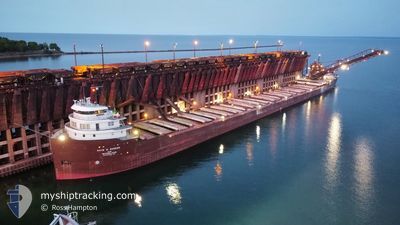
KAYE E BARKER
Self Discharging Bulk Carrier
Current Trip
MARQUETTE
| Time Travelled | 5 h, 14 mins |
|---|---|
| Remaining Time | --- |
| Distance Travelled | 65.58 nm |
| Remaining Distance | --- |
| AVG Speed | 13.2 Knopen |
| MAX Speed | 13.4 Knopen |
| AVG Wind | 13.3 knots |
| MAX Wind | 16.5 knots |
| MIN Temp | 0.6°C / 33.08°F |
| MAX Temp | 2.8°C / 37.04°F |
| Diepgang | 6.2 M |
| Positie ontvangen | 5 d geleden |
Current Position
| Lengtegraad | --- |
|---|---|
| Breedtegraat | --- |
| Status | Under way using engine |
| Snelheid | 9.5 Knopen |
| Koers | 21.7° |
| Gebied | --- |
| Station | T-AIS |
| Positie ontvangen | 5 d geleden |
Info
Information
The current position of KAYE E BARKER is in --- with coordinates 43.25800° / -82.28404° as reported on 2026-01-03 10:47 by AIS to our vessel tracker app. The vessel's current speed is 9.5 Knopen
The vessel KAYE E BARKER (IMO: 5097450, MMSI: 366904910) is a Self Discharging Bulk Carrier that was built in 1952 ( 74 Jaar oud ). It's sailing under the flag of [US] USA.
In this page you can find informations about the vessels current position, last detected port calls, and current voyage information. If the vessels is not in coverage by AIS you will find the latest position.
The current position of KAYE E BARKER is detected by our AIS receivers and we are not responsible for the reliability of the data. The last position was recorded while the vessel was in Coverage by the Ais receivers of our vessel tracking app.
The current draught of KAYE E BARKER as reported by AIS is 6.2 meters
Weather
| Temperature | 2.2°C / 35.96°F |
|---|---|
| Wind Speed | 11 knots |
| Direction | 172° S |
| Pressure | 1008.4 hPa |
| Humidity | 98 % |
| Cloud Coverage | 100 % |
Featured Company
Last Port Calls
| Port | Arrival | Departure | Time In Port |
|---|---|---|---|
| 2026-01-06 05:06 | 2026-01-08 09:15 | 2 d | |
| 2026-01-04 16:46 | 2026-01-04 18:02 | 1 h | |
| 2026-01-02 13:17 | 2026-01-02 22:58 | 9 h | |
| 2025-12-31 14:06 | 2026-01-02 03:02 | 1 d | |
| 2025-12-30 21:58 | 2025-12-31 09:22 | 11 h | |
| 2025-12-27 16:09 | 2025-12-27 18:22 | 2 h | |
| 2025-12-26 16:55 | 2025-12-27 04:18 | 11 h | |
| 2025-12-26 05:01 | 2025-12-26 06:14 | 1 h | |
| 2025-12-24 14:10 | 2025-12-25 03:16 | 13 h | |
| 2025-12-19 22:55 | 2025-12-20 01:19 | 2 h |
Most Visited Ports (Last year)
| Port | Arrivals | |
|---|---|---|
| 79 | ||
| 60 | ||
| 40 | ||
| 26 | ||
| 12 | ||
| 5 |
Last Trips
| Origin | Departure | Destination | Arrival | Distance | |
|---|---|---|---|---|---|
| 2026-01-04 18:02 | 2026-01-06 05:06 | 141.59 nm | |||
| 2026-01-02 22:58 | 2026-01-04 16:46 | 298.93 nm | |||
| 2026-01-02 03:02 | 2026-01-02 13:17 | 74.07 nm | |||
| 2025-12-31 09:22 | 2025-12-31 14:06 | 47.94 nm | |||
| 2025-12-27 18:22 | 2025-12-30 21:58 | 416.81 nm | |||
| 2025-12-27 04:18 | 2025-12-27 16:09 | 137.76 nm | |||
| 2025-12-26 06:14 | 2025-12-26 16:55 | 134.69 nm | |||
| 2025-12-25 03:16 | 2025-12-26 05:01 | 289.29 nm | |||
| 2025-12-20 01:19 | 2025-12-24 14:10 | 384.73 nm | |||
| 2025-12-18 09:44 | 2025-12-19 22:55 | 162.02 nm |
Events
| Tijd | Evenement | Details | Positie / Bestemming | Info |
|---|---|---|---|---|
| 2026-01-08 14:15 | Vertrekhaven |
|
46.57608 / -87.34211
MARQUETTE
|
Snelheid: 4.3 kn Koers: 101° |
| 2026-01-08 14:04 | Start beweging |
46.57109 / -87.37486
[US] MARQUETTE
|
Snelheid: 4.3 kn Koers: 101° |
|
| 2026-01-06 10:35 | Stop beweging |
46.57912 / -87.38786
[US] MARQUETTE
|
Snelheid: Koers: 319° |
|
| 2026-01-06 10:06 | Aankomsthaven |
|
46.56725 / -87.37447
[US] MARQUETTE
|
Snelheid: 3.6 kn Koers: 320° |
| 2026-01-06 09:51 | Start beweging | 0.74 nm, North East of MARQUETTE |
46.55484 / -87.35554
MARQUETTE
|
Snelheid: 4.4 kn Koers: 305° |
| 2026-01-05 13:24 | Stop beweging | 0.94 nm, East of MARQUETTE |
46.55191 / -87.34713
MARQUETTE
|
Snelheid: 0.2 kn Koers: 297° |
| 2026-01-04 23:02 | Vertrekhaven |
|
46.49635 / -84.40976
MARQUETTE
|
Snelheid: 7.3 kn Koers: 256° |
| 2026-01-04 22:46 | Start beweging |
46.50227 / -84.36579
[CA] SAULT STE MARIE
|
Snelheid: 5.3 kn Koers: 267° |
|
| 2026-01-04 21:46 | Stop beweging |
46.50327 / -84.34636
[CA] SAULT STE MARIE
|
Snelheid: Koers: 267° |
|
| 2026-01-04 21:46 | Aankomsthaven |
|
46.50327 / -84.34636
[CA] SAULT STE MARIE
|
Snelheid: 0.8 kn Koers: 268° |