
KATE
Not available
Current Trip
| Time Travelled | 12 h, 12 mins |
|---|---|
| Remaining Time | 4 h, 14 mins |
| Distance Travelled | 10.26 nm |
| Remaining Distance | 35.28 nm |
| AVG Speed | 7.1 Knopen |
| MAX Speed | 9 Knopen |
| AVG Wind | 6.8 knots |
| MAX Wind | 7 knots |
| MIN Temp | 7.1°C / 44.78°F |
| MAX Temp | 10.6°C / 51.08°F |
| Diepgang | 3 M |
| Positie ontvangen | 1 m geleden |
Current Position
| Lengtegraad | --- |
|---|---|
| Breedtegraat | --- |
| Status | Under way using engine |
| Snelheid | 8.6 Knopen |
| Koers | 245.9° |
| Gebied | North Sea |
| Station | T-AIS |
| Positie ontvangen | 1 m geleden |
Info
Information
The current position of KATE is in North Sea with coordinates 51.65231° / 4.29143° as reported on 2025-03-07 06:37 by AIS to our vessel tracker app. The vessel's current speed is 8.6 Knopen and is heading at the port of TERNEUZEN. The estimated time of arrival as calculated by MyShipTracking vessel tracking app is 2025-03-07 11:52 LT
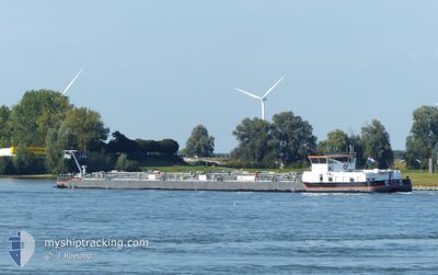
The vessel KATE (MMSI: 244000211) is a Not available It's sailing under the flag of [NL] Netherlands.
In this page you can find informations about the vessels current position, last detected port calls, and current voyage information. If the vessels is not in coverage by AIS you will find the latest position.
The current position of KATE is detected by our AIS receivers and we are not responsible for the reliability of the data. The last position was recorded while the vessel was in Coverage by the Ais receivers of our vessel tracking app.
The current draught of KATE as reported by AIS is 3 meters
Weather
| Temperature | 7.2°C / 44.96°F |
|---|---|
| Wind Speed | 7 knots |
| Direction | 175° S |
| Pressure | 1015.4 hPa |
| Humidity | 80.6 % |
| Cloud Coverage | 14 % |
Featured Company
Last Port Calls
| Port | Arrival | Departure | Time In Port |
|---|---|---|---|
| 2025-03-06 06:46 | 2025-03-06 19:26 | 12 h | |
| 2025-03-04 03:34 | 2025-03-04 03:54 | 20 m | |
| 2025-03-03 15:31 | 2025-03-04 02:04 | 10 h | |
| 2025-03-02 12:43 | 2025-03-03 05:20 | 16 h | |
| 2025-02-28 23:09 | 2025-03-01 06:47 | 7 h | |
| 2025-02-28 14:39 | 2025-02-28 14:47 | 7 m | |
| 2025-02-27 07:59 | 2025-02-28 14:15 | 1 d | |
| 2025-02-26 09:51 | 2025-02-26 18:18 | 8 h | |
| 2025-02-25 09:30 | 2025-02-25 20:38 | 11 h | |
| 2025-02-22 10:27 | 2025-02-22 17:51 | 7 h |
Last Trips
| Origin | Departure | Destination | Arrival | Distance | |
|---|---|---|---|---|---|
| 2025-03-04 03:54 | 2025-03-06 06:46 | 33.65 nm | |||
| 2025-03-04 02:04 | 2025-03-04 03:34 | 13.14 nm | |||
| 2025-03-03 05:20 | 2025-03-03 15:31 | 79.31 nm | |||
| 2025-03-01 06:47 | 2025-03-02 12:43 | 61.98 nm | |||
| 2025-02-28 14:47 | 2025-02-28 23:09 | 21.63 nm | |||
| 2025-02-28 14:15 | 2025-02-28 14:39 | 1.60 nm | |||
| 2025-02-26 18:18 | 2025-02-27 07:59 | 33.60 nm | |||
| 2025-02-25 20:38 | 2025-02-26 09:51 | 32.45 nm | |||
| 2025-02-22 17:51 | 2025-02-25 09:30 | 62.53 nm | |||
| 2025-02-19 11:09 | 2025-02-22 10:27 | 33.09 nm |
Events
| Tijd | Evenement | Details | Positie / Bestemming | Info |
|---|---|---|---|---|
| 2025-03-07 06:05 | Start beweging | 1.66 nm, East of OOLTGENSPLAAT |
51.68343 / 4.39737
TANK OPSLAG VERBEKE
|
Snelheid: 5.1 kn Koers: 253° |
| 2025-03-07 06:03 | Status Changed | Under way using engine Moored |
51.68408 / 4.39975
TANK OPSLAG VERBEKE
|
Snelheid: Koers: 228° |
| 2025-03-06 20:49 | Status Changed | Moored Under way using engine |
51.68420 / 4.40008
TANK OPSLAG VERBEKE
|
Snelheid: Koers: 227° |
| 2025-03-06 20:30 | Stop beweging | 1.6 nm, West of WILLEMSTAD |
51.68434 / 4.40006
TANK OPSLAG VERBEKE
|
Snelheid: 0.2 kn Koers: 221° |
| 2025-03-06 19:38 | Start beweging | 0.94 nm, West of WILLEMSTAD |
51.69259 / 4.41476
TANK OPSLAG VERBEKE
|
Snelheid: 3.1 kn Koers: 226° |
| 2025-03-06 19:22 | Stop beweging | 0.75 nm, West of WILLEMSTAD |
51.69578 / 4.41994
TANK OPSLAG VERBEKE
|
Snelheid: 0.2 kn Koers: 225° |
| 2025-03-06 18:38 | Destination Changed | TANK OPSLAG VERBEKE MOERDIJK SHELL 7 NED |
51.69515 / 4.51538
TANK OPSLAG VERBEKE
|
Snelheid: 8.2 kn Koers: 285.7° |
| 2025-03-06 18:38 | ETA Changed | 2025/03/06 14:09 2025/03/04 07:29 |
51.69515 / 4.51538
TANK OPSLAG VERBEKE
|
Snelheid: 8.2 kn Koers: 285.7° |
| 2025-03-06 18:31 | Binnenbereik |
51.69180 / 4.53793
North Sea
|
Snelheid: 7.7 kn Koers: 284.3° |
|
| 2025-03-06 18:26 | Vertrekhaven |
|
51.69180 / 4.53793
MOERDIJK SHELL 7 NED
|
Snelheid: 0.2 kn Koers: 253° |