
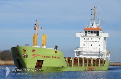
KARIN LEHMANN
General Cargo
Current Trip
| Time Travelled | 18 h, 27 mins |
|---|---|
| Remaining Time | --- |
| Distance Travelled | 191.88 nm |
| Remaining Distance | --- |
| AVG Speed | 10.5 Knopen |
| MAX Speed | 11.9 Knopen |
| AVG Wind | 13.5 knots |
| MAX Wind | 20.8 knots |
| MIN Temp | 2.1°C / 35.78°F |
| MAX Temp | 5.6°C / 42.08°F |
| Diepgang | 6 M |
| Positie ontvangen | 1 m geleden |
Current Position
| Lengtegraad | 9.28435° |
|---|---|
| Breedtegraat | 64.36019° |
| Status | Under way using engine |
| Snelheid | 9.8 Knopen |
| Koers | 221.2° |
| Gebied | Norwegian Sea |
| Station | T-AIS |
| Positie ontvangen | 1 m geleden |
Info
Information
The current position of KARIN LEHMANN is in Norwegian Sea with coordinates 64.36019° / 9.28435° as reported on 2024-04-26 08:58 by AIS to our vessel tracker app. The vessel's current speed is 9.8 Knopen and is heading at the port of VASTERAS. The estimated time of arrival as calculated by MyShipTracking vessel tracking app is 2024-05-01 10:00 LT
The vessel KARIN LEHMANN (IMO: 9225574, MMSI: 304146000) is a General Cargo that was built in 2000 ( 24 Jaar oud ). It's sailing under the flag of [AG] Antigua Barbuda.
In this page you can find informations about the vessels current position, last detected port calls, and current voyage information. If the vessels is not in coverage by AIS you will find the latest position.
The current position of KARIN LEHMANN is detected by our AIS receivers and we are not responsible for the reliability of the data. The last position was recorded while the vessel was in Coverage by the Ais receivers of our vessel tracking app.
The current draught of KARIN LEHMANN as reported by AIS is 6 meters
Weather
| Temperature | 5°C / 41°F |
|---|---|
| Wind Speed | 14 knots |
| Direction | 149° SSE |
| Pressure | 1009.1 hPa |
| Humidity | 68.4 % |
| Cloud Coverage | 19 % |
Featured Company
Last Port Calls
| Port | Arrival | Departure | Time In Port |
|---|---|---|---|
| 2024-04-23 05:05 | 2024-04-25 14:33 | 2 d | |
| 2024-04-14 09:09 | 2024-04-15 22:03 | 1 d | |
| 2024-04-13 04:25 | 2024-04-13 09:03 | 4 h | |
| 2024-04-11 17:23 | 2024-04-12 18:55 | 1 d | |
| 2024-04-07 14:50 | 2024-04-08 15:18 | 1 d | |
| 2024-04-02 01:42 | 2024-04-04 07:51 | 2 d | |
| 2024-03-26 15:18 | 2024-03-27 14:09 | 22 h | |
| 2024-03-23 09:17 | 2024-03-25 17:05 | 2 d | |
| 2024-03-19 12:31 | 2024-03-20 22:47 | 1 d | |
| 2024-03-15 22:24 | 2024-03-16 00:12 | 1 h |
Most Visited Ports (Last year)
| Port | Arrivals | |
|---|---|---|
| 15 | ||
| 12 | ||
| 12 | ||
| 6 | ||
| 5 | ||
| 3 |
Last Trips
| Origin | Departure | Destination | Arrival | Distance | |
|---|---|---|---|---|---|
| 2024-04-16 01:03 | 2024-04-23 07:05 | 1527.72 nm | |||
| 2024-04-13 12:03 | 2024-04-14 12:09 | 280.04 nm | |||
| 2024-04-12 21:55 | 2024-04-13 07:25 | 89.53 nm | |||
| 2024-04-08 17:18 | 2024-04-11 20:23 | 799.08 nm | |||
| 2024-04-04 09:51 | 2024-04-07 16:50 | 847.03 nm | |||
| 2024-03-27 15:09 | 2024-04-02 03:42 | 1121.60 nm | |||
| 2024-03-25 18:05 | 2024-03-26 16:18 | 265.03 nm | |||
| 2024-03-21 00:47 | 2024-03-23 10:17 | 644.05 nm | |||
| 2024-03-16 01:12 | 2024-03-19 14:31 | 386.61 nm | |||
| 2024-03-15 18:16 | 2024-03-15 23:24 | 48.74 nm |
Events
| Tijd | Evenement | Details | Positie / Bestemming | Info |
|---|---|---|---|---|
| 2024-04-25 14:33 | Vertrekhaven |
|
66.30522 / 14.09051
SE VST
|
Snelheid: 7.6 kn Koers: 259° |
| 2024-04-25 14:31 | Start beweging |
66.30618 / 14.10199
[NO] MOIRANA
|
Snelheid: 7.6 kn Koers: 259° |
|
| 2024-04-25 13:45 | ETA Changed | 2024/05/01 10:00 2024/04/21 20:00 |
66.30657 / 14.11771
[NO] MOIRANA
|
Snelheid: Koers: 253° |
| 2024-04-25 13:39 | Destination Changed | SE VST NOMQN |
66.30654 / 14.11765
[NO] MOIRANA
|
Snelheid: Koers: 253° |
| 2024-04-23 05:21 | Stop beweging |
66.30739 / 14.11244
[NO] MOIRANA
|
Snelheid: 0.3 kn Koers: 245° |
|
| 2024-04-23 05:05 | Aankomsthaven |
|
66.31106 / 14.09730
[NO] MOIRANA
|
Snelheid: 8.8 kn Koers: 68.1° |
| 2024-04-21 21:27 | Start beweging | 1.65 nm, North East of ALESUND |
62.48349 / 6.19573
NOMQN
|
Snelheid: 4.3 kn Koers: 322° |
| 2024-04-21 21:25 | Status Changed | Under way using engine Moored |
62.48165 / 6.19399
NOMQN
|
Snelheid: Koers: 25° |
| 2024-04-20 21:52 | Status Changed | Moored Not under command |
62.48128 / 6.19304
NOMQN
|
Snelheid: Koers: 25° |
| 2024-04-20 21:31 | Stop beweging | 1.52 nm, North East of ALESUND |
62.48138 / 6.19343
NOMQN
|
Snelheid: 0.3 kn Koers: 26° |